


<< Text Pages >> Anslow's Cottages Trackway - Ancient Trackway in England in Berkshire
Submitted by SolarMegalith on Saturday, 25 February 2012 Page Views: 3706
Multi-periodSite Name: Anslow''s Cottages TrackwayCountry: England
NOTE: This site is 3.062 km away from the location you searched for.
County: Berkshire Type: Ancient Trackway
Nearest Town: Reading
Map Ref: SU6923470984
Latitude: 51.433636N Longitude: 1.005429W
Condition:
| 5 | Perfect |
| 4 | Almost Perfect |
| 3 | Reasonable but with some damage |
| 2 | Ruined but still recognisable as an ancient site |
| 1 | Pretty much destroyed, possibly visible as crop marks |
| 0 | No data. |
| -1 | Completely destroyed |
| 5 | Superb |
| 4 | Good |
| 3 | Ordinary |
| 2 | Not Good |
| 1 | Awful |
| 0 | No data. |
| 5 | Can be driven to, probably with disabled access |
| 4 | Short walk on a footpath |
| 3 | Requiring a bit more of a walk |
| 2 | A long walk |
| 1 | In the middle of nowhere, a nightmare to find |
| 0 | No data. |
| 5 | co-ordinates taken by GPS or official recorded co-ordinates |
| 4 | co-ordinates scaled from a detailed map |
| 3 | co-ordinates scaled from a bad map |
| 2 | co-ordinates of the nearest village |
| 1 | co-ordinates of the nearest town |
| 0 | no data |
Internal Links:
External Links:
Ancient Trackway in Berkshire
The multi-period site of Anslow's Cottages revealed traces of occupation dated from Bronze Age to medieval period. The earliest feature, 1091, is interpreted as remains of a Bronze Age trackway originally leading to the river channel.
The other prehistoric features are 873 (alignment of the post-holes, also Bronze Age) and remains of several Bronze Age ditches. The later evidence includes remains of mid-Saxon post settings and late Saxon wicker basket dated for 1060 AD.
Reference:
Butterworth, C.A. and Lobb, S.J. 1992. "Excavations in the Burghfield Area, Berkshire". Salisbury: Wessex Archaeology Ltd. (p. 79-169)
You may be viewing yesterday's version of this page. To see the most up to date information please register for a free account.
Do not use the above information on other web sites or publications without permission of the contributor.
Nearby Images from Geograph Britain and Ireland:
©2008(licence)
©2012(licence)
©2012(licence)
©2012(licence)
©2012(licence)
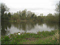
The above images may not be of the site on this page, they are loaded from Geograph.
Please Submit an Image of this site or go out and take one for us!
Click here to see more info for this site
Nearby sites
Key: Red: member's photo, Blue: 3rd party photo, Yellow: other image, Green: no photo - please go there and take one, Grey: site destroyed
Download sites to:
KML (Google Earth)
GPX (GPS waypoints)
CSV (Garmin/Navman)
CSV (Excel)
To unlock full downloads you need to sign up as a Contributory Member. Otherwise downloads are limited to 50 sites.
Turn off the page maps and other distractions
Nearby sites listing. In the following links * = Image available
1.4km SE 132° Reading Cursus* Cursus (SU70307005)
3.4km NE 44° Reading Museum* Museum (SU716735)
4.2km WSW 257° Burghfield Cursus Cursus (SU65137000)
4.5km NNE 27° St. Anne's Well (Caversham)* Holy Well or Sacred Spring (SU712750)
4.7km E 84° Whiteknights Stones* Modern Stone Circle etc (SU739715)
6.6km W 273° Englefield Cursus (SU626712)
6.7km W 265° Englefield Cursus (SU626703)
7.1km SW 233° Ufton Nervet Bell Barrow* Round Barrow(s) (SU6356266625)
7.5km WSW 256° Ufton Nervet Cursus Cursus (SU620691)
7.6km W 259° Ufton Nervet Cursus Cursus (SU618695)
7.7km SW 220° Holden's Firs* Barrow Cemetery (SU64366506)
8.0km SW 233° Raven Hill* Promontory Fort / Cliff Castle (SU62876615)
8.8km ENE 57° Sonning Cursus Cursus (SU765759)
8.9km ENE 57° Sonning Cursus Cursus (SU767759)
9.0km NNW 327° Bozedown Camp* Hillfort (SU6419578403)
9.2km W 281° St. Andrew's Well* Holy Well or Sacred Spring (SU602726)
10.0km N 356° Wyfold Castle* Hillfort (SU68328099)
10.1km N 356° Castle Grove Camp Hillfort (SU6832580996)
10.2km SSW 213° Calleva Atrebatum* Ancient Village or Settlement (SU638623)
10.3km SW 220° The Frith (Hampshire)* Hillfort (SU62686308)
10.8km SW 223° Aldermaston Enclosure* Misc. Earthwork (SU6197062917)
11.8km ESE 123° Warren Lodge Barrows* Round Barrow(s) (SU7925664643)
12.3km NW 316° Goring Cursus Cursus (SU606798)
12.4km NW 315° Goring Enclosure Causewayed Enclosure (SU604797)
12.5km SSE 147° Cudbury Clump Barrow* Round Barrow(s) (SU76216058)
View more nearby sites and additional images


 We would like to know more about this location. Please feel free to add a brief description and any relevant information in your own language.
 Wir möchten mehr über diese Stätte erfahren. Bitte zögern Sie nicht, eine kurze Beschreibung und relevante Informationen in Deutsch hinzuzufügen.
 Nous aimerions en savoir encore un peu sur les lieux. S'il vous plaît n'hesitez pas à ajouter une courte description et tous les renseignements pertinents dans votre propre langue.
 Quisieramos informarnos un poco más de las lugares. No dude en añadir una breve descripción y otros datos relevantes en su propio idioma.