 with our Megalithic Portal iPhone app")

<< Our Photo Pages >> Folville Cross - Ancient Cross in England in Leicestershire and Rutland
Submitted by enkidu41 on Monday, 16 August 2004 Page Views: 9472
Early Medieval (Dark Age)Site Name: Folville CrossCountry: England
NOTE: This site is 1.632 km away from the location you searched for.
County: Leicestershire and Rutland Type: Ancient Cross
Nearest Town: Melton Mowbray Nearest Village: Ashby Folville
Map Ref: SK715134
Latitude: 52.713546N Longitude: 0.943036W
Condition:
| 5 | Perfect |
| 4 | Almost Perfect |
| 3 | Reasonable but with some damage |
| 2 | Ruined but still recognisable as an ancient site |
| 1 | Pretty much destroyed, possibly visible as crop marks |
| 0 | No data. |
| -1 | Completely destroyed |
| 5 | Superb |
| 4 | Good |
| 3 | Ordinary |
| 2 | Not Good |
| 1 | Awful |
| 0 | No data. |
| 5 | Can be driven to, probably with disabled access |
| 4 | Short walk on a footpath |
| 3 | Requiring a bit more of a walk |
| 2 | A long walk |
| 1 | In the middle of nowhere, a nightmare to find |
| 0 | No data. |
| 5 | co-ordinates taken by GPS or official recorded co-ordinates |
| 4 | co-ordinates scaled from a detailed map |
| 3 | co-ordinates scaled from a bad map |
| 2 | co-ordinates of the nearest village |
| 1 | co-ordinates of the nearest town |
| 0 | no data |
Internal Links:
External Links:
")
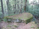
This 3' high, 4 sided cross-shaft stands at the edge of a field to the west side of a crossroads on the parish boundary.
It is probable that it is the eroded remains of a deliberately worked shaft, although at first glance it looks like a standing stone.
Early in fifteenth century Sir Roger Beler, a judge and baron of the Exchequer, was killed in a duel with Sir Eustace de Folville (or, more probably, simply murdered) and local tradition says that this cross shaft marks the site. The location is eminently suited as a meeting place for such an encounter, being on the parish boundary as well as at a crossroads. The Folville family have been described as 'the most lawless gang of bandits that ever dominated the Leicestershire countryside since the Norman conquest' and their pastimes included cattle rustling, kidnapping, intimidation, robbery and murder.
Based on the description by, and used by kind permission of, Bob Trubshaw, from his Interactive Little-known Leicestershire and Rutland CD-ROM.
You may be viewing yesterday's version of this page. To see the most up to date information please register for a free account.
Do not use the above information on other web sites or publications without permission of the contributor.
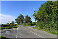
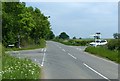
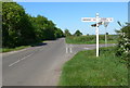
Nearby Images from Geograph Britain and Ireland:
©2016(licence)
©2018(licence)
©2012(licence)

©2018(licence)
©2012(licence)
The above images may not be of the site on this page, they are loaded from Geograph.
Please Submit an Image of this site or go out and take one for us!
Click here to see more info for this site
Nearby sites
Key: Red: member's photo, Blue: 3rd party photo, Yellow: other image, Green: no photo - please go there and take one, Grey: site destroyed
Download sites to:
KML (Google Earth)
GPX (GPS waypoints)
CSV (Garmin/Navman)
CSV (Excel)
To unlock full downloads you need to sign up as a Contributory Member. Otherwise downloads are limited to 50 sites.
Turn off the page maps and other distractions
Nearby sites listing. In the following links * = Image available
2.8km W 267° The Blue Stone (Gaddesby)* Standing Stone (Menhir) (SK687132)
4.1km NNW 335° Stump Cross (Frisby on the Wreake) Ancient Cross (SK6969917032)
4.7km NNW 335° Frisby Cross Ancient Cross (SK6942017659)
4.8km ESE 109° Burrough-on-the-hill* Hillfort (SK761119)
5.6km N 354° All Saints (Asfordby)* Ancient Cross (SK7081218939)
5.6km N 354° Asfordby Cross* Ancient Cross (SK7078419006)
6.2km NW 310° Hoby Stone Standing Stone (Menhir) (SK667173)
6.3km W 259° Queniborough Stones* Standing Stones (SK653121)
6.6km ENE 58° Burton Lazars Stockwell* Holy Well or Sacred Spring (SK770170)
6.6km W 281° Blue Stone (Rearsby)* Natural Stone / Erratic / Other Natural Feature (SK6497414518)
7.0km WSW 251° Mowde Bush Stone* Standing Stone (Menhir) (SK649110)
7.2km SW 226° Beeby Holy Well* Holy Well or Sacred Spring (SK664083)
7.2km W 277° Rearsby Timber Circle Timber Circle (SK643142)
7.5km SW 228° Beeby Henge (SK660083)
7.6km N 355° Saxelbye Stone* Standing Stone (Menhir) (SK707210)
8.4km NW 321° Ragdale Stone* Standing Stone (Menhir) (SK661199)
8.5km SSW 201° Ingarsby* Standing Stone (Menhir) (SK6857805373)
8.9km NNW 341° Grimston Stone* Standing Stone (Menhir) (SK684218)
9.0km NNW 341° Grimston Church Monolith* Standing Stone (Menhir) (SK685219)
9.5km N 6° Ab Kettleby* Holy Well or Sacred Spring (SK724229)
10.6km S 179° Billesdon Cross* Ancient Cross (SK7191302822)
10.9km N 7° Holwell Mouth* Holy Well or Sacred Spring (SK7269324230)
11.0km W 268° Cossington Bronze Age Barrows* Barrow Cemetery (SK605129)
11.0km SW 236° The Humber Stone* Standing Stone (Menhir) (SK6241607095)
11.8km N 2° Clawson Hose and Harby Cursus Cursus (SK718252)
View more nearby sites and additional images


 We would like to know more about this location. Please feel free to add a brief description and any relevant information in your own language.
 Wir möchten mehr über diese Stätte erfahren. Bitte zögern Sie nicht, eine kurze Beschreibung und relevante Informationen in Deutsch hinzuzufügen.
 Nous aimerions en savoir encore un peu sur les lieux. S'il vous plaît n'hesitez pas à ajouter une courte description et tous les renseignements pertinents dans votre propre langue.
 Quisieramos informarnos un poco más de las lugares. No dude en añadir una breve descripción y otros datos relevantes en su propio idioma.