


<< Text Pages >> Robin Hood's Howl - Round Barrow(s) in England in Yorkshire (North)
Submitted by coldrum on Monday, 18 October 2010 Page Views: 19234
Neolithic and Bronze AgeSite Name: Robin Hood''s HowlCountry: England
NOTE: This site is 1.664 km away from the location you searched for.
County: Yorkshire (North) Type: Round Barrow(s)
Map Ref: SE68038695
Latitude: 54.273683N Longitude: 0.956809W
Condition:
| 5 | Perfect |
| 4 | Almost Perfect |
| 3 | Reasonable but with some damage |
| 2 | Ruined but still recognisable as an ancient site |
| 1 | Pretty much destroyed, possibly visible as crop marks |
| 0 | No data. |
| -1 | Completely destroyed |
| 5 | Superb |
| 4 | Good |
| 3 | Ordinary |
| 2 | Not Good |
| 1 | Awful |
| 0 | No data. |
| 5 | Can be driven to, probably with disabled access |
| 4 | Short walk on a footpath |
| 3 | Requiring a bit more of a walk |
| 2 | A long walk |
| 1 | In the middle of nowhere, a nightmare to find |
| 0 | No data. |
| 5 | co-ordinates taken by GPS or official recorded co-ordinates |
| 4 | co-ordinates scaled from a detailed map |
| 3 | co-ordinates scaled from a bad map |
| 2 | co-ordinates of the nearest village |
| 1 | co-ordinates of the nearest town |
| 0 | no data |
Be the first person to rate this site - see the 'Contribute!' box in the right hand menu.
Internal Links:
External Links:
Round Barrow in Yorkshire (North)
From Pastscape:
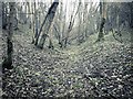
"Earthwork remains of a bronze age round barrow located immediately west of the wooded gully, Robin Hood's Howl. Excavations have reported finding a large quantity of burnt bone together with an urn. The monument survives as a low stony mound approximately 25 metres in diameter and 0.5 metres high. Scheduled."
Source: Pastscape
You may be viewing yesterday's version of this page. To see the most up to date information please register for a free account.
Do not use the above information on other web sites or publications without permission of the contributor.
Nearby Images from Geograph Britain and Ireland:
©2021(licence)
©2020(licence)
©2020(licence)
©2022(licence)
©2020(licence)
The above images may not be of the site on this page, they are loaded from Geograph.
Please Submit an Image of this site or go out and take one for us!
Click here to see more info for this site
Nearby sites
Key: Red: member's photo, Blue: 3rd party photo, Yellow: other image, Green: no photo - please go there and take one, Grey: site destroyed
Download sites to:
KML (Google Earth)
GPX (GPS waypoints)
CSV (Garmin/Navman)
CSV (Excel)
To unlock full downloads you need to sign up as a Contributory Member. Otherwise downloads are limited to 50 sites.
Turn off the page maps and other distractions
Nearby sites listing. In the following links * = Image available
1.2km SSW 197° Kirkdale Sundial* Early Christian Sculptured Stone (SE6768885776)
1.4km S 190° Kirkdale Hyena Cave* Cave or Rock Shelter (SE678856)
2.8km N 9° Kirk Howe Cairn (SE68458975)
3.6km SE 140° St Michael and All Angels (Great Edstone)* Early Christian Sculptured Stone (SE704842)
3.9km NE 40° Ryedale Folk Museum* Museum (SE7051890022)
4.6km ESE 102° Sinnington Round Barrow* Round Barrow(s) (SE7255686032)
5.0km NNE 17° Hangman Stone (Shortsha Beck)* Marker Stone (SE6941391740)
5.1km NNE 22° Slap Stones Wath RC1* Round Cairn (SE6986791732)
5.4km NE 51° Mary Magdalene's Well* Holy Well or Sacred Spring (SE722904)
5.5km NNE 16° Blakey Road South BS1* Marker Stone (SE6945792278)
5.5km ENE 78° Low Cross (Appleton Le Moors)* Ancient Cross (SE7342188200)
5.6km ENE 74° High Cross (Appleton Le Moors)* Ancient Cross (SE7335888560)
5.7km N 355° Harland Moor* Stone Circle (SE675926)
5.7km NNE 13° Lund Road Standing Stone* Standing Stone (Menhir) (SE6922992572)
5.8km NNE 14° Blakey Ridge Guide Stone* Marker Stone (SE6936292558)
5.8km NNE 15° Thorn Stone (Blakey Ridge)* Marker Stone (SE6944592556)
5.9km NE 55° St Mary (Lastingham)* Ancient Cross (SE72819045)
5.9km N 10° Hagg End Cairnfield* Round Barrow(s) (SE6895692803)
6.0km NE 55° St Cedd's Well* Holy Well or Sacred Spring (SE7291990460)
6.1km NE 55° St Chad's Well (Lastingham)* Holy Well or Sacred Spring (SE7296390542)
6.4km NNE 25° High Snape's ring cairn* Ring Cairn (SE706928)
6.6km E 98° Sinnington Crosses* Ancient Cross (SE746861)
6.8km NNW 339° Bog House Standing Stone* Standing Stone (Menhir) (SE6550893300)
7.5km WSW 247° All Saints (Helmsley)* Early Christian Sculptured Stone (SE61188387)
7.7km NNW 347° Obtrusch* Round Cairn (SE6614394416)
View more nearby sites and additional images


 We would like to know more about this location. Please feel free to add a brief description and any relevant information in your own language.
 Wir möchten mehr über diese Stätte erfahren. Bitte zögern Sie nicht, eine kurze Beschreibung und relevante Informationen in Deutsch hinzuzufügen.
 Nous aimerions en savoir encore un peu sur les lieux. S'il vous plaît n'hesitez pas à ajouter une courte description et tous les renseignements pertinents dans votre propre langue.
 Quisieramos informarnos un poco más de las lugares. No dude en añadir una breve descripción y otros datos relevantes en su propio idioma.