


<< Our Photo Pages >> Whiteknights Stones - Modern Stone Circle etc in England in Berkshire
Submitted by Spiddly on Wednesday, 07 March 2018 Page Views: 1866
Modern SitesSite Name: Whiteknights StonesCountry: England
NOTE: This site is 1.962 km away from the location you searched for.
County: Berkshire Type: Modern Stone Circle etc
Nearest Town: Reading
Map Ref: SU739715
Latitude: 51.437686N Longitude: 0.938211W
Condition:
| 5 | Perfect |
| 4 | Almost Perfect |
| 3 | Reasonable but with some damage |
| 2 | Ruined but still recognisable as an ancient site |
| 1 | Pretty much destroyed, possibly visible as crop marks |
| 0 | No data. |
| -1 | Completely destroyed |
| 5 | Superb |
| 4 | Good |
| 3 | Ordinary |
| 2 | Not Good |
| 1 | Awful |
| 0 | No data. |
| 5 | Can be driven to, probably with disabled access |
| 4 | Short walk on a footpath |
| 3 | Requiring a bit more of a walk |
| 2 | A long walk |
| 1 | In the middle of nowhere, a nightmare to find |
| 0 | No data. |
| 5 | co-ordinates taken by GPS or official recorded co-ordinates |
| 4 | co-ordinates scaled from a detailed map |
| 3 | co-ordinates scaled from a bad map |
| 2 | co-ordinates of the nearest village |
| 1 | co-ordinates of the nearest town |
| 0 | no data |
Internal Links:
External Links:
")
These included a grotto, which is still there, although it has lost its decorative coral and sea shells. But most intersting for us is that he created his own stone row. The stones of the stone row are still present, but they were uprooted and re-built as a fernery in 1878.
Source and full references here: Where did the Whiteknights sarsen stones come from? by Katy Whitaker https://hcommons.org/deposits/item/hc:18363/, where there is a photo of the grotto and stone row. With thanks to Katy Whitaker for the information.
You may be viewing yesterday's version of this page. To see the most up to date information please register for a free account.
")
")
")
Do not use the above information on other web sites or publications without permission of the contributor.
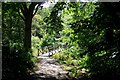
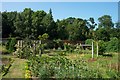
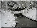
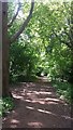
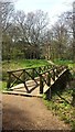
Nearby Images from Geograph Britain and Ireland:
©2007(licence)
©2009(licence)
©2007(licence)
©2017(licence)
©2017(licence)
The above images may not be of the site on this page, they are loaded from Geograph.
Please Submit an Image of this site or go out and take one for us!
Click here to see more info for this site
Nearby sites
Key: Red: member's photo, Blue: 3rd party photo, Yellow: other image, Green: no photo - please go there and take one, Grey: site destroyed
Download sites to:
KML (Google Earth)
GPX (GPS waypoints)
CSV (Garmin/Navman)
CSV (Excel)
To unlock full downloads you need to sign up as a Contributory Member. Otherwise downloads are limited to 50 sites.
Turn off the page maps and other distractions
Nearby sites listing. In the following links * = Image available
3.0km NW 312° Reading Museum* Museum (SU716735)
3.9km WSW 249° Reading Cursus* Cursus (SU70307005)
4.4km NW 323° St. Anne's Well (Caversham)* Holy Well or Sacred Spring (SU712750)
4.7km W 265° Anslow's Cottages Trackway Ancient Trackway (SU6923470984)
5.1km NNE 31° Sonning Cursus Cursus (SU765759)
5.2km NNE 33° Sonning Cursus Cursus (SU767759)
8.7km SE 143° Warren Lodge Barrows* Round Barrow(s) (SU7925664643)
8.9km W 261° Burghfield Cursus Cursus (SU65137000)
10.7km NNE 23° Mont de la Ville* Passage Grave (SU77968140)
10.8km NE 35° Rebecca's Well (Crazies Hill)* Holy Well or Sacred Spring (SU7993080487)
11.0km NNW 330° Wyfold Castle* Hillfort (SU68328099)
11.0km NNW 330° Castle Grove Camp Hillfort (SU6832580996)
11.2km S 169° Cudbury Clump Barrow* Round Barrow(s) (SU76216058)
11.3km W 269° Englefield Cursus (SU626712)
11.3km SSE 160° Eversley Church Sarsen Stone* Natural Stone / Erratic / Other Natural Feature (SU7791060924)
11.3km W 265° Englefield Cursus (SU626703)
11.4km WSW 246° Ufton Nervet Bell Barrow* Round Barrow(s) (SU6356266625)
11.5km WSW 237° Holden's Firs* Barrow Cemetery (SU64366506)
11.9km NW 306° Bozedown Camp* Hillfort (SU6419578403)
12.1km W 259° Ufton Nervet Cursus Cursus (SU620691)
12.2km WSW 245° Raven Hill* Promontory Fort / Cliff Castle (SU62876615)
12.2km W 261° Ufton Nervet Cursus Cursus (SU618695)
12.6km ESE 114° Woodenhill Plantation Barrow Round Barrow(s) (SU85496656)
13.1km E 94° The Quelm Stone* Natural Stone / Erratic / Other Natural Feature (SU870708)
13.3km ESE 105° Bill Hill (Berkshire)* Round Barrow(s) (SU868683)
View more nearby sites and additional images


 We would like to know more about this location. Please feel free to add a brief description and any relevant information in your own language.
 Wir möchten mehr über diese Stätte erfahren. Bitte zögern Sie nicht, eine kurze Beschreibung und relevante Informationen in Deutsch hinzuzufügen.
 Nous aimerions en savoir encore un peu sur les lieux. S'il vous plaît n'hesitez pas à ajouter une courte description et tous les renseignements pertinents dans votre propre langue.
 Quisieramos informarnos un poco más de las lugares. No dude en añadir una breve descripción y otros datos relevantes en su propio idioma.