


<< Our Photo Pages >> Botyl Well - Holy Well or Sacred Spring in England in Buckinghamshire
Submitted by enkidu41 on Saturday, 18 December 2004 Page Views: 8680
Springs and Holy WellsSite Name: Botyl Well Alternative Name: St Botolph's WellCountry: England
NOTE: This site is 1.106 km away from the location you searched for.
County: Buckinghamshire Type: Holy Well or Sacred Spring
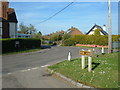
Nearest Town: Buckingham Nearest Village: Botolph Claydon
Map Ref: SP732245
Latitude: 51.914229N Longitude: 0.937187W
Condition:
| 5 | Perfect |
| 4 | Almost Perfect |
| 3 | Reasonable but with some damage |
| 2 | Ruined but still recognisable as an ancient site |
| 1 | Pretty much destroyed, possibly visible as crop marks |
| 0 | No data. |
| -1 | Completely destroyed |
| 5 | Superb |
| 4 | Good |
| 3 | Ordinary |
| 2 | Not Good |
| 1 | Awful |
| 0 | No data. |
| 5 | Can be driven to, probably with disabled access |
| 4 | Short walk on a footpath |
| 3 | Requiring a bit more of a walk |
| 2 | A long walk |
| 1 | In the middle of nowhere, a nightmare to find |
| 0 | No data. |
| 5 | co-ordinates taken by GPS or official recorded co-ordinates |
| 4 | co-ordinates scaled from a detailed map |
| 3 | co-ordinates scaled from a bad map |
| 2 | co-ordinates of the nearest village |
| 1 | co-ordinates of the nearest town |
| 0 | no data |
Internal Links:
External Links:
")
There may, however, be an element of folk etymology involved. Botyl, still the name of the main street, is simply the Old English word "botl" meaning "house" and may have been corrupted (perhaps deliberately by the early church to erase pagan influences) to Botulph. There seems little reason to suppose that St. Botulph came this far west from his 'home base' of Lincolnshire.
Note: Botyl Well rediscovered.
You may be viewing yesterday's version of this page. To see the most up to date information please register for a free account.
")
")
")
Do not use the above information on other web sites or publications without permission of the contributor.
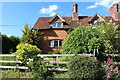
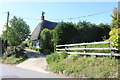
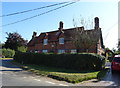
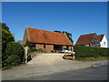
Nearby Images from Geograph Britain and Ireland:
©2020(licence)
©2020(licence)
©2019(licence)
©2019(licence)
©2011(licence)
The above images may not be of the site on this page, they are loaded from Geograph.
Please Submit an Image of this site or go out and take one for us!
Click here to see more info for this site
Nearby sites
Key: Red: member's photo, Blue: 3rd party photo, Yellow: other image, Green: no photo - please go there and take one, Grey: site destroyed
Download sites to:
KML (Google Earth)
GPX (GPS waypoints)
CSV (Garmin/Navman)
CSV (Excel)
To unlock full downloads you need to sign up as a Contributory Member. Otherwise downloads are limited to 50 sites.
Turn off the page maps and other distractions
Nearby sites listing. In the following links * = Image available
2.0km ENE 64° Sionhill Farm Henge (SP75012541)
4.9km ESE 115° Scorne Well* Holy Well or Sacred Spring (SP777225)
7.8km ESE 120° Fair Alice well Holy Well or Sacred Spring (SP800207)
7.9km ESE 120° Whittle Hole* Holy Well or Sacred Spring (SP801207)
8.2km ESE 118° Holy Well (Whitchurch)* Holy Well or Sacred Spring (SP805207)
8.3km ESE 117° Whitchurch Holy Well Holy Well or Sacred Spring (SP806208)
8.8km N 1° Thornborough (Bucks)* Barrow Cemetery (SP732333)
9.9km NNW 336° St Rumwald's Well* Holy Well or Sacred Spring (SP690335)
11.7km NE 39° Whaddon Barrow* Round Barrow(s)
13.4km SSE 153° Hartwell Springs* Holy Well or Sacred Spring (SP7939412589)
13.5km ENE 59° St. John's Well (Buckinghamshire)* Holy Well or Sacred Spring (SP847316)
13.9km SE 133° St. Osyth's Well (Bierton)* Holy Well or Sacred Spring (SP836152)
14.0km S 178° Cuddington Spring Holy Well or Sacred Spring (SP739105)
14.3km S 186° Stock Well (Chearsley)* Holy Well or Sacred Spring (SP718103)
14.6km W 260° Bicester Stone Circle* Modern Stone Circle etc (SP588217)
15.3km E 81° Soulbury Stone* Natural Stone / Erratic / Other Natural Feature (SP88292709)
15.7km W 263° Bicester Burial Mounds Barrow Cemetery (SP576223)
15.8km NNE 22° Gorrick’s Well Holy Well or Sacred Spring (SP78803930)
17.7km E 83° Linslade Holy Well Holy Well or Sacred Spring (SP908270)
18.4km NNE 19° St. Vincent's Well Holy Well or Sacred Spring (SP7942)
18.9km E 83° Shepherd's Race (Heath)* Turf Maze (SP9227)
19.5km NE 56° Caldecotte Cursus Cursus (SP892357)
20.8km SSE 154° Ragpit Hill Cross Dyke Misc. Earthwork (SP82750601)
20.8km SSE 154° Ragpit Cross Dykes Misc. Earthwork (SP82750600)
20.9km SSE 153° Ragpit Cross Dyke Misc. Earthwork (SP83020598)
View more nearby sites and additional images


 We would like to know more about this location. Please feel free to add a brief description and any relevant information in your own language.
 Wir möchten mehr über diese Stätte erfahren. Bitte zögern Sie nicht, eine kurze Beschreibung und relevante Informationen in Deutsch hinzuzufügen.
 Nous aimerions en savoir encore un peu sur les lieux. S'il vous plaît n'hesitez pas à ajouter une courte description et tous les renseignements pertinents dans votre propre langue.
 Quisieramos informarnos un poco más de las lugares. No dude en añadir una breve descripción y otros datos relevantes en su propio idioma.