<< Our Photo Pages >> Danby Rigg (Slate Hill) - Marker Stone in England in Yorkshire (North)
Submitted by Anne T on Tuesday, 04 July 2017 Page Views: 1555
Multi-periodSite Name: Danby Rigg (Slate Hill)Country: England County: Yorkshire (North) Type: Marker Stone
Nearest Town: Guisborough Nearest Village: Ainthorpe
Map Ref: NZ7078805869
Latitude: 54.443306N Longitude: 0.909974W
Condition:
| 5 | Perfect |
| 4 | Almost Perfect |
| 3 | Reasonable but with some damage |
| 2 | Ruined but still recognisable as an ancient site |
| 1 | Pretty much destroyed, possibly visible as crop marks |
| 0 | No data. |
| -1 | Completely destroyed |
| 5 | Superb |
| 4 | Good |
| 3 | Ordinary |
| 2 | Not Good |
| 1 | Awful |
| 0 | No data. |
| 5 | Can be driven to, probably with disabled access |
| 4 | Short walk on a footpath |
| 3 | Requiring a bit more of a walk |
| 2 | A long walk |
| 1 | In the middle of nowhere, a nightmare to find |
| 0 | No data. |
| 5 | co-ordinates taken by GPS or official recorded co-ordinates |
| 4 | co-ordinates scaled from a detailed map |
| 3 | co-ordinates scaled from a bad map |
| 2 | co-ordinates of the nearest village |
| 1 | co-ordinates of the nearest town |
| 0 | no data |
Be the first person to rate this site - see the 'Contribute!' box in the right hand menu.
Internal Links:
External Links:
I have visited· I would like to visit
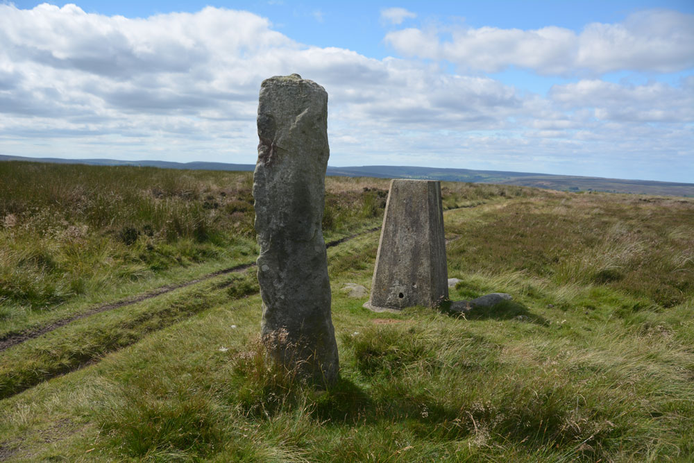
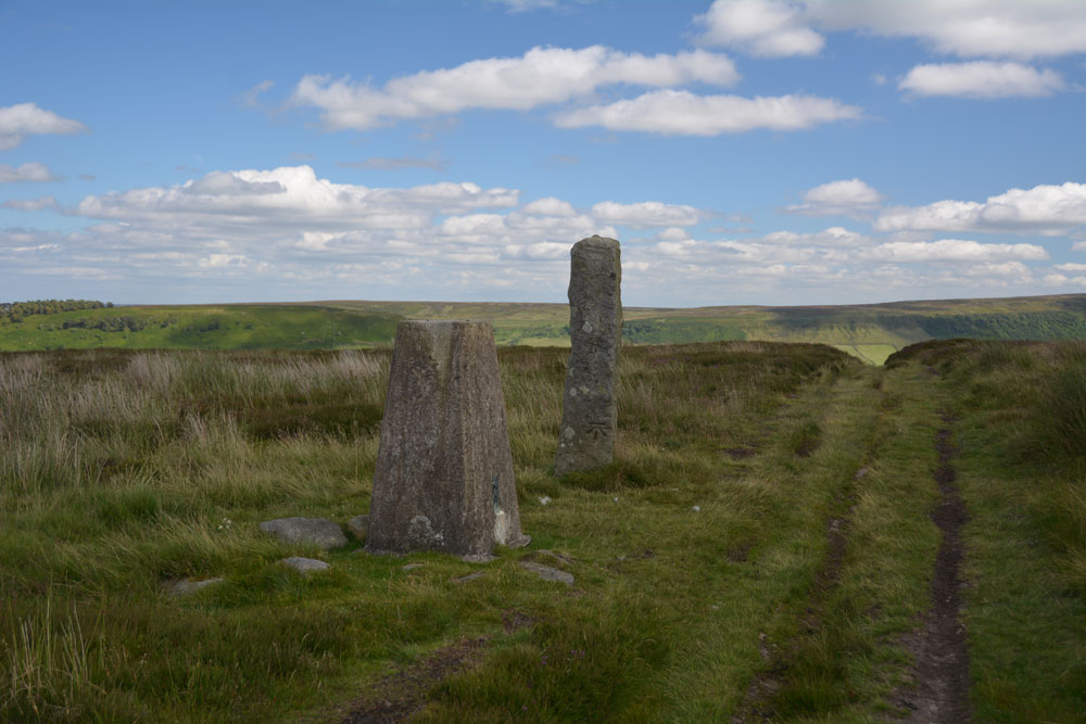
Anne T visited on 2nd Jul 2017 - their rating: Cond: 4 Amb: 4 Access: 4 Marker/Standing Stone & Trig Point, Danby Rigg, North Yorkshire: Not marked on the OS map, this stone sits within a couple of metres of Trig Point TP2728 (Danby Moor). It is sited almost on the eastern edge of Danby Rigg, where the ridge starts to slope sharply down to Little Fryup Dale. There is no information recorded about it on Pastscape, although their information for the area indicates a number of way markers, some scheduled, which mark the route of a medieval footpath which runs from Slate Head to Ainthorpe. Other way markers (such as this) mark out two separate footpaths from Little Fryup Dale in the east to Danby Dale at the western most side of the ridge. This sits at the side of the western most track, continuing the farm track east-west over the ridge.
The area has a long history and plays host to many features, including cairn cemeteries, cross dykes, cairn circles and round cairns, many dating to the Bronze Age and possibly Neolithic.
The easiest way to reach this stone and trig point is to walk from (or park at) the cross roads just to the south of Slate Hill House (where Castle Lane, New Way and Slate Hill meet). There is a farm track and a footpath starting almost from the same point up to the top of Danby Rigg. The footpath is somewhat overgrown and steep towards the top, so we followed the well used farm track which heads almost directly west then tracks north east up the slope. Almost as soon as the path levels out, you see the stone and the trig point. The views back towards where Little Fryup Dale meets Great Fryup Dale. The views across these valleys and northwards back towards Ainthorpe are stunning.
oldman have visited here
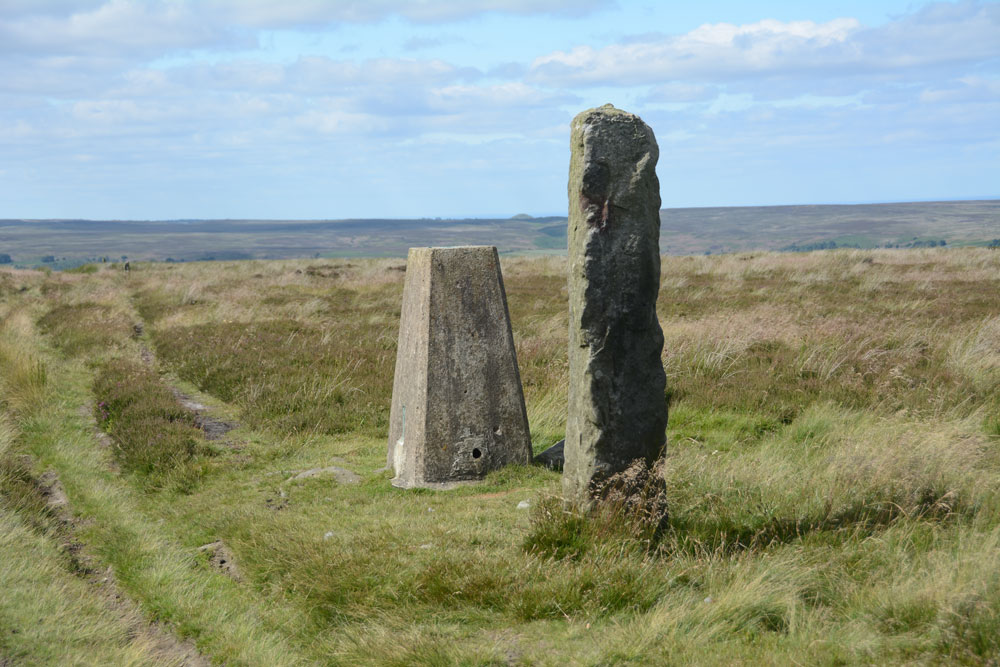
Not marked on the OS map, this stone sits within a couple of metres of Trig Point TP2728 (Danby Moor). It is sited almost on the eastern edge of Danby Rigg, where the ridge starts to slope sharply down to Little Fryup Dale. There is no information recorded about it on Pastscape, although their information for the area indicates a number of way markers, some scheduled, which mark the route of a medieval footpath which runs from Slate Head to Ainthorpe. Other way markers mark out two separate footpaths from Little Fryup Dale in the east to Danby Dale at the western most side of the ridge.
The area has a long history and plays host to many features, including cairn cemeteries, cross dykes, cairn circles and round cairns, many dating to the Bronze Age and possibly Neolithic.
The easiest way to reach this stone and trig point is to walk from (or park at) the cross roads just to the south of Slate Hill House (where Castle Lane, New Way and Slate Hill meet). There is a farm track and a footpath starting almost from the same point up to the top of Danby Rigg. The footpath is somewhat overgrown and steep towards the top, so we followed the well used farm track which heads almost directly west then tracks north east up the slope. Almost as soon as the path levels out, you see the stone and the trig point. The views back towards where Little Fryup Dale meets Great Fryup Dale. The views across these valleys and northwards back towards Ainthorpe are stunning.
You may be viewing yesterday's version of this page. To see the most up to date information please register for a free account.




Do not use the above information on other web sites or publications without permission of the contributor.
Click here to see more info for this site
Nearby sites
Key: Red: member's photo, Blue: 3rd party photo, Yellow: other image, Green: no photo - please go there and take one, Grey: site destroyed
Download sites to:
KML (Google Earth)
GPX (GPS waypoints)
CSV (Garmin/Navman)
CSV (Excel)
To unlock full downloads you need to sign up as a Contributory Member. Otherwise downloads are limited to 50 sites.
Turn off the page maps and other distractions
Nearby sites listing. In the following links * = Image available
76m NNW 334° Danby Rigg Marker Stones* Marker Stone (NZ7075305937)
183m NE 47° Danby Rigg Cross Dyke (Crossley Side)* Misc. Earthwork (NZ7092005996)
216m WSW 243° Danby Rigg Settlement* Ancient Village or Settlement (NZ7059605768)
253m NE 43° Danby Rigg (Crossley Gate)* Cairn (NZ7095706058)
255m ENE 78° Old Wife's Stones (Danby Rigg)* Standing Stones (NZ7103705927)
257m NNW 331° Danby Rigg Cross Dyke (North End Farm Side)* Misc. Earthwork (NZ7065806091)
335m NE 41° Danby Rigg Marker Stone (Crossley Gate)* Marker Stone (NZ7100606124)
335m NNW 340° Segmented Pit Alignment (Ainthorpe / Danby Rigg)* Misc. Earthwork (NZ7066906183)
382m N 351° Barrow Cemetery (Ainthorpe Rigg)* Barrow Cemetery (NZ7071906245)
424m N 2° Ring Cairns (Ainthorpe / Danby Rigg)* Ring Cairn (NZ7079906293)
513m SW 215° Danby Rigg Double Dyke* Misc. Earthwork (NZ7050305442)
691m N 2° Danby Rigg Cairn With Standing Stone* Ring Cairn (NZ70800656)
780m N 359° Black Nab Marker Stone (Ainthorpe / Danby Rigg)* Marker Stone (NZ7075806649)
1.2km SW 215° Hanging Stone (Ainthorpe Rigg)* Natural Stone / Erratic / Other Natural Feature (NZ7011904896)
1.7km SSW 205° Dancing Stone (Botton)* Natural Stone / Erratic / Other Natural Feature (NZ7007604283)
2.7km WSW 246° Low Crag Dyke* Misc. Earthwork (NZ6833104727)
3.2km SW 235° High Stone Dike (Castleton Rigg)* Misc. Earthwork (NZ6820403990)
3.4km SE 132° Hart Leap Stones* Misc. Earthwork (NZ73380365)
3.7km SE 144° Rokan Stone* Marker Stone (NZ7298402936)
3.7km ESE 110° Black Hill Cross (Glaisdale Rigg)* Ancient Cross (NZ7425304643)
3.7km SE 131° Glaisdale Stone* Standing Stone (Menhir) (NZ7366603471)
3.8km E 100° Glaisdale Rigg (Hill Top)* Marker Stone (NZ7452605269)
3.9km NNE 25° Castleton Pits RB1* Round Barrow(s) (NZ7240009450)
4.0km SE 125° Glaisdale Rigg Tall Cairn* Cairn (NZ7406403622)
4.0km SSW 196° Botton Cross* Ancient Cross (NZ6972402002)
View more nearby sites and additional images




 We would like to know more about this location. Please feel free to add a brief description and any relevant information in your own language.
 Wir möchten mehr über diese Stätte erfahren. Bitte zögern Sie nicht, eine kurze Beschreibung und relevante Informationen in Deutsch hinzuzufügen.
 Nous aimerions en savoir encore un peu sur les lieux. S'il vous plaît n'hesitez pas à ajouter une courte description et tous les renseignements pertinents dans votre propre langue.
 Quisieramos informarnos un poco más de las lugares. No dude en añadir una breve descripción y otros datos relevantes en su propio idioma.