


<< Text Pages >> Sonning Cursus - Cursus in England in Berkshire
Submitted by EssexMan on Wednesday, 07 April 2010 Page Views: 5199
Neolithic and Bronze AgeSite Name: Sonning CursusCountry: England
NOTE: This site is 2.746 km away from the location you searched for.
County: Berkshire Type: Cursus
Nearest Town: Reading Nearest Village: Sonning
Map Ref: SU767759 Landranger Map Number: 175
Latitude: 51.476870N Longitude: 0.896983W
Condition:
| 5 | Perfect |
| 4 | Almost Perfect |
| 3 | Reasonable but with some damage |
| 2 | Ruined but still recognisable as an ancient site |
| 1 | Pretty much destroyed, possibly visible as crop marks |
| 0 | No data. |
| -1 | Completely destroyed |
| 5 | Superb |
| 4 | Good |
| 3 | Ordinary |
| 2 | Not Good |
| 1 | Awful |
| 0 | No data. |
| 5 | Can be driven to, probably with disabled access |
| 4 | Short walk on a footpath |
| 3 | Requiring a bit more of a walk |
| 2 | A long walk |
| 1 | In the middle of nowhere, a nightmare to find |
| 0 | No data. |
| 5 | co-ordinates taken by GPS or official recorded co-ordinates |
| 4 | co-ordinates scaled from a detailed map |
| 3 | co-ordinates scaled from a bad map |
| 2 | co-ordinates of the nearest village |
| 1 | co-ordinates of the nearest town |
| 0 | no data |
Internal Links:
External Links:
Minor Cursus in Berkshire
Status: Characteristic
NMR No. SU 77 NE 119
Extent: 250mx35m
Terminal type: Square
Note: This location marks one terminal (end) of a cursus monument. The location of the other terminal can be found in the Nearby Site list below.
The Northern Antiquarian (TNA) also features a page for this cursus - see their entry for Sonning Cursus, Reading, Berkshire, which gives a brief archaeology & history, quoting from recent archaeological sources, together with a plan of the curus and other ancient remains.
This cursus is also recorded as Pastscape Monument 1231620, the summary of which reads: "A probable cursus at Sonning seen as a cropmark on air photographs. Visible as an incomplete elongated rectangular enclosure aligned roughly east-west, only the eastern terminal appears on air photographs. The extant portion of the monument is circa 200 metres in length and 45 metres across, with a clear entrance gap or causeway midway through the the eastern terminal. The cursus is part of a cluster of prehistoric cropmark sites located northeast of Sonning and east of the River Thames." See their complete record for more details.
You may be viewing yesterday's version of this page. To see the most up to date information please register for a free account.
Do not use the above information on other web sites or publications without permission of the contributor.
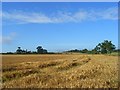
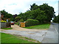
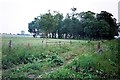
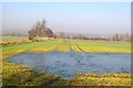
Nearby Images from Geograph Britain and Ireland:
©2008(licence)
©2013(licence)
©2017(licence)

©2007(licence)
©2013(licence)
The above images may not be of the site on this page, they are loaded from Geograph.
Please Submit an Image of this site or go out and take one for us!
Click here to see more info for this site
Nearby sites
Key: Red: member's photo, Blue: 3rd party photo, Yellow: other image, Green: no photo - please go there and take one, Grey: site destroyed
Download sites to:
KML (Google Earth)
GPX (GPS waypoints)
CSV (Garmin/Navman)
CSV (Excel)
To unlock full downloads you need to sign up as a Contributory Member. Otherwise downloads are limited to 50 sites.
Turn off the page maps and other distractions
Nearby sites listing. In the following links * = Image available
199m W 271° Sonning Cursus Cursus (SU765759)
5.2km SSW 213° Whiteknights Stones* Modern Stone Circle etc (SU739715)
5.6km W 262° St. Anne's Well (Caversham)* Holy Well or Sacred Spring (SU712750)
5.6km NE 36° Rebecca's Well (Crazies Hill)* Holy Well or Sacred Spring (SU7993080487)
5.6km WSW 246° Reading Museum* Museum (SU716735)
5.6km NNE 14° Mont de la Ville* Passage Grave (SU77968140)
8.7km SW 228° Reading Cursus* Cursus (SU70307005)
8.9km WSW 237° Anslow's Cottages Trackway Ancient Trackway (SU6923470984)
9.5km ENE 62° Maidenhead Thicket Bowl Barrow* Round Barrow(s) (SU850805)
9.6km NNE 25° Medmenham Camp* Hillfort (SU80698467)
9.8km WNW 302° Castle Grove Camp Hillfort (SU6832580996)
9.8km WNW 302° Wyfold Castle* Hillfort (SU68328099)
9.9km NNE 32° Danesfield Camp* Hillfort (SU81768440)
9.9km ENE 59° Robin Hood's Arbour* Ancient Village or Settlement (SU85188108)
11.2km NW 318° Stoke Row Puddingstone* Natural Stone / Erratic / Other Natural Feature (SU6910684123)
11.2km NE 37° Low Grounds Farm Barrow Cemetery (SU834849)
11.5km ESE 117° The Quelm Stone* Natural Stone / Erratic / Other Natural Feature (SU870708)
11.5km SSE 168° Warren Lodge Barrows* Round Barrow(s) (SU7925664643)
11.7km NE 44° Princess Elizabeth's Well* Holy Well or Sacred Spring (SU848844)
12.6km SE 128° Bill Hill (Berkshire)* Round Barrow(s) (SU868683)
12.7km NNW 330° Nettlebed Puddingstones* Natural Stone / Erratic / Other Natural Feature (SU7018186797)
12.7km ESE 105° Holyport Modern Stone Circle Modern Stone Circle etc (SU8908672865)
12.7km WNW 282° Bozedown Camp* Hillfort (SU6419578403)
12.8km SE 138° Woodenhill Plantation Barrow Round Barrow(s) (SU85496656)
13.0km WSW 244° Burghfield Cursus Cursus (SU65137000)
View more nearby sites and additional images


 We would like to know more about this location. Please feel free to add a brief description and any relevant information in your own language.
 Wir möchten mehr über diese Stätte erfahren. Bitte zögern Sie nicht, eine kurze Beschreibung und relevante Informationen in Deutsch hinzuzufügen.
 Nous aimerions en savoir encore un peu sur les lieux. S'il vous plaît n'hesitez pas à ajouter une courte description et tous les renseignements pertinents dans votre propre langue.
 Quisieramos informarnos un poco más de las lugares. No dude en añadir una breve descripción y otros datos relevantes en su propio idioma.