


<< Text Pages >> Ancient field boundaries near Blackwater - Misc. Earthwork in England in Surrey
Submitted by Storm_oak on Monday, 25 November 2013 Page Views: 2617
Multi-periodSite Name: Ancient field boundaries near BlackwaterCountry: England
NOTE: This site is 2.304 km away from the location you searched for.
County: Surrey Type: Misc. Earthwork
Nearest Town: Yateley Nearest Village: Blackwater
Map Ref: SU8257058911
Latitude: 51.323324N Longitude: 0.816417W
Condition:
| 5 | Perfect |
| 4 | Almost Perfect |
| 3 | Reasonable but with some damage |
| 2 | Ruined but still recognisable as an ancient site |
| 1 | Pretty much destroyed, possibly visible as crop marks |
| 0 | No data. |
| -1 | Completely destroyed |
| 5 | Superb |
| 4 | Good |
| 3 | Ordinary |
| 2 | Not Good |
| 1 | Awful |
| 0 | No data. |
| 5 | Can be driven to, probably with disabled access |
| 4 | Short walk on a footpath |
| 3 | Requiring a bit more of a walk |
| 2 | A long walk |
| 1 | In the middle of nowhere, a nightmare to find |
| 0 | No data. |
| 5 | co-ordinates taken by GPS or official recorded co-ordinates |
| 4 | co-ordinates scaled from a detailed map |
| 3 | co-ordinates scaled from a bad map |
| 2 | co-ordinates of the nearest village |
| 1 | co-ordinates of the nearest town |
| 0 | no data |
Internal Links:
External Links:
Misc. Earthwork in Surrey
Series of banks and possibly ditches believed to be Neolithic field boundaries in diamond pattern with round barrow set at the edge of them. Extends for some distance over MOD owned heathland and can be seen from the A30. One section has been excavated early in the 2000s by PHD student at Farnborough College of Technology. Some damage was caused to the banks from around the time of the Second World war when tanks and soldiers carried out training on the site and the tanks drove over the banks. Most of the banks are however intact. Recorded on Ancient Sites and Monuments register.
Drive from Camberley to Hook along the A30. On the left hand side there is a large layby which it is free to park in. The banks are visible from the edge of the heathland and extend for quite a distance to the right along the heathland and as far as a fence that runs along the back which segregates part of the common. It is unclear if the banks extend into that area.
You may be viewing yesterday's version of this page. To see the most up to date information please register for a free account.
Do not use the above information on other web sites or publications without permission of the contributor.
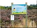
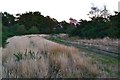
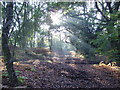
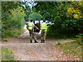
Nearby Images from Geograph Britain and Ireland:
©2014(licence)
©2014(licence)
©2008(licence)
©2014(licence)
©2008(licence)
The above images may not be of the site on this page, they are loaded from Geograph.
Please Submit an Image of this site or go out and take one for us!
Click here to see more info for this site
Nearby sites
Key: Red: member's photo, Blue: 3rd party photo, Yellow: other image, Green: no photo - please go there and take one, Grey: site destroyed
Download sites to:
KML (Google Earth)
GPX (GPS waypoints)
CSV (Garmin/Navman)
CSV (Excel)
To unlock full downloads you need to sign up as a Contributory Member. Otherwise downloads are limited to 50 sites.
Turn off the page maps and other distractions
Nearby sites listing. In the following links * = Image available
422m SE 126° Hornley Common* Round Barrow(s) (SU8291758669)
530m E 95° Round Barrow near Blackwater Round Barrow(s) (SU8310158871)
5.1km WNW 294° Eversley Church Sarsen Stone* Natural Stone / Erratic / Other Natural Feature (SU7791060924)
6.6km WNW 286° Cudbury Clump Barrow* Round Barrow(s) (SU76216058)
6.6km NNW 331° Warren Lodge Barrows* Round Barrow(s) (SU7925664643)
6.9km SE 143° Barrow on Queen's Hotel roundabout* Round Barrow(s) (SU8682953432)
7.7km SSE 165° Bat's Hogsty* Misc. Earthwork (SU84685152)
7.7km NNE 30° Caesar's Camp (Berkshire)* Hillfort (SU863657)
8.2km NNE 22° Woodenhill Plantation Barrow Round Barrow(s) (SU85496656)
8.9km S 175° Caesar's Camp (Hampshire)* Hillfort (SU835501)
9.5km S 183° Heath Brow Barrows* Barrow Cemetery (SU82184937)
10.3km NNE 25° Bill Hill (Berkshire)* Round Barrow(s) (SU868683)
10.8km ENE 78° West End Common Barrows* Barrow Cemetery (SU931614)
10.8km NE 38° Swinley Park Barrow* Round Barrow(s) (SU89106754)
11.3km ENE 79° New England Barrow Round Barrow(s) (SU93616129)
11.5km SSE 163° Badshot Lea* Long Barrow (SU86084793)
12.7km NNE 21° The Quelm Stone* Natural Stone / Erratic / Other Natural Feature (SU870708)
12.8km ESE 107° Bullswater Common Barrows Barrow Cemetery (SU9487555356)
13.0km E 88° St John the Baptist's Well* Holy Well or Sacred Spring (SU956595)
13.1km NE 43° Bowledge Hill Bell Barrow* Round Barrow(s) (SU91336872)
13.6km SSE 160° Botany Hill Camp Hillfort (SU875462)
13.8km SSE 158° Soldier's Ring* Hillfort (SU880462)
13.9km SSE 162° St. Mary's Well (Compton)* Holy Well or Sacred Spring (SU870457)
14.7km ENE 60° Sunningdale Barrows Round Barrow(s) (SU952664)
14.8km SE 146° Hillbury hillfort* Hillfort (SU911468)
View more nearby sites and additional images


 We would like to know more about this location. Please feel free to add a brief description and any relevant information in your own language.
 Wir möchten mehr über diese Stätte erfahren. Bitte zögern Sie nicht, eine kurze Beschreibung und relevante Informationen in Deutsch hinzuzufügen.
 Nous aimerions en savoir encore un peu sur les lieux. S'il vous plaît n'hesitez pas à ajouter une courte description et tous les renseignements pertinents dans votre propre langue.
 Quisieramos informarnos un poco más de las lugares. No dude en añadir una breve descripción y otros datos relevantes en su propio idioma.