

<< Our Photo Pages >> Whaddon Barrow - Round Barrow(s) in England in Buckinghamshire
Submitted by njbarton on Friday, 28 May 2021 Page Views: 562
EnglandSite Name: Whaddon Barrow Alternative Name: Mill MoundCountry: England
NOTE: This site is 4.555 km away from the location you searched for.
County: Buckinghamshire Type: Round Barrow(s)
Nearest Town: Milton Keynes Nearest Village: Whaddon
Latitude: 51.996834N Longitude: 0.830359W
Condition:
| 5 | Perfect |
| 4 | Almost Perfect |
| 3 | Reasonable but with some damage |
| 2 | Ruined but still recognisable as an ancient site |
| 1 | Pretty much destroyed, possibly visible as crop marks |
| 0 | No data. |
| -1 | Completely destroyed |
| 5 | Superb |
| 4 | Good |
| 3 | Ordinary |
| 2 | Not Good |
| 1 | Awful |
| 0 | No data. |
| 5 | Can be driven to, probably with disabled access |
| 4 | Short walk on a footpath |
| 3 | Requiring a bit more of a walk |
| 2 | A long walk |
| 1 | In the middle of nowhere, a nightmare to find |
| 0 | No data. |
| 5 | co-ordinates taken by GPS or official recorded co-ordinates |
| 4 | co-ordinates scaled from a detailed map |
| 3 | co-ordinates scaled from a bad map |
| 2 | co-ordinates of the nearest village |
| 1 | co-ordinates of the nearest town |
| 0 | no data |
Internal Links:
External Links:
I have visited· I would like to visit
Chriski would like to visit
")
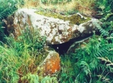
Shown on the OS map as "Mill Mound", however, it was originally a bowl barrow and is recognised as such in the schedule of ancient monuments, link to ancientmonumentsuk
It's located on a ridge with a rather a nice view.
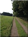
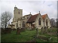
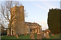
An easy walk across a field from Whaddon church
You may be viewing yesterday's version of this page. To see the most up to date information please register for a free account.
")
")
Do not use the above information on other web sites or publications without permission of the contributor.
Nearby Images from Geograph Britain and Ireland:
©2016(licence)
©2017(licence)
©2017(licence)
©2016(licence)
©2017(licence)
The above images may not be of the site on this page, they are loaded from Geograph.
Please Submit an Image of this site or go out and take one for us!
Click here to see more info for this site
Nearby sites
Click here to view sites on an interactive map of the areaKey: Red: member's photo, Blue: 3rd party photo, Yellow: other image, Green: no photo - please go there and take one, Grey: site destroyed
Download sites to:
KML (Google Earth)
GPX (GPS waypoints)
CSV (Garmin/Navman)
CSV (Excel)
To unlock full downloads you need to sign up as a Contributory Member. Otherwise downloads are limited to 50 sites.
Turn off the page maps and other distractions
Nearby sites listing. In the following links * = Image available
4.8km ESE 118° St. John's Well (Buckinghamshire)* Holy Well or Sacred Spring (SP847316)
5.7km NNW 345° Gorrick’s Well Holy Well or Sacred Spring (SP78803930)
7.2km W 267° Thornborough (Bucks)* Barrow Cemetery (SP732333)
8.3km N 351° St. Vincent's Well Holy Well or Sacred Spring (SP7942)
9.0km ENE 79° Caldecotte Cursus Cursus (SP892357)
9.8km NE 48° Millennium Medicine Wheel* Stone Circle (SP8758740483)
10.0km SSW 214° Sionhill Farm Henge (SP75012541)
10.3km SE 131° Soulbury Stone* Natural Stone / Erratic / Other Natural Feature (SP88292709)
11.4km W 269° St Rumwald's Well* Holy Well or Sacred Spring (SP690335)
11.6km SSW 194° Scorne Well* Holy Well or Sacred Spring (SP777225)
11.7km SW 219° Botyl Well* Holy Well or Sacred Spring (SP732245)
11.8km E 86° Danesborough Hillfort Hillfort (SP922348)
12.1km NNE 26° Gayhurst Barrow cemetery Barrow Cemetery (SP855448)
12.4km SE 124° Linslade Holy Well Holy Well or Sacred Spring (SP908270)
13.0km S 180° Whitchurch Holy Well Holy Well or Sacred Spring (SP806208)
13.1km S 180° Holy Well (Whitchurch)* Holy Well or Sacred Spring (SP805207)
13.1km S 182° Whittle Hole* Holy Well or Sacred Spring (SP801207)
13.1km S 183° Fair Alice well Holy Well or Sacred Spring (SP800207)
13.4km ESE 121° Shepherd's Race (Heath)* Turf Maze (SP9227)
17.8km NNE 16° Holy Well (Ravenstone)* Holy Well or Sacred Spring (SP849510)
17.9km ENE 62° Holywell (Cranfield)* Holy Well or Sacred Spring (SP961424)
18.9km S 171° St. Osyth's Well (Bierton)* Holy Well or Sacred Spring (SP836152)
20.6km NNE 18° Holy Well (Olney)* Holy Well or Sacred Spring (SP864535)
20.7km ENE 71° The Devil's stone (Bedfordshire)* Standing Stone (Menhir) (SP9989840865)
21.2km ESE 104° Conger Hill* Hillfort (TL011289)
View more nearby sites and additional images


 We would like to know more about this location. Please feel free to add a brief description and any relevant information in your own language.
 Wir möchten mehr über diese Stätte erfahren. Bitte zögern Sie nicht, eine kurze Beschreibung und relevante Informationen in Deutsch hinzuzufügen.
 Nous aimerions en savoir encore un peu sur les lieux. S'il vous plaît n'hesitez pas à ajouter une courte description et tous les renseignements pertinents dans votre propre langue.
 Quisieramos informarnos un poco más de las lugares. No dude en añadir una breve descripción y otros datos relevantes en su propio idioma.