


<< Our Photo Pages >> Warren Lodge Barrows - Round Barrow(s) in England in Berkshire
Submitted by SolarMegalith on Tuesday, 08 March 2011 Page Views: 7405
Neolithic and Bronze AgeSite Name: Warren Lodge BarrowsCountry: England
NOTE: This site is 4.166 km away from the location you searched for.
County: Berkshire Type: Round Barrow(s)
Nearest Town: Wokingham Nearest Village: Finchampstead
Map Ref: SU7925664643
Latitude: 51.375320N Longitude: 0.862701W
Condition:
| 5 | Perfect |
| 4 | Almost Perfect |
| 3 | Reasonable but with some damage |
| 2 | Ruined but still recognisable as an ancient site |
| 1 | Pretty much destroyed, possibly visible as crop marks |
| 0 | No data. |
| -1 | Completely destroyed |
| 5 | Superb |
| 4 | Good |
| 3 | Ordinary |
| 2 | Not Good |
| 1 | Awful |
| 0 | No data. |
| 5 | Can be driven to, probably with disabled access |
| 4 | Short walk on a footpath |
| 3 | Requiring a bit more of a walk |
| 2 | A long walk |
| 1 | In the middle of nowhere, a nightmare to find |
| 0 | No data. |
| 5 | co-ordinates taken by GPS or official recorded co-ordinates |
| 4 | co-ordinates scaled from a detailed map |
| 3 | co-ordinates scaled from a bad map |
| 2 | co-ordinates of the nearest village |
| 1 | co-ordinates of the nearest town |
| 0 | no data |
Internal Links:
External Links:
I have visited· I would like to visit
SolarMegalith visited on 20th Mar 2011 - their rating: Cond: 3 Amb: 4 Access: 4
")
A Bronze Age bowl barrow and possible remains of a bell barrow are located in a small forest north from Finchampstead.
Read More at Pastscape.
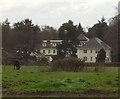
A large Bronze Age bell barrow is located near buildings of Warren Lodge. It was excavated in 1967. SE from the bell barrow there are remains of a bowl barrow with distinguishable traces of a quarry ditch, The site is easily accessable.
You may be viewing yesterday's version of this page. To see the most up to date information please register for a free account.
")
")
")
")
Do not use the above information on other web sites or publications without permission of the contributor.
Nearby Images from Geograph Britain and Ireland:
©2014(licence)
©2010(licence)
©2011(licence)
©2010(licence)
©2008(licence)
The above images may not be of the site on this page, they are loaded from Geograph.
Please Submit an Image of this site or go out and take one for us!
Click here to see more info for this site
Nearby sites
Key: Red: member's photo, Blue: 3rd party photo, Yellow: other image, Green: no photo - please go there and take one, Grey: site destroyed
Download sites to:
KML (Google Earth)
GPX (GPS waypoints)
CSV (Garmin/Navman)
CSV (Excel)
To unlock full downloads you need to sign up as a Contributory Member. Otherwise downloads are limited to 50 sites.
Turn off the page maps and other distractions
Nearby sites listing. In the following links * = Image available
4.0km SSW 201° Eversley Church Sarsen Stone* Natural Stone / Erratic / Other Natural Feature (SU7791060924)
5.1km SW 218° Cudbury Clump Barrow* Round Barrow(s) (SU76216058)
6.5km ENE 74° Woodenhill Plantation Barrow Round Barrow(s) (SU85496656)
6.6km SSE 151° Ancient field boundaries near Blackwater Misc. Earthwork (SU8257058911)
6.9km SSE 147° Round Barrow near Blackwater Round Barrow(s) (SU8310158871)
7.0km SSE 149° Hornley Common* Round Barrow(s) (SU8291758669)
7.1km E 82° Caesar's Camp (Berkshire)* Hillfort (SU863657)
8.4km ENE 65° Bill Hill (Berkshire)* Round Barrow(s) (SU868683)
8.7km NW 323° Whiteknights Stones* Modern Stone Circle etc (SU739715)
9.9km NE 52° The Quelm Stone* Natural Stone / Erratic / Other Natural Feature (SU870708)
10.2km ENE 74° Swinley Park Barrow* Round Barrow(s) (SU89106754)
10.4km WNW 302° Reading Cursus* Cursus (SU70307005)
11.5km NNW 348° Sonning Cursus Cursus (SU767759)
11.6km NNW 347° Sonning Cursus Cursus (SU765759)
11.7km NW 320° Reading Museum* Museum (SU716735)
11.8km WNW 303° Anslow's Cottages Trackway Ancient Trackway (SU6923470984)
12.7km ENE 72° Bowledge Hill Bell Barrow* Round Barrow(s) (SU91336872)
12.8km NE 51° Holyport Modern Stone Circle Modern Stone Circle etc (SU8908672865)
13.1km NW 323° St. Anne's Well (Caversham)* Holy Well or Sacred Spring (SU712750)
13.5km SSE 147° Barrow on Queen's Hotel roundabout* Round Barrow(s) (SU8682953432)
13.7km WSW 244° Bullsdown Camp* Hillfort (SU67085838)
14.2km ESE 104° West End Common Barrows* Barrow Cemetery (SU931614)
14.2km SSE 158° Bat's Hogsty* Misc. Earthwork (SU84685152)
14.7km ESE 104° New England Barrow Round Barrow(s) (SU93616129)
14.9km W 272° Holden's Firs* Barrow Cemetery (SU64366506)
View more nearby sites and additional images


 We would like to know more about this location. Please feel free to add a brief description and any relevant information in your own language.
 Wir möchten mehr über diese Stätte erfahren. Bitte zögern Sie nicht, eine kurze Beschreibung und relevante Informationen in Deutsch hinzuzufügen.
 Nous aimerions en savoir encore un peu sur les lieux. S'il vous plaît n'hesitez pas à ajouter une courte description et tous les renseignements pertinents dans votre propre langue.
 Quisieramos informarnos un poco más de las lugares. No dude en añadir una breve descripción y otros datos relevantes en su propio idioma.