

<< Our Photo Pages >> Dolmen de la Pierre Virante - Burial Chamber or Dolmen in France in Pays de la Loire:Vendée (85)
Submitted by Rubis on Monday, 18 October 2010 Page Views: 3040
Neolithic and Bronze AgeSite Name: Dolmen de la Pierre ViranteCountry: France
NOTE: This site is 8.97 km away from the location you searched for.
Département: Pays de la Loire:Vendée (85) Type: Burial Chamber or Dolmen
Nearest Town: Fontenay le Comte Nearest Village: Xanton Chassenon
Latitude: 46.459835N Longitude: 0.689741W
Condition:
| 5 | Perfect |
| 4 | Almost Perfect |
| 3 | Reasonable but with some damage |
| 2 | Ruined but still recognisable as an ancient site |
| 1 | Pretty much destroyed, possibly visible as crop marks |
| 0 | No data. |
| -1 | Completely destroyed |
| 5 | Superb |
| 4 | Good |
| 3 | Ordinary |
| 2 | Not Good |
| 1 | Awful |
| 0 | No data. |
| 5 | Can be driven to, probably with disabled access |
| 4 | Short walk on a footpath |
| 3 | Requiring a bit more of a walk |
| 2 | A long walk |
| 1 | In the middle of nowhere, a nightmare to find |
| 0 | No data. |
| 5 | co-ordinates taken by GPS or official recorded co-ordinates |
| 4 | co-ordinates scaled from a detailed map |
| 3 | co-ordinates scaled from a bad map |
| 2 | co-ordinates of the nearest village |
| 1 | co-ordinates of the nearest town |
| 0 | no data |
Internal Links:
External Links:
")
A booklet was published in 1971, written by Roger Joussaume. In the booklet, there are photos of the excavations where can be seen the tumulus.
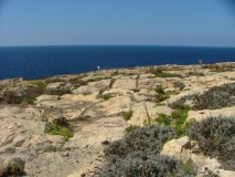
It is now again buried and the farmer cultivates the nearest as possible from the dolmen, behind the wooden henges.
To go to the dolmen, you must take a little road behind the cemetery where stands a little green postsign ("dolmen de la pierre virante). The dolmen is on the right of the little road.
R. Joussaume said that it was not really a dolmen but a long-barrow. The only similars to it are in the south of England! A lot of skeletons and objects were discored: necklaces, axes, knifes...
An old person said to R. Joussaume that a capstone was sitll visible in 1914 but it has been found buried.
Legend says that one of the stone takes a bath in the river Autize, the night of Christmas.
Longitude and latitude taken from Geoportail (thanx for the lesson, Captain!).
You may be viewing yesterday's version of this page. To see the most up to date information please register for a free account.
")
")
")
")
")
")
")
")
")
")
Do not use the above information on other web sites or publications without permission of the contributor.
Click here to see more info for this site
Nearby sites
Click here to view sites on an interactive map of the areaKey: Red: member's photo, Blue: 3rd party photo, Yellow: other image, Green: no photo - please go there and take one, Grey: site destroyed
Download sites to:
KML (Google Earth)
GPX (GPS waypoints)
CSV (Garmin/Navman)
CSV (Excel)
To unlock full downloads you need to sign up as a Contributory Member. Otherwise downloads are limited to 50 sites.
Turn off the page maps and other distractions
Nearby sites listing. In the following links * = Image available
972m S 176° Dolmen de la Pierre Levée (Nieul sur l'Autise)* Burial Chamber or Dolmen
5.6km SSE 155° Enceinte de Champ-Durand* Ancient Village or Settlement
21.1km NNE 24° La Roche Branlante de la Morlière* Natural Stone / Erratic / Other Natural Feature
22.5km SSE 167° Amuré Allée couverte* Passage Grave
23.2km NNW 339° Pierre à Cupules des Girardières Rock Art
25.3km NNW 345° Polissoir ou pierre à sculpture Polissoir
25.7km WNW 294° La Pierre Folle de Thiré* Burial Chamber or Dolmen
26.3km NNW 343° Dolmen de la Pierre-qui-Vire* Burial Chamber or Dolmen
26.5km SSW 201° Nécropole de Champ-Chalon* Barrow Cemetery
27.9km NW 322° Menhir de la Vierge* Standing Stone (Menhir)
28.0km SSW 193° Tumulus La Pointe (Benon)* Artificial Mound
28.8km SSW 211° La Butte des Moindreaux* Chambered Tomb
28.9km NW 320° Pierre Folle des Cous* Burial Chamber or Dolmen
28.9km NW 320° Ciste des Cous* Burial Chamber or Dolmen
29.1km NW 320° Menhir du Fief de Cous* Standing Stone (Menhir)
29.3km NW 320° Dolmen de la Pierre Rousse* Burial Chamber or Dolmen
29.3km NW 320° Menhir de la Pierre Rousse* Standing Stone (Menhir)
29.4km NW 320° Dolmen de la Jaudonnière* Passage Grave
31.8km NW 319° Menhir des Landes* Standing Stone (Menhir)
31.8km NW 319° Dolmen des Landes* Burial Chamber or Dolmen
36.6km SSE 160° Tumulus du Péré* Chambered Tomb
37.7km NNW 343° Deux polissoirs Polissoir
37.8km NNW 344° Pouzauges Stones* Not Known (by us)
38.0km NNW 343° Dolmen du Marchais* Burial Chamber or Dolmen
38.6km S 169° Dolmen de Marsais* Burial Chamber or Dolmen
View more nearby sites and additional images


 We would like to know more about this location. Please feel free to add a brief description and any relevant information in your own language.
 Wir möchten mehr über diese Stätte erfahren. Bitte zögern Sie nicht, eine kurze Beschreibung und relevante Informationen in Deutsch hinzuzufügen.
 Nous aimerions en savoir encore un peu sur les lieux. S'il vous plaît n'hesitez pas à ajouter une courte description et tous les renseignements pertinents dans votre propre langue.
 Quisieramos informarnos un poco más de las lugares. No dude en añadir una breve descripción y otros datos relevantes en su propio idioma.