<< Our Photo Pages >> Kingshaugh - Hillfort in England in Nottinghamshire
Submitted by HOLYWELL on Friday, 10 April 2009 Page Views: 6439
Iron Age and Later PrehistorySite Name: KingshaughCountry: England
NOTE: This site is 5.579 km away from the location you searched for.
County: Nottinghamshire Type: Hillfort
Nearest Town: Tuxford Nearest Village: East Markham
Map Ref: SK765735
Latitude: 53.253007N Longitude: 0.854844W
Condition:
| 5 | Perfect |
| 4 | Almost Perfect |
| 3 | Reasonable but with some damage |
| 2 | Ruined but still recognisable as an ancient site |
| 1 | Pretty much destroyed, possibly visible as crop marks |
| 0 | No data. |
| -1 | Completely destroyed |
| 5 | Superb |
| 4 | Good |
| 3 | Ordinary |
| 2 | Not Good |
| 1 | Awful |
| 0 | No data. |
| 5 | Can be driven to, probably with disabled access |
| 4 | Short walk on a footpath |
| 3 | Requiring a bit more of a walk |
| 2 | A long walk |
| 1 | In the middle of nowhere, a nightmare to find |
| 0 | No data. |
| 5 | co-ordinates taken by GPS or official recorded co-ordinates |
| 4 | co-ordinates scaled from a detailed map |
| 3 | co-ordinates scaled from a bad map |
| 2 | co-ordinates of the nearest village |
| 1 | co-ordinates of the nearest town |
| 0 | no data |
Internal Links:
External Links:

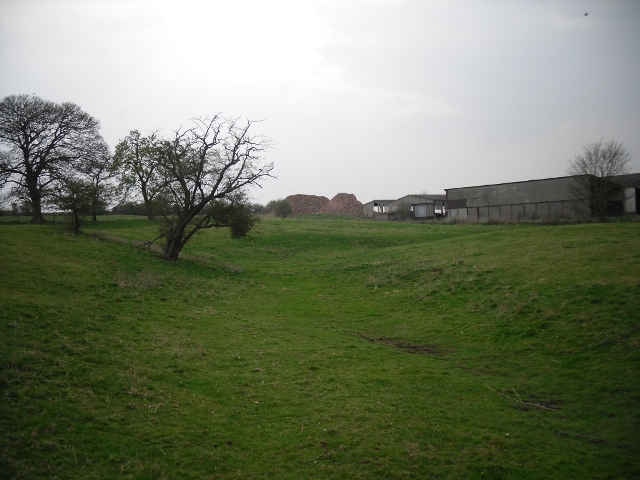
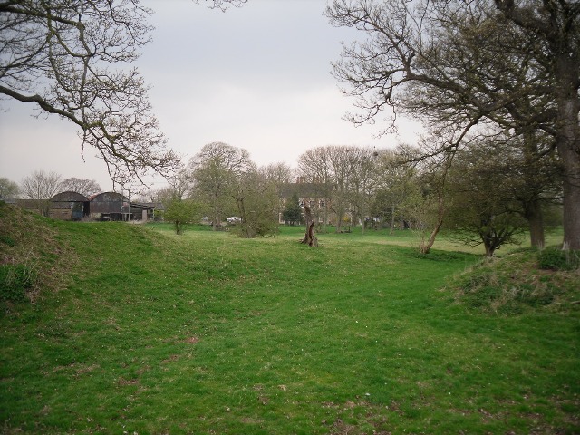
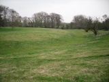
The current house is probably what remains was improved in the 17th century and may contain walls and foundations of Earl John’s Hunting lodge or rather its chapel. Much of what remains appears to be improved in 1193-4, during Earl John's rebellion against King Richard I, the lodge was fortified and the earth and timber ringwork defences built. There are remains of a wooden palisade as well as a complex series of banks and ditches, which are lined with buried remains. These banks have more ancient origins.
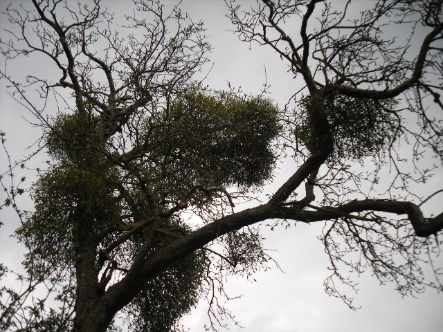
The site has a rather eerie feel to it helped by its somewhat isolation and old gnarled trees with large amounts of mistletoe. It has never been excavated and was damaged by previous owners when it was used for point to point. The present owners, Mr and Mrs Elliott were most acomodating and guided me around. The site was open to the public but this is less of a regular thing now since both have had ill health.
You may be viewing yesterday's version of this page. To see the most up to date information please register for a free account.



Do not use the above information on other web sites or publications without permission of the contributor.
Click here to see more info for this site
Nearby sites
Key: Red: member's photo, Blue: 3rd party photo, Yellow: other image, Green: no photo - please go there and take one, Grey: site destroyed
Download sites to:
KML (Google Earth)
GPX (GPS waypoints)
CSV (Garmin/Navman)
CSV (Excel)
To unlock full downloads you need to sign up as a Contributory Member. Otherwise downloads are limited to 50 sites.
Turn off the page maps and other distractions
Nearby sites listing. In the following links * = Image available
2.9km SW 224° Holy well (Tuxford) Holy Well or Sacred Spring (SK745714)
4.8km NNW 340° Lady well (Headon)* Holy Well or Sacred Spring (SK7483877954)
4.9km SW 226° Holy well ( Tuxford ) Holy Well or Sacred Spring (SK7370)
7.5km NNW 342° Castle Hill (Nottinghamshire) Hillfort (SK741806)
7.9km SSW 212° The Duck's Mouth* Holy Well or Sacred Spring (SK724667)
10.1km NNW 338° St John's Well (Welham) Holy Well or Sacred Spring (SK72558280)
11.1km SSE 148° Besthorpe Ancient Village or Settlement (SK825641)
13.4km ENE 76° South Ingleby Tumulus Misc. Earthwork (SK8946576860)
14.5km W 260° Budby Barrow* Round Barrow(s) (SK62187087)
16.5km SSE 157° Langford, Brough and Glebe Farm sites on the A46* Ancient Village or Settlement (SK833584)
17.3km WSW 254° Thynghowe* Artificial Mound (SK59936834)
19.5km ENE 76° St Pancras Well* Holy Well or Sacred Spring (SK954785)
20.2km ESE 104° Lincoln stone circle* Modern Stone Circle etc (SK962689)
20.7km SSW 199° Southwell Minster* Early Christian Sculptured Stone (SK70165378)
20.9km S 173° Farndon Fields* Natural Stone / Erratic / Other Natural Feature (SK794528)
21.1km S 187° Holy Trinity (Rolleston)* Ancient Cross (SK7418552503)
21.1km S 187° Rolleston Cross* Ancient Cross (SK7418052489)
21.2km E 96° The Collection, Lincoln* Museum (SK9771471547)
21.7km SSW 202° St Catherine's Well (Westthorpe)* Holy Well or Sacred Spring (SK68565327)
21.9km WNW 300° St Mary's Well (Wallingwells) Holy Well or Sacred Spring (SK572840)
22.7km SW 214° Hart's Well* Holy Well or Sacred Spring (SK6415254451)
22.7km SW 217° Combs Camp Hillfort (SK63145512)
22.8km W 273° Mother Grundy’s Parlour Cave or Rock Shelter (SK536743)
22.9km W 273° Creswell Crags* Cave or Rock Shelter (SK535743)
23.0km W 273° Robin Hood’s Cave* Cave or Rock Shelter (SK534742)
View more nearby sites and additional images


 We would like to know more about this location. Please feel free to add a brief description and any relevant information in your own language.
 Wir möchten mehr über diese Stätte erfahren. Bitte zögern Sie nicht, eine kurze Beschreibung und relevante Informationen in Deutsch hinzuzufügen.
 Nous aimerions en savoir encore un peu sur les lieux. S'il vous plaît n'hesitez pas à ajouter une courte description et tous les renseignements pertinents dans votre propre langue.
 Quisieramos informarnos un poco más de las lugares. No dude en añadir una breve descripción y otros datos relevantes en su propio idioma.