


<< Our Photo Pages >> High Park Farm (Ugthorpe Moor) - Round Barrow(s) in England in Yorkshire (North)
Submitted by johndhunter on Friday, 07 February 2020 Page Views: 635
Neolithic and Bronze AgeSite Name: High Park Farm (Ugthorpe Moor)Country: England
NOTE: This site is 1.415 km away from the location you searched for.
County: Yorkshire (North) Type: Round Barrow(s)
Nearest Town: Whitby Nearest Village: Ugthorpe
Map Ref: NZ7826210445
Latitude: 54.483327N Longitude: 0.793545W
Condition:
| 5 | Perfect |
| 4 | Almost Perfect |
| 3 | Reasonable but with some damage |
| 2 | Ruined but still recognisable as an ancient site |
| 1 | Pretty much destroyed, possibly visible as crop marks |
| 0 | No data. |
| -1 | Completely destroyed |
| 5 | Superb |
| 4 | Good |
| 3 | Ordinary |
| 2 | Not Good |
| 1 | Awful |
| 0 | No data. |
| 5 | Can be driven to, probably with disabled access |
| 4 | Short walk on a footpath |
| 3 | Requiring a bit more of a walk |
| 2 | A long walk |
| 1 | In the middle of nowhere, a nightmare to find |
| 0 | No data. |
| 5 | co-ordinates taken by GPS or official recorded co-ordinates |
| 4 | co-ordinates scaled from a detailed map |
| 3 | co-ordinates scaled from a bad map |
| 2 | co-ordinates of the nearest village |
| 1 | co-ordinates of the nearest town |
| 0 | no data |
Internal Links:
External Links:
 (PID:207534)")
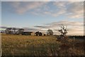
A Bronze Age round barrow 200m to the south west of High Park Farm on Ugthorpe Moor. Denuded by ploughing it lies in a field just to the south of the minor road to Lealholm, its north west edge being bisected by the fence line which separates the field from the road. This is Historic England List Entry Number 1016544 which tells us that it is made of earth and stone that it is up to 23m in diameter and stands up to 0.4m high. H.E. also surmises because of its spatial association with other round barrows in the area that it is thought to represent a territorial marker.
Pastscape has much the same information at Monument 29099
Note: Samuel Anderson a 19th century antiquary of Whitby excavated most if not all of the barrows on Ugthorpe Moor around 1852-53. His son Edward Anderson stated that he remembered that his father dug into the howes on Ugthorpe Moor at night, driving there in a cab from Whitby. However this night time journey is more likely to have been for the purpose of bringing back the finds from his experienced barrow digger, James Ruddock’s digging during the day. Anderson made notes describing the barrows and what he took from them, mainly collared urns but working out which barrow is which and its locality is difficult, also some of the barrows are no longer extant. Anderson sold his collection for £150 in 1855 to finance his jet manufacturing business. It was bought by Joseph Mayer and ended up in Liverpool Museum where most of the collection, though not all was destroyed when the Germans bombed it on 10/11th May 1941.
Source: “A 19th century antiquary: the excavations and collections of Samuel Anderson” by Terry Manby printed in CBA Research Report 101 (1995)
You may be viewing yesterday's version of this page. To see the most up to date information please register for a free account.
Do not use the above information on other web sites or publications without permission of the contributor.
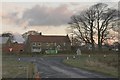
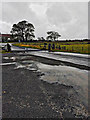
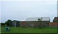
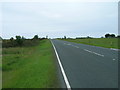
Nearby Images from Geograph Britain and Ireland:
©2007(licence)
©2019(licence)
©2011(licence)
©2011(licence)
©2006(licence)
The above images may not be of the site on this page, they are loaded from Geograph.
Please Submit an Image of this site or go out and take one for us!
Click here to see more info for this site
Nearby sites
Key: Red: member's photo, Blue: 3rd party photo, Yellow: other image, Green: no photo - please go there and take one, Grey: site destroyed
Download sites to:
KML (Google Earth)
GPX (GPS waypoints)
CSV (Garmin/Navman)
CSV (Excel)
To unlock full downloads you need to sign up as a Contributory Member. Otherwise downloads are limited to 50 sites.
Turn off the page maps and other distractions
Nearby sites listing. In the following links * = Image available
244m SW 231° Keld Bog (Ugthorpe Moor)* Round Barrow(s) (NZ7807410288)
543m SSW 193° Ugthorpe Moor Pit Alignment and Round Barrows* Misc. Earthwork (NZ7814909913)
571m SE 127° Travellers Rest Farm* Marker Stone (NZ7872410107)
2.2km SW 231° Lealholm Rigg RB1* Round Barrow(s) (NZ7657909043)
2.3km SW 230° Lealholm Rigg RB2* Round Barrow(s) (NZ7650908914)
2.4km SW 225° Lealholm Rigg Marker Stone* Marker Stone (NZ7658608722)
2.5km W 264° Temple Beeld (Lealholm Moor)* Stone Row / Alignment (NZ7572810141)
2.7km WSW 247° Lealholm Moor Ring Cairn* Ring Cairn (NZ7582909347)
2.7km WSW 247° Lealholm Moor Round Barrow* Round Barrow(s) (NZ7575209348)
2.9km N 5° Long Stone (Newton Mulgrave Woods)* Standing Stone (Menhir) (NZ7846113319)
3.1km WSW 248° Rawland Howe* Round Barrow(s) (NZ7542809261)
3.1km N 5° Newton Mulgrave Moor RB1* Round Barrow(s) (NZ7847913526)
3.2km N 6° Brown Higg Stone* Marker Stone (NZ7852013661)
3.3km N 5° Newton Mulgrave Moor RB2* Round Barrow(s) (NZ7849213733)
3.3km WNW 282° Good Goose Thorne (East)* Marker Stone (NZ7497011089)
3.4km N 3° Newton Mulgrave Moor RB3* Round Barrow(s) (NZ7836513815)
3.4km WNW 285° Nan Stone.* Marker Stone (NZ7498411279)
3.4km N 355° Newton Mulgrave Moor RB8* Round Barrow(s) (NZ7793213861)
3.5km N 1° Newton Mulgrave Moor RB4 - 7* Barrow Cemetery (NZ7829113935)
3.6km W 278° Long Stone (Black Dike Moor)* Marker Stone (NZ7469210909)
3.8km W 275° Black Dike Moor Segmented Pit Alignment* Misc. Earthwork (NZ7443210707)
3.8km SE 124° Lady Cross (Egton Low Moor)* Ancient Cross (NZ8147708327)
3.9km WSW 257° Brown Rigg (Lealholm Moor)* Round Barrow(s) (NZ7451709505)
3.9km N 351° Newton Mulgrave Moor LB* Long Barrow (NZ7761214328)
4.0km WSW 256° Stump Cross (Lealholm Moor)* Ancient Cross (NZ7441109439)
View more nearby sites and additional images


 We would like to know more about this location. Please feel free to add a brief description and any relevant information in your own language.
 Wir möchten mehr über diese Stätte erfahren. Bitte zögern Sie nicht, eine kurze Beschreibung und relevante Informationen in Deutsch hinzuzufügen.
 Nous aimerions en savoir encore un peu sur les lieux. S'il vous plaît n'hesitez pas à ajouter une courte description et tous les renseignements pertinents dans votre propre langue.
 Quisieramos informarnos un poco más de las lugares. No dude en añadir una breve descripción y otros datos relevantes en su propio idioma.