


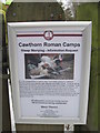
<< Our Photo Pages >> Cawthorne Square Barrow - Round Barrow(s) in England in Yorkshire (North)
Submitted by kelpie on Wednesday, 08 September 2004 Page Views: 5835
Neolithic and Bronze AgeSite Name: Cawthorne Square BarrowCountry: England
NOTE: This site is 1.784 km away from the location you searched for.
County: Yorkshire (North) Type: Round Barrow(s)
Nearest Town: Pickering Nearest Village: Cropton
Map Ref: SE78458987
Latitude: 54.298430N Longitude: 0.796067W
Condition:
| 5 | Perfect |
| 4 | Almost Perfect |
| 3 | Reasonable but with some damage |
| 2 | Ruined but still recognisable as an ancient site |
| 1 | Pretty much destroyed, possibly visible as crop marks |
| 0 | No data. |
| -1 | Completely destroyed |
| 5 | Superb |
| 4 | Good |
| 3 | Ordinary |
| 2 | Not Good |
| 1 | Awful |
| 0 | No data. |
| 5 | Can be driven to, probably with disabled access |
| 4 | Short walk on a footpath |
| 3 | Requiring a bit more of a walk |
| 2 | A long walk |
| 1 | In the middle of nowhere, a nightmare to find |
| 0 | No data. |
| 5 | co-ordinates taken by GPS or official recorded co-ordinates |
| 4 | co-ordinates scaled from a detailed map |
| 3 | co-ordinates scaled from a bad map |
| 2 | co-ordinates of the nearest village |
| 1 | co-ordinates of the nearest town |
| 0 | no data |
Internal Links:
External Links:
I have visited· I would like to visit
kelpie has visited here
")
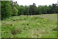
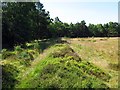
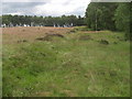
This is a square barrow measuring 11m across. The corners are rounded and the whole is surrounded by a ditch about a metre wide which although mostly in-filled is still visible.
There has been significant excavation work in the past and this has left the barrow with a very large hole at its centre.
A footpath passes close by but I would imagine few people who pass it are aware it is there. That said it is a good example of a square barrow which occur almost entirely in the North and East Yorkshire areas.
You may be viewing yesterday's version of this page. To see the most up to date information please register for a free account.
Do not use the above information on other web sites or publications without permission of the contributor.
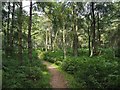
Nearby Images from Geograph Britain and Ireland:
©2020(licence)
©2015(licence)
©2018(licence)
©2011(licence)
©2012(licence)
The above images may not be of the site on this page, they are loaded from Geograph.
Please Submit an Image of this site or go out and take one for us!
Click here to see more info for this site
Nearby sites
Key: Red: member's photo, Blue: 3rd party photo, Yellow: other image, Green: no photo - please go there and take one, Grey: site destroyed
Download sites to:
KML (Google Earth)
GPX (GPS waypoints)
CSV (Garmin/Navman)
CSV (Excel)
To unlock full downloads you need to sign up as a Contributory Member. Otherwise downloads are limited to 50 sites.
Turn off the page maps and other distractions
Nearby sites listing. In the following links * = Image available
553m W 264° Cawthorne Banks Tumulus* Cairn (SE779898)
688m WNW 291° Cawthorn Cart Burial Misc. Earthwork (SE778901)
2.0km NE 48° Rawcliffe Howe* Cairn (SE799912)
2.4km ENE 66° Black Howe (Rawcliffe)* Cairn (SE80599087)
2.9km W 259° Cropton Cross* Ancient Cross (SE7562689277)
3.3km WNW 289° Black Park* Standing Stone (Menhir) (SE753909)
3.4km E 96° Penny Howe Round Barrow(s) (SE81808955)
4.3km NNE 14° Old Wives' Well* Holy Well or Sacred Spring (SE7943894057)
4.5km S 184° Middleton Crosses* Ancient Cross (SE782854)
4.5km N 355° Leaf Howe* Barrow Cemetery (SE780944)
4.7km NNE 15° Mauley Cross* Ancient Cross (SE796944)
4.8km N 354° High Muffles Tumulus* Round Barrow(s) (SE7789694630)
4.8km E 81° The Dragon Stone* Early Christian Sculptured Stone (SE832907)
5.0km ENE 67° Dundale Rigg RB1* Round Barrow(s) (SE8306091935)
5.1km ENE 59° Levisham Moor South RB2* Round Barrow(s) (SE8280792608)
5.2km WSW 257° High Cross (Appleton Le Moors)* Ancient Cross (SE7335888560)
5.3km WSW 253° Low Cross (Appleton Le Moors)* Ancient Cross (SE7342188200)
5.3km ENE 63° Pigtrough Rigg Settlement* Ancient Village or Settlement (SE8319492354)
5.4km ENE 65° Levisham Moor South RB1* Round Barrow(s) (SE8329592214)
5.4km SW 227° Sinnington Crosses* Ancient Cross (SE746861)
5.5km NW 306° Abrahams Hut (Spaunton Moor)* Round Cairn (SE7394093016)
5.5km W 278° St Chad's Well (Lastingham)* Holy Well or Sacred Spring (SE7296390542)
5.5km W 277° St Cedd's Well* Holy Well or Sacred Spring (SE7291990460)
5.6km NE 55° Levisham Moor Cross Dyke South* Misc. Earthwork (SE8298893126)
5.6km E 87° St Robert's Holy Well* Holy Well or Sacred Spring (SE841903)
View more nearby sites and additional images


 We would like to know more about this location. Please feel free to add a brief description and any relevant information in your own language.
 Wir möchten mehr über diese Stätte erfahren. Bitte zögern Sie nicht, eine kurze Beschreibung und relevante Informationen in Deutsch hinzuzufügen.
 Nous aimerions en savoir encore un peu sur les lieux. S'il vous plaît n'hesitez pas à ajouter une courte description et tous les renseignements pertinents dans votre propre langue.
 Quisieramos informarnos un poco más de las lugares. No dude en añadir una breve descripción y otros datos relevantes en su propio idioma.