

<< Our Photo Pages >> Princess Elizabeth's Well - Holy Well or Sacred Spring in England in Buckinghamshire
Submitted by DavidCWoods on Sunday, 29 August 2004 Page Views: 9604
Springs and Holy WellsSite Name: Princess Elizabeth's Well Alternative Name: Quen Elizabeth's WellCountry: England
NOTE: This site is 1.118 km away from the location you searched for.
County: Buckinghamshire Type: Holy Well or Sacred Spring
Nearest Town: Marlow Nearest Village: Bisham
Map Ref: SU848844
Latitude: 51.552125N Longitude: 0.778336W
Condition:
| 5 | Perfect |
| 4 | Almost Perfect |
| 3 | Reasonable but with some damage |
| 2 | Ruined but still recognisable as an ancient site |
| 1 | Pretty much destroyed, possibly visible as crop marks |
| 0 | No data. |
| -1 | Completely destroyed |
| 5 | Superb |
| 4 | Good |
| 3 | Ordinary |
| 2 | Not Good |
| 1 | Awful |
| 0 | No data. |
| 5 | Can be driven to, probably with disabled access |
| 4 | Short walk on a footpath |
| 3 | Requiring a bit more of a walk |
| 2 | A long walk |
| 1 | In the middle of nowhere, a nightmare to find |
| 0 | No data. |
| 5 | co-ordinates taken by GPS or official recorded co-ordinates |
| 4 | co-ordinates scaled from a detailed map |
| 3 | co-ordinates scaled from a bad map |
| 2 | co-ordinates of the nearest village |
| 1 | co-ordinates of the nearest town |
| 0 | no data |
Be the first person to rate this site - see the 'Contribute!' box in the right hand menu.
Internal Links:
External Links:
")
The well is on private land, marked on the 1:25000 OS map.
The well (or spring) had a reputation for curing people with eye problems and during the 14th century apparently had a tame bird living in the tree overhanging it.
When a bishop tried to have the well covered with stones local "sons of the devil" from Marlow and High Wycombe removed the stones and restored the well.
The name is supposed to come from its use by Queen Elizabeth I when visiting Bisham Abbey.
You may be viewing yesterday's version of this page. To see the most up to date information please register for a free account.
")
")
Do not use the above information on other web sites or publications without permission of the contributor.
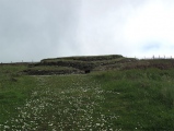
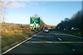
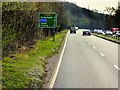
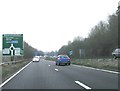
Nearby Images from Geograph Britain and Ireland:

©2013(licence)
©2017(licence)
©2015(licence)
©2014(licence)
©2014(licence)
The above images may not be of the site on this page, they are loaded from Geograph.
Please Submit an Image of this site or go out and take one for us!
Click here to see more info for this site
Nearby sites
Key: Red: member's photo, Blue: 3rd party photo, Yellow: other image, Green: no photo - please go there and take one, Grey: site destroyed
Download sites to:
KML (Google Earth)
GPX (GPS waypoints)
CSV (Garmin/Navman)
CSV (Excel)
To unlock full downloads you need to sign up as a Contributory Member. Otherwise downloads are limited to 50 sites.
Turn off the page maps and other distractions
Nearby sites listing. In the following links * = Image available
1.5km WNW 291° Low Grounds Farm Barrow Cemetery (SU834849)
3.0km W 271° Danesfield Camp* Hillfort (SU81768440)
3.3km S 174° Robin Hood's Arbour* Ancient Village or Settlement (SU85188108)
3.9km S 178° Maidenhead Thicket Bowl Barrow* Round Barrow(s) (SU850805)
4.1km W 275° Medmenham Camp* Hillfort (SU80698467)
5.0km E 80° Tarry Stone* Marker Stone (SU8974585392)
5.2km ESE 115° Bapsey Pond* Holy Well or Sacred Spring (SU896823)
6.2km ESE 112° Taplow Mound* Artificial Mound (SU90618216)
6.2km SW 232° Rebecca's Well (Crazies Hill)* Holy Well or Sacred Spring (SU7993080487)
7.5km WSW 247° Mont de la Ville* Passage Grave (SU77968140)
7.7km E 81° Root Mound Round Barrow(s) (SU92438574)
8.1km NNE 19° Keep Hill Hillfort (SU87379205)
8.2km SE 132° Weir Bank Stud Farm Ancient Village or Settlement (SU90957900)
8.9km N 0° Desborough Castle* Hillfort (SU847933)
9.9km E 89° Seven Ways Plain* Hillfort (SU94718466)
10.6km N 350° Church Hill Celtic Fields Misc. Earthwork (SU82809480)
10.8km N 350° West Wycombe Camp* Hillfort (SU82769499)
11.1km N 349° Celtic field system on Church Hill Misc. Earthwork (SU82559530)
11.2km N 349° Church Hill Trackway Ancient Trackway (SU82469533)
11.5km WNW 295° Stonor Park* Stone Circle (SU74318913)
11.5km WNW 295° Stonor Park Puddingstones Natural Stone / Erratic / Other Natural Feature (SU74288919)
11.7km SW 225° Sonning Cursus Cursus (SU767759)
11.9km SW 225° Sonning Cursus Cursus (SU765759)
12.3km SSE 161° Holyport Modern Stone Circle Modern Stone Circle etc (SU8908672865)
12.4km E 101° Stoke Park Bowl Barrow* Round Barrow(s) (SU97038222)
View more nearby sites and additional images


 We would like to know more about this location. Please feel free to add a brief description and any relevant information in your own language.
 Wir möchten mehr über diese Stätte erfahren. Bitte zögern Sie nicht, eine kurze Beschreibung und relevante Informationen in Deutsch hinzuzufügen.
 Nous aimerions en savoir encore un peu sur les lieux. S'il vous plaît n'hesitez pas à ajouter une courte description et tous les renseignements pertinents dans votre propre langue.
 Quisieramos informarnos un poco más de las lugares. No dude en añadir una breve descripción y otros datos relevantes en su propio idioma.