


<< Our Photo Pages >> St. John's Well (Buckinghamshire) - Holy Well or Sacred Spring in England in Buckinghamshire
Submitted by DavidCWoods on Tuesday, 01 March 2005 Page Views: 8991
Springs and Holy WellsSite Name: St. John's Well (Buckinghamshire)Country: England
NOTE: This site is 0.738 km away from the location you searched for.
County: Buckinghamshire Type: Holy Well or Sacred Spring
Nearest Town: Milton Keynes Nearest Village: Newton Longville
Map Ref: SP847316
Latitude: 51.976421N Longitude: 0.768286W
Condition:
| 5 | Perfect |
| 4 | Almost Perfect |
| 3 | Reasonable but with some damage |
| 2 | Ruined but still recognisable as an ancient site |
| 1 | Pretty much destroyed, possibly visible as crop marks |
| 0 | No data. |
| -1 | Completely destroyed |
| 5 | Superb |
| 4 | Good |
| 3 | Ordinary |
| 2 | Not Good |
| 1 | Awful |
| 0 | No data. |
| 5 | Can be driven to, probably with disabled access |
| 4 | Short walk on a footpath |
| 3 | Requiring a bit more of a walk |
| 2 | A long walk |
| 1 | In the middle of nowhere, a nightmare to find |
| 0 | No data. |
| 5 | co-ordinates taken by GPS or official recorded co-ordinates |
| 4 | co-ordinates scaled from a detailed map |
| 3 | co-ordinates scaled from a bad map |
| 2 | co-ordinates of the nearest village |
| 1 | co-ordinates of the nearest town |
| 0 | no data |
Internal Links:
External Links:
 (PID:12396)")
Beneath the trees is a dip and on the edge of this is a concrete slab which apparently marks the site of St. John’s Well.
You may be viewing yesterday's version of this page. To see the most up to date information please register for a free account.
 (PID:12394)")
 (PID:12395)")
Do not use the above information on other web sites or publications without permission of the contributor.
Nearby Images from Geograph Britain and Ireland:
©2010(licence)
©2006(licence)
©2015(licence)
©2012(licence)
©2008(licence)
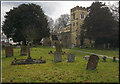
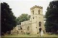
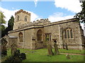
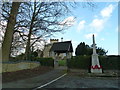
The above images may not be of the site on this page, they are loaded from Geograph.
Please Submit an Image of this site or go out and take one for us!
Click here to see more info for this site
Nearby sites
Key: Red: member's photo, Blue: 3rd party photo, Yellow: other image, Green: no photo - please go there and take one, Grey: site destroyed
Download sites to:
KML (Google Earth)
GPX (GPS waypoints)
CSV (Garmin/Navman)
CSV (Excel)
To unlock full downloads you need to sign up as a Contributory Member. Otherwise downloads are limited to 50 sites.
Turn off the page maps and other distractions
Nearby sites listing. In the following links * = Image available
4.8km WNW 298° Whaddon Barrow* Round Barrow(s)
5.8km SE 143° Soulbury Stone* Natural Stone / Erratic / Other Natural Feature (SP88292709)
6.1km NE 49° Caldecotte Cursus Cursus (SP892357)
7.6km SE 128° Linslade Holy Well Holy Well or Sacred Spring (SP908270)
8.1km ENE 68° Danesborough Hillfort Hillfort (SP922348)
8.6km ESE 123° Shepherd's Race (Heath)* Turf Maze (SP9227)
9.3km NNE 19° Millennium Medicine Wheel* Stone Circle (SP8758740483)
9.7km NW 324° Gorrick’s Well Holy Well or Sacred Spring (SP78803930)
11.5km SW 218° Scorne Well* Holy Well or Sacred Spring (SP777225)
11.5km WSW 238° Sionhill Farm Henge (SP75012541)
11.5km SSW 202° Whitchurch Holy Well Holy Well or Sacred Spring (SP806208)
11.6km W 279° Thornborough (Bucks)* Barrow Cemetery (SP732333)
11.7km SSW 202° Holy Well (Whitchurch)* Holy Well or Sacred Spring (SP805207)
11.8km SSW 204° Whittle Hole* Holy Well or Sacred Spring (SP801207)
11.8km NNW 332° St. Vincent's Well Holy Well or Sacred Spring (SP7942)
11.9km SSW 204° Fair Alice well Holy Well or Sacred Spring (SP800207)
13.2km N 4° Gayhurst Barrow cemetery Barrow Cemetery (SP855448)
13.5km WSW 239° Botyl Well* Holy Well or Sacred Spring (SP732245)
15.7km NE 47° Holywell (Cranfield)* Holy Well or Sacred Spring (SP961424)
15.8km W 278° St Rumwald's Well* Holy Well or Sacred Spring (SP690335)
16.4km S 185° St. Osyth's Well (Bierton)* Holy Well or Sacred Spring (SP836152)
16.6km E 100° Conger Hill* Hillfort (TL011289)
17.3km ESE 123° Maiden Bower* Hillfort (SP995225)
17.5km ESE 122° Maiden Bower Causewayed Enclosure Causewayed Enclosure (SP99662247)
17.6km SE 137° Edlesborough* Artificial Mound (SP970190)
View more nearby sites and additional images


 We would like to know more about this location. Please feel free to add a brief description and any relevant information in your own language.
 Wir möchten mehr über diese Stätte erfahren. Bitte zögern Sie nicht, eine kurze Beschreibung und relevante Informationen in Deutsch hinzuzufügen.
 Nous aimerions en savoir encore un peu sur les lieux. S'il vous plaît n'hesitez pas à ajouter une courte description et tous les renseignements pertinents dans votre propre langue.
 Quisieramos informarnos un poco más de las lugares. No dude en añadir una breve descripción y otros datos relevantes en su propio idioma.