


<< Text Pages >> Gayhurst Barrow cemetery - Barrow Cemetery in England in Northamptonshire
Submitted by Andy B on Wednesday, 16 December 2009 Page Views: 5907
Neolithic and Bronze AgeSite Name: Gayhurst Barrow cemeteryCountry: England
NOTE: This site is 2.184 km away from the location you searched for.
County: Northamptonshire Type: Barrow Cemetery
Map Ref: SP855448
Latitude: 52.094947N Longitude: 0.753346W
Condition:
| 5 | Perfect |
| 4 | Almost Perfect |
| 3 | Reasonable but with some damage |
| 2 | Ruined but still recognisable as an ancient site |
| 1 | Pretty much destroyed, possibly visible as crop marks |
| 0 | No data. |
| -1 | Completely destroyed |
| 5 | Superb |
| 4 | Good |
| 3 | Ordinary |
| 2 | Not Good |
| 1 | Awful |
| 0 | No data. |
| 5 | Can be driven to, probably with disabled access |
| 4 | Short walk on a footpath |
| 3 | Requiring a bit more of a walk |
| 2 | A long walk |
| 1 | In the middle of nowhere, a nightmare to find |
| 0 | No data. |
| 5 | co-ordinates taken by GPS or official recorded co-ordinates |
| 4 | co-ordinates scaled from a detailed map |
| 3 | co-ordinates scaled from a bad map |
| 2 | co-ordinates of the nearest village |
| 1 | co-ordinates of the nearest town |
| 0 | no data |
Internal Links:
External Links:
I have visited· I would like to visit
Chriski would like to visit
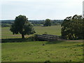
However, the largest, a double-ditched barrow 34m in diameter, which lay at the centre of the cemetery, still survived as a low earthwork and was well-preserved, although recent decades of ploughing had just removed the mound so that the central area was suffering regular plough damage. Also, a side branch of the river was cutting into the barrow, posing a longer-term threat. The planning archaeologist for Milton Keynes, Brian Giggins, decided that gravel extraction at the site could not be stopped, given the poor preservation of six of the barrows, and called for the excavation of all seven barrows in advance of gravel extraction.
Between 1998 and 2000, Northamptonshire Archaeology, working for GFX Hartigan Ltd, excavated the entire area. The six smaller ring ditches produced meagre results, with cremation burials surviving in only two. In contrast, at the centre of the largest barrow there was a massive grave pit, 3.5m long and 1.45m deep, with a sequence of five successive burials. An extended inhumation of an adult man within an oak-lined chamber, accompanied by only a foreleg of a small pig, was followed by a cremation, a crouched inhumation burial of an older man, also within a small chamber and accompanied by two flint knives and a red-deer antler, a second cremation and, finally, a cremation within a collared urn that had been damaged by ploughing. Radiocarbon dating places the burials between c 2100 and c 1900 cal BC, while the six satellite barrows date to 1800 to 1500 cal BC.
However, what made this barrow not only remarkable, but unique in Britain, was a deposit of cattle bones, perhaps containing the remains of some 300 animals, that had been deposited as part of an elaborate funerary practice at the time of the first burial.
Source, with images at MK Heritage. See also Northamptonshire Archaeology.
You may be viewing yesterday's version of this page. To see the most up to date information please register for a free account.
Do not use the above information on other web sites or publications without permission of the contributor.
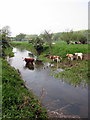
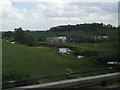
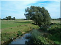
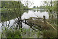
Nearby Images from Geograph Britain and Ireland:
©2012(licence)
©2011(licence)
©2006(licence)
©2012(licence)
©2006(licence)
The above images may not be of the site on this page, they are loaded from Geograph.
Please Submit an Image of this site or go out and take one for us!
Click here to see more info for this site
Nearby sites
Key: Red: member's photo, Blue: 3rd party photo, Yellow: other image, Green: no photo - please go there and take one, Grey: site destroyed
Download sites to:
KML (Google Earth)
GPX (GPS waypoints)
CSV (Garmin/Navman)
CSV (Excel)
To unlock full downloads you need to sign up as a Contributory Member. Otherwise downloads are limited to 50 sites.
Turn off the page maps and other distractions
Nearby sites listing. In the following links * = Image available
4.8km SSE 155° Millennium Medicine Wheel* Stone Circle (SP8758740483)
6.2km N 355° Holy Well (Ravenstone)* Holy Well or Sacred Spring (SP849510)
7.1km WSW 248° St. Vincent's Well Holy Well or Sacred Spring (SP7942)
8.7km SW 232° Gorrick’s Well Holy Well or Sacred Spring (SP78803930)
8.7km N 7° Holy Well (Olney)* Holy Well or Sacred Spring (SP864535)
9.8km SSE 159° Caldecotte Cursus Cursus (SP892357)
10.8km ESE 104° Holywell (Cranfield)* Holy Well or Sacred Spring (SP961424)
11.4km NE 50° Nell's Well* Holy Well or Sacred Spring (SP941523)
12.0km SSE 147° Danesborough Hillfort Hillfort (SP922348)
12.1km SSW 206° Whaddon Barrow* Round Barrow(s)
13.2km S 184° St. John's Well (Buckinghamshire)* Holy Well or Sacred Spring (SP847316)
14.9km ESE 106° The Devil's stone (Bedfordshire)* Standing Stone (Menhir) (SP9989840865)
15.6km NE 39° Harrold Barrows* Barrow Cemetery (SP95245702)
16.2km ENE 58° Holywell (Bedfordshire)* Holy Well or Sacred Spring (SP9907753646)
16.8km SW 228° Thornborough (Bucks)* Barrow Cemetery (SP732333)
17.0km N 7° Grendon Cursus Cursus (SP87256174)
17.7km ENE 73° Biddenham Bridge Holy Well* Holy Well or Sacred Spring (TL024502)
17.9km NW 320° Hunsbury* Hillfort (SP738584)
17.9km S 172° Soulbury Stone* Natural Stone / Erratic / Other Natural Feature (SP88292709)
17.9km ENE 78° Kempston Cursus Cursus (TL030489)
18.0km NNW 330° Becket's Well* Holy Well or Sacred Spring (SP761602)
18.5km NNW 329° Northampton Museum and Art Gallery* Museum (SP7559260400)
18.6km SSE 164° Linslade Holy Well Holy Well or Sacred Spring (SP908270)
18.9km SSE 161° Shepherd's Race (Heath)* Turf Maze (SP9227)
19.4km NW 318° Upton Bowl Barrow Barrow Cemetery (SP72355909)
View more nearby sites and additional images


 We would like to know more about this location. Please feel free to add a brief description and any relevant information in your own language.
 Wir möchten mehr über diese Stätte erfahren. Bitte zögern Sie nicht, eine kurze Beschreibung und relevante Informationen in Deutsch hinzuzufügen.
 Nous aimerions en savoir encore un peu sur les lieux. S'il vous plaît n'hesitez pas à ajouter une courte description et tous les renseignements pertinents dans votre propre langue.
 Quisieramos informarnos un poco más de las lugares. No dude en añadir una breve descripción y otros datos relevantes en su propio idioma.