


<< Other Photo Pages >> Great Missenden Puddingstone - Natural Stone / Erratic / Other Natural Feature in England in Buckinghamshire
Submitted by Thorgrim on Friday, 21 January 2005 Page Views: 6473
Natural PlacesSite Name: Great Missenden PuddingstoneCountry: England
NOTE: This site is 2.087 km away from the location you searched for.
County: Buckinghamshire Type: Natural Stone / Erratic / Other Natural Feature
Nearest Town: Chesham Nearest Village: Great Missenden
Map Ref: SP9142700686
Latitude: 51.697485N Longitude: 0.678536W
Condition:
| 5 | Perfect |
| 4 | Almost Perfect |
| 3 | Reasonable but with some damage |
| 2 | Ruined but still recognisable as an ancient site |
| 1 | Pretty much destroyed, possibly visible as crop marks |
| 0 | No data. |
| -1 | Completely destroyed |
| 5 | Superb |
| 4 | Good |
| 3 | Ordinary |
| 2 | Not Good |
| 1 | Awful |
| 0 | No data. |
| 5 | Can be driven to, probably with disabled access |
| 4 | Short walk on a footpath |
| 3 | Requiring a bit more of a walk |
| 2 | A long walk |
| 1 | In the middle of nowhere, a nightmare to find |
| 0 | No data. |
| 5 | co-ordinates taken by GPS or official recorded co-ordinates |
| 4 | co-ordinates scaled from a detailed map |
| 3 | co-ordinates scaled from a bad map |
| 2 | co-ordinates of the nearest village |
| 1 | co-ordinates of the nearest town |
| 0 | no data |
Internal Links:
External Links:
I have visited· I would like to visit
willowman1 visited on 19th Sep 2017 - their rating: Cond: 5 Amb: 3 Access: 5 This is a plain sarsen, NOT a puddingstone.
There is another in the kitchen garden of Hyde House (SP927010).
You may be viewing yesterday's version of this page. To see the most up to date information please register for a free account.
")
Do not use the above information on other web sites or publications without permission of the contributor.
willowman1 has found this location on Google Street View:
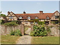
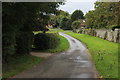
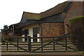
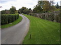
Nearby Images from Geograph Britain and Ireland:
©2006(licence)
©2016(licence)
©2016(licence)
©2008(licence)
©2016(licence)
The above images may not be of the site on this page, they are loaded from Geograph.
Please Submit an Image of this site or go out and take one for us!
Click here to see more info for this site
Nearby sites
Key: Red: member's photo, Blue: 3rd party photo, Yellow: other image, Green: no photo - please go there and take one, Grey: site destroyed
Download sites to:
KML (Google Earth)
GPX (GPS waypoints)
CSV (Garmin/Navman)
CSV (Excel)
To unlock full downloads you need to sign up as a Contributory Member. Otherwise downloads are limited to 50 sites.
Turn off the page maps and other distractions
Nearby sites listing. In the following links * = Image available
4.3km E 80° St Mary's Church (Chesham)* Natural Stone / Erratic / Other Natural Feature (SP9566801521)
4.8km W 269° Stonygreen Puddingstone Natural Stone / Erratic / Other Natural Feature (SP866005)
5.8km W 262° Denner Hill Puddingstone Natural Stone / Erratic / Other Natural Feature (SU857998)
5.9km WNW 284° Grim's Ditch Barrows Round Barrow(s) (SP857020)
6.7km NNE 15° Cholesbury Camp* Hillfort (SP930072)
7.0km ENE 78° Botley Puddingstones Natural Stone / Erratic / Other Natural Feature (SP983023)
8.0km NNW 337° Boddington Camp* Hillfort (SP882080)
8.3km NW 322° Bacombe Hill Bowl Barrow Round Barrow(s) (SP86130709)
8.3km NW 322° Bacombe Hill Barrow Cemetery (SP86160712)
8.5km WSW 254° Chilterns Grims Ditch* Misc. Earthwork (SU833982)
8.9km ENE 69° Whelpley Hill* Hillfort (SP99680397)
9.0km NNE 17° Grim’s Ditch (Hertfordshire) Misc. Earthwork (SP93850938)
9.3km WNW 299° Pulpit Hill* Hillfort (SP832050)
9.3km WSW 248° Bradenham Puddingstone* Natural Stone / Erratic / Other Natural Feature (SU828971)
9.5km SSW 206° Keep Hill Hillfort (SU87379205)
9.8km WNW 291° Whiteleaf Barrows* Long Barrow (SP82220398)
9.9km WNW 303° Ragpit Cross Dyke Misc. Earthwork (SP83020598)
10.0km SW 223° Desborough Castle* Hillfort (SU847933)
10.1km WSW 257° Smalldean Round Barrow(s) (SU816982)
10.2km WNW 303° Ragpit Cross Dykes Misc. Earthwork (SP82750600)
10.2km WNW 303° Ragpit Hill Cross Dyke Misc. Earthwork (SP82750601)
10.3km WSW 238° West Wycombe Camp* Hillfort (SU82769499)
10.4km WSW 240° Celtic field system on Church Hill Misc. Earthwork (SU82559530)
10.4km WSW 240° Church Hill Trackway Ancient Trackway (SU82469533)
10.4km WSW 237° Church Hill Celtic Fields Misc. Earthwork (SU82809480)
View more nearby sites and additional images

")
 We would like to know more about this location. Please feel free to add a brief description and any relevant information in your own language.
 Wir möchten mehr über diese Stätte erfahren. Bitte zögern Sie nicht, eine kurze Beschreibung und relevante Informationen in Deutsch hinzuzufügen.
 Nous aimerions en savoir encore un peu sur les lieux. S'il vous plaît n'hesitez pas à ajouter une courte description et tous les renseignements pertinents dans votre propre langue.
 Quisieramos informarnos un poco más de las lugares. No dude en añadir una breve descripción y otros datos relevantes en su propio idioma.