


<< Text Pages >> Campones Dolmen 2 - Burial Chamber or Dolmen in Spain in Aragón
Submitted by holger_rix on Thursday, 31 December 2015 Page Views: 514
Neolithic and Bronze AgeSite Name: Campones Dolmen 2Country: Spain
NOTE: This site is 8.847 km away from the location you searched for.
Region: Aragón Type: Burial Chamber or Dolmen
Latitude: 42.738305N Longitude: 0.588397W
Condition:
| 5 | Perfect |
| 4 | Almost Perfect |
| 3 | Reasonable but with some damage |
| 2 | Ruined but still recognisable as an ancient site |
| 1 | Pretty much destroyed, possibly visible as crop marks |
| 0 | No data. |
| -1 | Completely destroyed |
| 5 | Superb |
| 4 | Good |
| 3 | Ordinary |
| 2 | Not Good |
| 1 | Awful |
| 0 | No data. |
| 5 | Can be driven to, probably with disabled access |
| 4 | Short walk on a footpath |
| 3 | Requiring a bit more of a walk |
| 2 | A long walk |
| 1 | In the middle of nowhere, a nightmare to find |
| 0 | No data. |
| 5 | co-ordinates taken by GPS or official recorded co-ordinates |
| 4 | co-ordinates scaled from a detailed map |
| 3 | co-ordinates scaled from a bad map |
| 2 | co-ordinates of the nearest village |
| 1 | co-ordinates of the nearest town |
| 0 | no data |
Be the first person to rate this site - see the 'Contribute!' box in the right hand menu.
Internal Links:
External Links:
Burial Chamber (Dolmen) in Aragón
Source: euskal-herria.org
You may be viewing yesterday's version of this page. To see the most up to date information please register for a free account.
Do not use the above information on other web sites or publications without permission of the contributor.
Nearby Images from Flickr
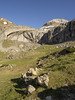

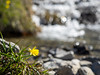
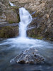
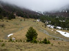
The above images may not be of the site on this page, but were taken nearby. They are loaded from Flickr so please click on them for image credits.
Click here to see more info for this site
Nearby sites
Click here to view sites on an interactive map of the areaKey: Red: member's photo, Blue: 3rd party photo, Yellow: other image, Green: no photo - please go there and take one, Grey: site destroyed
Download sites to:
KML (Google Earth)
GPX (GPS waypoints)
CSV (Garmin/Navman)
CSV (Excel)
To unlock full downloads you need to sign up as a Contributory Member. Otherwise downloads are limited to 50 sites.
Turn off the page maps and other distractions
Nearby sites listing. In the following links * = Image available
45m E 85° Campones Dolmen 1 Burial Chamber or Dolmen
736m N 359° Plana De Napazal Dolmen Burial Chamber or Dolmen
1.4km NE 37° Barranco Rigüelo Chromlech Stone Circle
1.5km NE 44° Barranco Rigüelo Dolmen* Burial Chamber or Dolmen
2.4km N 358° Cubilar Del Barranco Dolmen 3 Burial Chamber or Dolmen
2.4km N 352° Cubilar Del Barranco Dolmen 1* Burial Chamber or Dolmen
2.4km NNW 341° Izagra Dolmen 2* Burial Chamber or Dolmen
2.5km E 81° Plano Bajo Oeste Túmulo* Round Barrow(s)
2.5km E 81° Plano Bajo Este Túmulo* Round Barrow(s)
2.6km N 349° Cubilar Del Barranco Dolmen 2 Burial Chamber or Dolmen
2.7km SE 127° Añaza Dolmen Burial Chamber or Dolmen
2.7km NNW 341° Ladera Del Bozo Dolmen Burial Chamber or Dolmen
2.8km NNW 347° Izagra Dolmen 1 Burial Chamber or Dolmen
4.6km NW 314° Dolmen del Llano de Lizara* Burial Chamber or Dolmen
5.2km NW 314° Oldecua Menhir* Standing Stone (Menhir)
5.3km NW 313° Fuente Fonfría Ancient Village or Settlement
6.0km NW 310° Foraton Dolmen* Burial Chamber or Dolmen
6.1km N 1° Cantal de Curets Dolmen Burial Chamber or Dolmen
6.5km N 4° Puerto de Estanés Dolmen 1* Burial Chamber or Dolmen
6.5km N 5° Puerto de Estanés Dolmen 2* Burial Chamber or Dolmen
7.0km NNE 16° Arroyo Escuret Cromlech* Stone Circle
7.3km NW 310° Barranco Del Foraton Chromlech* Stone Circle
7.4km NNW 340° Las Arrallas Dolmen Burial Chamber or Dolmen
7.5km NW 308° Barranco Del Foraton Sur Dolmen* Burial Chamber or Dolmen
7.6km SE 140° Cueva De Las Güixas* Cave or Rock Shelter
View more nearby sites and additional images


 We would like to know more about this location. Please feel free to add a brief description and any relevant information in your own language.
 Wir möchten mehr über diese Stätte erfahren. Bitte zögern Sie nicht, eine kurze Beschreibung und relevante Informationen in Deutsch hinzuzufügen.
 Nous aimerions en savoir encore un peu sur les lieux. S'il vous plaît n'hesitez pas à ajouter une courte description et tous les renseignements pertinents dans votre propre langue.
 Quisieramos informarnos un poco más de las lugares. No dude en añadir una breve descripción y otros datos relevantes en su propio idioma.