

, Aubrey Burl")
<< Our Photo Pages >> Langford, Brough and Glebe Farm sites on the A46 - Ancient Village or Settlement in England in Nottinghamshire
Submitted by tjhavenith on Friday, 04 August 2017 Page Views: 2691
Multi-periodSite Name: Langford, Brough and Glebe Farm sites on the A46Country: England
NOTE: This site is 7.235 km away from the location you searched for.
County: Nottinghamshire Type: Ancient Village or Settlement
Nearest Town: Newark Nearest Village: Brough
Map Ref: SK833584
Latitude: 53.116285N Longitude: 0.756878W
Condition:
| 5 | Perfect |
| 4 | Almost Perfect |
| 3 | Reasonable but with some damage |
| 2 | Ruined but still recognisable as an ancient site |
| 1 | Pretty much destroyed, possibly visible as crop marks |
| 0 | No data. |
| -1 | Completely destroyed |
| 5 | Superb |
| 4 | Good |
| 3 | Ordinary |
| 2 | Not Good |
| 1 | Awful |
| 0 | No data. |
| 5 | Can be driven to, probably with disabled access |
| 4 | Short walk on a footpath |
| 3 | Requiring a bit more of a walk |
| 2 | A long walk |
| 1 | In the middle of nowhere, a nightmare to find |
| 0 | No data. |
| 5 | co-ordinates taken by GPS or official recorded co-ordinates |
| 4 | co-ordinates scaled from a detailed map |
| 3 | co-ordinates scaled from a bad map |
| 2 | co-ordinates of the nearest village |
| 1 | co-ordinates of the nearest town |
| 0 | no data |
Internal Links:
External Links:
")
A summary of the information board:
Langford
At Langford, pits and gullies were found that contained Late Neolithic and Early Bronze Age pottery (2400 - 2000 BC). Additionally a ring ditch cemetery was found near Langford Hall. This contained cremation burials of Middle Bronze Age (c. 1700 - 1500 BC). 8 cremation urns were found, 3 enclosed by the ring ditch and 5 outside of the enclosure.
Brough
The line of the bypass at Brough was marked out around 100 BC by fields that were defined by ditches. These were laid out following a east-west/north-south alignment. It is thought that the larger ring gullies may represent roundhouse foundations, while the smaller rung gullies may have provided drainage for haystack stands. The pottery here shows that this site was in use until 1 AD, but was then abandoned.
Glebe Farm
An Early Bronze Age cremation cemetery aged between 2000 - 1700 BC was found to comprise of cremation burials in urns which were set inside an oval ditched enclosure.
Further south on the A46 similar excavations were completed during construction work near Stragglethorpe. You may wish you view/read about that site too
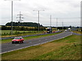
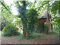
At the site of the information board are 2 benches to sit at. There is a slight incline to the board, which may not be accessible for wheelchair users, especially in summer when the grass is long. The street view will give you a better idea of accessibility.
Street View
You may be viewing yesterday's version of this page. To see the most up to date information please register for a free account.
")
Do not use the above information on other web sites or publications without permission of the contributor.
Nearby Images from Geograph Britain and Ireland:
©2006(licence)
©2014(licence)
©2010(licence)
©2024(licence)
©2012(licence)
The above images may not be of the site on this page, they are loaded from Geograph.
Please Submit an Image of this site or go out and take one for us!
Click here to see more info for this site
Nearby sites
Key: Red: member's photo, Blue: 3rd party photo, Yellow: other image, Green: no photo - please go there and take one, Grey: site destroyed
Download sites to:
KML (Google Earth)
GPX (GPS waypoints)
CSV (Garmin/Navman)
CSV (Excel)
To unlock full downloads you need to sign up as a Contributory Member. Otherwise downloads are limited to 50 sites.
Turn off the page maps and other distractions
Nearby sites listing. In the following links * = Image available
5.8km N 353° Besthorpe Ancient Village or Settlement (SK825641)
6.8km SW 216° Farndon Fields* Natural Stone / Erratic / Other Natural Feature (SK794528)
9.8km SSW 205° Hawton Cursus Cursus (SK79294949)
10.8km WSW 238° Holy Trinity (Rolleston)* Ancient Cross (SK7418552503)
10.8km WSW 238° Rolleston Cross* Ancient Cross (SK7418052489)
13.3km SW 214° Willow Rundle Spring* Holy Well or Sacred Spring (SK7602047230)
13.7km NW 308° The Duck's Mouth* Holy Well or Sacred Spring (SK724667)
13.9km WSW 252° Southwell Minster* Early Christian Sculptured Stone (SK70165378)
15.5km NW 319° Holy well ( Tuxford ) Holy Well or Sacred Spring (SK7370)
15.6km WSW 252° St Catherine's Well (Westthorpe)* Holy Well or Sacred Spring (SK68565327)
15.7km NNW 327° Holy well (Tuxford) Holy Well or Sacred Spring (SK745714)
16.5km NNW 337° Kingshaugh* Hillfort (SK765735)
16.6km NE 52° Lincoln stone circle* Modern Stone Circle etc (SK962689)
18.2km S 175° Salt Well* Holy Well or Sacred Spring (SK853403)
19.4km NNE 19° South Ingleby Tumulus Misc. Earthwork (SK8946576860)
19.5km NE 49° The Collection, Lincoln* Museum (SK9771471547)
19.5km W 259° Hart's Well* Holy Well or Sacred Spring (SK6415254451)
19.6km S 189° Bottesford Cross* Ancient Cross (SK8061638944)
20.0km SE 144° Honington Camp* Hillfort (SK954424)
20.4km W 262° Combs Camp Hillfort (SK63145512)
20.4km WSW 256° Oldox Camp* Hillfort (SK635532)
21.3km NE 54° Lincoln Greetwell Henge/disc barrow* Barrow Cemetery (TF00407110)
21.3km NNW 338° Lady well (Headon)* Holy Well or Sacred Spring (SK7483877954)
21.3km SE 136° Lady Well (Ancaster)* Holy Well or Sacred Spring (SK98404332)
21.6km SW 220° Shelford and Newton Cursus Cursus (SK696417)
View more nearby sites and additional images


 We would like to know more about this location. Please feel free to add a brief description and any relevant information in your own language.
 Wir möchten mehr über diese Stätte erfahren. Bitte zögern Sie nicht, eine kurze Beschreibung und relevante Informationen in Deutsch hinzuzufügen.
 Nous aimerions en savoir encore un peu sur les lieux. S'il vous plaît n'hesitez pas à ajouter une courte description et tous les renseignements pertinents dans votre propre langue.
 Quisieramos informarnos un poco más de las lugares. No dude en añadir una breve descripción y otros datos relevantes en su propio idioma.