

<< Our Photo Pages >> The Mount (Beaconsfield) - Round Barrow(s) in England in Buckinghamshire
Submitted by coldrum on Friday, 01 July 2011 Page Views: 5055
Neolithic and Bronze AgeSite Name: The Mount (Beaconsfield)Country: England
NOTE: This site is 1.296 km away from the location you searched for.
County: Buckinghamshire Type: Round Barrow(s)
Nearest Town: Beaconsfield
Map Ref: SU95549089
Latitude: 51.608748N Longitude: 0.621716W
Condition:
| 5 | Perfect |
| 4 | Almost Perfect |
| 3 | Reasonable but with some damage |
| 2 | Ruined but still recognisable as an ancient site |
| 1 | Pretty much destroyed, possibly visible as crop marks |
| 0 | No data. |
| -1 | Completely destroyed |
| 5 | Superb |
| 4 | Good |
| 3 | Ordinary |
| 2 | Not Good |
| 1 | Awful |
| 0 | No data. |
| 5 | Can be driven to, probably with disabled access |
| 4 | Short walk on a footpath |
| 3 | Requiring a bit more of a walk |
| 2 | A long walk |
| 1 | In the middle of nowhere, a nightmare to find |
| 0 | No data. |
| 5 | co-ordinates taken by GPS or official recorded co-ordinates |
| 4 | co-ordinates scaled from a detailed map |
| 3 | co-ordinates scaled from a bad map |
| 2 | co-ordinates of the nearest village |
| 1 | co-ordinates of the nearest town |
| 0 | no data |
Be the first person to rate this site - see the 'Contribute!' box in the right hand menu.
Internal Links:
External Links:
 (PID:195312)")
Pastscape entry:
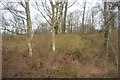
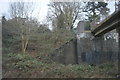
"The Mount" is a circular mound overgrown with trees and scrub, situated in a plantation once a part of Wilton Park, now a golf course. It measures c 23.0m in diameter and 2.8m high, the summit being 3.0m in diameter. At a height of 1.0m there are traces of a berm around the mound."
Source: Pastscape
You may be viewing yesterday's version of this page. To see the most up to date information please register for a free account.
Do not use the above information on other web sites or publications without permission of the contributor.
Nearby Images from Geograph Britain and Ireland:
©2011(licence)
©2011(licence)
©2015(licence)
©2017(licence)
©2012(licence)
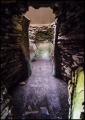
The above images may not be of the site on this page, they are loaded from Geograph.
Please Submit an Image of this site or go out and take one for us!
Click here to see more info for this site
Nearby sites
Key: Red: member's photo, Blue: 3rd party photo, Yellow: other image, Green: no photo - please go there and take one, Grey: site destroyed
Download sites to:
KML (Google Earth)
GPX (GPS waypoints)
CSV (Garmin/Navman)
CSV (Excel)
To unlock full downloads you need to sign up as a Contributory Member. Otherwise downloads are limited to 50 sites.
Turn off the page maps and other distractions
Nearby sites listing. In the following links * = Image available
4.8km SE 128° Bulstrode Camp* Hillfort (SU994880)
6.0km SSW 212° Root Mound Round Barrow(s) (SU92438574)
6.3km S 189° Seven Ways Plain* Hillfort (SU94718466)
8.0km SW 228° Tarry Stone* Marker Stone (SU8974585392)
8.2km W 279° Keep Hill Hillfort (SU87379205)
8.8km S 171° Stoke Park Bowl Barrow* Round Barrow(s) (SU97038222)
10.0km SSW 210° Taplow Mound* Artificial Mound (SU90618216)
10.4km SW 216° Bapsey Pond* Holy Well or Sacred Spring (SU896823)
10.6km NNW 338° Great Missenden Puddingstone* Natural Stone / Erratic / Other Natural Feature (SP9142700686)
10.6km N 2° St Mary's Church (Chesham)* Natural Stone / Erratic / Other Natural Feature (SP9566801521)
10.9km S 175° Montem mound Artificial Mound (SU9665880045)
11.1km WNW 284° Desborough Castle* Hillfort (SU847933)
11.2km NE 49° Church Hill puddingstones Natural Stone / Erratic / Other Natural Feature (TQ03899840)
11.7km NNE 15° Botley Puddingstones Natural Stone / Erratic / Other Natural Feature (SP983023)
12.5km WSW 240° Princess Elizabeth's Well* Holy Well or Sacred Spring (SU848844)
12.7km SSW 202° Weir Bank Stud Farm Ancient Village or Settlement (SU90957900)
13.1km NW 318° Stonygreen Puddingstone Natural Stone / Erratic / Other Natural Feature (SP866005)
13.3km NW 313° Denner Hill Puddingstone Natural Stone / Erratic / Other Natural Feature (SU857998)
13.3km WNW 288° Church Hill Celtic Fields Misc. Earthwork (SU82809480)
13.4km WNW 289° West Wycombe Camp* Hillfort (SU82769499)
13.5km WSW 245° Low Grounds Farm Barrow Cemetery (SU834849)
13.7km WNW 290° Celtic field system on Church Hill Misc. Earthwork (SU82559530)
13.7km NNE 19° Whelpley Hill* Hillfort (SP99680397)
13.8km NE 42° Chipperfield Common Round Barrows* Round Barrow(s) (TL04620126)
13.8km WNW 290° Church Hill Trackway Ancient Trackway (SU82469533)
View more nearby sites and additional images


 We would like to know more about this location. Please feel free to add a brief description and any relevant information in your own language.
 Wir möchten mehr über diese Stätte erfahren. Bitte zögern Sie nicht, eine kurze Beschreibung und relevante Informationen in Deutsch hinzuzufügen.
 Nous aimerions en savoir encore un peu sur les lieux. S'il vous plaît n'hesitez pas à ajouter une courte description et tous les renseignements pertinents dans votre propre langue.
 Quisieramos informarnos un poco más de las lugares. No dude en añadir una breve descripción y otros datos relevantes en su propio idioma.