


<< Text Pages >> Horsell Birch - Natural Stone / Erratic / Other Natural Feature in England in Surrey
Submitted by durandal on Thursday, 21 December 2017 Page Views: 2212
Natural PlacesSite Name: Horsell BirchCountry: England
NOTE: This site is 2.333 km away from the location you searched for.
County: Surrey Type: Natural Stone / Erratic / Other Natural Feature
Nearest Town: Woking Nearest Village: Horsell
Map Ref: SU98805956
Latitude: 51.326569N Longitude: 0.583402W
Condition:
| 5 | Perfect |
| 4 | Almost Perfect |
| 3 | Reasonable but with some damage |
| 2 | Ruined but still recognisable as an ancient site |
| 1 | Pretty much destroyed, possibly visible as crop marks |
| 0 | No data. |
| -1 | Completely destroyed |
| 5 | Superb |
| 4 | Good |
| 3 | Ordinary |
| 2 | Not Good |
| 1 | Awful |
| 0 | No data. |
| 5 | Can be driven to, probably with disabled access |
| 4 | Short walk on a footpath |
| 3 | Requiring a bit more of a walk |
| 2 | A long walk |
| 1 | In the middle of nowhere, a nightmare to find |
| 0 | No data. |
| 5 | co-ordinates taken by GPS or official recorded co-ordinates |
| 4 | co-ordinates scaled from a detailed map |
| 3 | co-ordinates scaled from a bad map |
| 2 | co-ordinates of the nearest village |
| 1 | co-ordinates of the nearest town |
| 0 | no data |
Internal Links:
External Links:
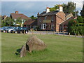
A sarsen stone discovered c19 during the excavation for a pipeline across Horsell Birch. Moved and erected at current location.
Limited primary sources, identified by a local historian and published as part of a newspaper series.
From the article: The stone has been erected near the Danewell Gutter stream, but does not appear to have been an ancient standing stone. It is one of a number of large sarsen stones to be found in the back gardens of houses in the Hook Heath area.
Google Street View available.
You may be viewing yesterday's version of this page. To see the most up to date information please register for a free account.
Do not use the above information on other web sites or publications without permission of the contributor.
Nearby Images from Geograph Britain and Ireland:
©2011(licence)
©2015(licence)
©2016(licence)
©2011(licence)
©2011(licence)
The above images may not be of the site on this page, they are loaded from Geograph.
Please Submit an Image of this site or go out and take one for us!
Click here to see more info for this site
Nearby sites
Key: Red: member's photo, Blue: 3rd party photo, Yellow: other image, Green: no photo - please go there and take one, Grey: site destroyed
Download sites to:
KML (Google Earth)
GPX (GPS waypoints)
CSV (Garmin/Navman)
CSV (Excel)
To unlock full downloads you need to sign up as a Contributory Member. Otherwise downloads are limited to 50 sites.
Turn off the page maps and other distractions
Nearby sites listing. In the following links * = Image available
2.6km E 86° Horsell Common W* Barrow Cemetery (TQ01405980)
2.8km E 87° Horsell Common E* Round Barrow(s) (TQ01615977)
3.2km W 270° St John the Baptist's Well* Holy Well or Sacred Spring (SU956595)
4.4km N 9° Chobham Common (1)* Misc. Earthwork (SU994639)
4.9km NNW 345° Albury Bottom Enclosure* Misc. Earthwork (SU97426430)
5.1km E 100° Pyrford Stone* Marker Stone (TQ0382258782)
5.1km N 5° Longcross Barrow* Round Barrow(s) (SU99126466)
5.5km WNW 290° New England Barrow Round Barrow(s) (SU93616129)
5.6km N 5° Flutters Hill Barrow* Round Barrow(s) (SU99206516)
5.7km E 87° Jack Temple Healing Centre* Modern Stone Circle etc (TQ045600)
5.7km SW 224° Bullswater Common Barrows Barrow Cemetery (SU9487555356)
6.0km WNW 289° West End Common Barrows* Barrow Cemetery (SU931614)
6.0km SSE 166° Jacobs Well* Holy Well or Sacred Spring (TQ004538)
6.0km S 173° Whitmoor Common* Round Barrow(s) (SU996536)
6.1km N 2° Barrowhills Round Barrow(s) (SU98866567)
7.7km NNW 333° Sunningdale Barrows Round Barrow(s) (SU952664)
8.5km N 356° Leptis Magna (Virginia Waters)* Ancient Temple (SU980680)
8.8km E 94° Bowl barrow west of Cockcrow Hill* Round Barrow(s) (TQ07635910)
8.9km NNE 26° St Ann's Hill* Hillfort (TQ026676)
9.0km NNE 25° The Nun's Well (Surrey)* Holy Well or Sacred Spring (TQ0247767756)
9.1km NE 36° Chertsey Museum Museum (TQ040670)
9.1km E 94° Cockrow Hill Bell Barrow* Round Barrow(s) (TQ07905915)
9.7km E 91° Red Hill (Surrey)* Henge (TQ08505961)
9.9km ENE 78° St George's Hill* Hillfort (TQ085618)
10.3km S 176° Guildford Museum* Museum (SU9968349258)
View more nearby sites and additional images


 We would like to know more about this location. Please feel free to add a brief description and any relevant information in your own language.
 Wir möchten mehr über diese Stätte erfahren. Bitte zögern Sie nicht, eine kurze Beschreibung und relevante Informationen in Deutsch hinzuzufügen.
 Nous aimerions en savoir encore un peu sur les lieux. S'il vous plaît n'hesitez pas à ajouter une courte description et tous les renseignements pertinents dans votre propre langue.
 Quisieramos informarnos un poco más de las lugares. No dude en añadir una breve descripción y otros datos relevantes en su propio idioma.