


<< Text Pages >> California Belt Round Barrows - Barrow Cemetery in England in Yorkshire (North)
Submitted by coldrum on Monday, 30 August 2010 Page Views: 2825
Neolithic and Bronze AgeSite Name: California Belt Round BarrowsCountry: England
NOTE: This site is 4.862 km away from the location you searched for.
County: Yorkshire (North) Type: Barrow Cemetery
Map Ref: SE95808719
Latitude: 54.271398N Longitude: 0.530419W
Condition:
| 5 | Perfect |
| 4 | Almost Perfect |
| 3 | Reasonable but with some damage |
| 2 | Ruined but still recognisable as an ancient site |
| 1 | Pretty much destroyed, possibly visible as crop marks |
| 0 | No data. |
| -1 | Completely destroyed |
| 5 | Superb |
| 4 | Good |
| 3 | Ordinary |
| 2 | Not Good |
| 1 | Awful |
| 0 | No data. |
| 5 | Can be driven to, probably with disabled access |
| 4 | Short walk on a footpath |
| 3 | Requiring a bit more of a walk |
| 2 | A long walk |
| 1 | In the middle of nowhere, a nightmare to find |
| 0 | No data. |
| 5 | co-ordinates taken by GPS or official recorded co-ordinates |
| 4 | co-ordinates scaled from a detailed map |
| 3 | co-ordinates scaled from a bad map |
| 2 | co-ordinates of the nearest village |
| 1 | co-ordinates of the nearest town |
| 0 | no data |
Be the first person to rate this site - see the 'Contribute!' box in the right hand menu.
Internal Links:
External Links:
I have visited· I would like to visit
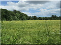
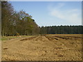
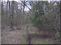
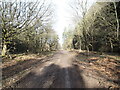
Bungie visited on 1st May 2019 - their rating: Cond: 1 Access: 3 Located either side of the forest track. I thought I could see a slight round area where the barrows are, especially the east one, although they don't show up on my photos. Also " found " them dowsing but as I am a beginner it might have been wishful thinking !
You can drive up toward them and park at the end of the road to carry on by foot. A pleasant woodland walk but don't expect to see much. Fox Head Barrow is near-by.
From Pastscape:
"Up to 4 Bronze Age round barrows situated south east of California Belt east of Fox Head located both sides of the Great Moor Road south of Wykeham Forest. All greatly reduced by ploughing. At least one of these barrows was excavated in 1961-2 when 4 cremations were uncovered 2 within urns. Another was excavated in 1965. It was surrounded by a kerb of carved and decorated boulders some of which are now in Scarborough Museum. This mound was found to have been constructed over a primary burial of a child. Above the head were four flint scrapers and three other blades. It also contained 4 secondary cremation burials. Other finds included food vessels, small flint blades, hazelnut shells, a collared urn and a pygmy cup."
Pastscape
You may be viewing yesterday's version of this page. To see the most up to date information please register for a free account.
Do not use the above information on other web sites or publications without permission of the contributor.
Nearby Images from Geograph Britain and Ireland:
©2022(licence)
©2007(licence)
©2016(licence)
©2024(licence)
©2022(licence)
The above images may not be of the site on this page, they are loaded from Geograph.
Please Submit an Image of this site or go out and take one for us!
Click here to see more info for this site
Nearby sites
Key: Red: member's photo, Blue: 3rd party photo, Yellow: other image, Green: no photo - please go there and take one, Grey: site destroyed
Download sites to:
KML (Google Earth)
GPX (GPS waypoints)
CSV (Garmin/Navman)
CSV (Excel)
To unlock full downloads you need to sign up as a Contributory Member. Otherwise downloads are limited to 50 sites.
Turn off the page maps and other distractions
Nearby sites listing. In the following links * = Image available
72m NW 305° Fox Head Round Barrow* Round Barrow(s) (SE95748723)
1.2km NW 318° Loft Howe* Round Barrow(s) (SE95018804)
2.2km N 351° Wykeham Forest Iron Age Square Barrow Cemetery Misc. Earthwork (SE954894)
3.5km NNE 19° Hackness Church* Ancient Cross (SE96919056)
3.8km NNE 22° St Hilda's Holy Well* Holy Well or Sacred Spring (SE9714890729)
4.3km ESE 102° East Ayton Long Barrow Long Barrow (TA000864)
5.0km E 86° Seamer Beacon* Round Barrow(s) (TA008876)
5.6km W 259° Rob Howe Long Barrow Long Barrow (SE90308600)
6.5km WNW 303° Three Howes (South Moor)* Round Barrow(s) (SE90329063)
6.7km W 262° Scamridge Long Barrow Long Barrow (SE892861)
6.7km NW 305° Fox Howe* Round Barrow(s) (SE90249096)
7.0km E 88° Falsgrave Park Circle* Modern Stone Circle etc (TA028876)
7.1km WNW 302° Brown Howes* Round Barrow(s) (SE89709084)
7.5km NW 305° Dargate Dykes* Ancient Village or Settlement (SE89519132)
7.8km ESE 115° Crossgates Stone (Seamer) Natural Stone / Erratic / Other Natural Feature (TA02948398)
8.5km WNW 291° Adder Stone (Dalby Forest)* Natural Stone / Erratic / Other Natural Feature (SE8778090110)
8.6km E 84° Rotunda Museum* Museum (TA0432588255)
9.3km SE 133° Star Carr* Ancient Village or Settlement (TA0282181013)
9.5km WNW 296° The Bridestones (Staindale)* Natural Stone / Erratic / Other Natural Feature (SE872912)
9.5km E 80° Our Lady's Well (Scarborough)* Holy Well or Sacred Spring (TA051891)
9.6km NNW 333° High Greens Cairn Cemetery Cairn (SE91239564)
9.9km NNE 29° Cloughton Moor Stone Circle (TA0036595947)
9.9km NNE 16° Linglands Farm NW (Hardwood Dale) Cairn (SE9830296749)
9.9km NNE 14° Linglands Farm Cairnfields (Hardwood Dale) Cairn (SE9804796859)
10.1km NNE 15° Harwood Dale* Stone Circle (SE9824796976)
View more nearby sites and additional images


 We would like to know more about this location. Please feel free to add a brief description and any relevant information in your own language.
 Wir möchten mehr über diese Stätte erfahren. Bitte zögern Sie nicht, eine kurze Beschreibung und relevante Informationen in Deutsch hinzuzufügen.
 Nous aimerions en savoir encore un peu sur les lieux. S'il vous plaît n'hesitez pas à ajouter une courte description et tous les renseignements pertinents dans votre propre langue.
 Quisieramos informarnos un poco más de las lugares. No dude en añadir una breve descripción y otros datos relevantes en su propio idioma.