


<< Text Pages >> Maiden Bower Causewayed Enclosure - Causewayed Enclosure in England in Bedfordshire
Submitted by coldrum on Tuesday, 06 December 2011 Page Views: 5319
Neolithic and Bronze AgeSite Name: Maiden Bower Causewayed EnclosureCountry: England
NOTE: This site is 0.97 km away from the location you searched for.
County: Bedfordshire Type: Causewayed Enclosure
Nearest Town: Dunstable
Map Ref: SP99662247
Latitude: 51.891883N Longitude: 0.553199W
Condition:
| 5 | Perfect |
| 4 | Almost Perfect |
| 3 | Reasonable but with some damage |
| 2 | Ruined but still recognisable as an ancient site |
| 1 | Pretty much destroyed, possibly visible as crop marks |
| 0 | No data. |
| -1 | Completely destroyed |
| 5 | Superb |
| 4 | Good |
| 3 | Ordinary |
| 2 | Not Good |
| 1 | Awful |
| 0 | No data. |
| 5 | Can be driven to, probably with disabled access |
| 4 | Short walk on a footpath |
| 3 | Requiring a bit more of a walk |
| 2 | A long walk |
| 1 | In the middle of nowhere, a nightmare to find |
| 0 | No data. |
| 5 | co-ordinates taken by GPS or official recorded co-ordinates |
| 4 | co-ordinates scaled from a detailed map |
| 3 | co-ordinates scaled from a bad map |
| 2 | co-ordinates of the nearest village |
| 1 | co-ordinates of the nearest town |
| 0 | no data |
Be the first person to rate this site - see the 'Contribute!' box in the right hand menu.
Internal Links:
External Links:
Causewayed Enclosure in Bedfordshire
"A Neolithic causewayed enclosure masked by the later Iron Age hillfort of Maiden Bower. Features which appear to suggest the presence of a Neolithic causewayed enclosure are visible in a quarry face beneath the earthwork rampart of Maiden Bower.
The earthworks were surveyed by RCHME in 1994 as part of the Industry and Enclosure in the Neolithic Project, and at the same time all published and some unpublished sources relating to the archaeological investigation of the site were examined. Recording and salvage work was undertaken from 1878 by Worthington Smith, although the Neolithic date of his finds was not recognised until the 1930s. Even then, it was the multiple (and mostly recent) gaps in the bank of the Iron Age enclosure which attracted attention, rather than the buried features exposed by quarrying.
Ditch segments and possible pits containing Neolithic artefacts, plus traces of a bank, appear to lie beneath and outside the later enclosure, and have continued to be observed and recorded sporadically since the 1930s.
The shape and dimensions of the `grave-like excavations' described by Smith, the quantity of bone, the disarticulated remains of a human being, the antler `comb'; the heavy-rimmed, decorated Bowl pottery and the location of the earthwork all suggest that the earthworks do represent the remains of a causewayed enclosure.
Maiden Bower was included in some recent research into the dating of Early Neolithic enclosures. The radiocarbon measurements point to a period of use probably in the 38th to 33rd centuries cal BC (3800 to 3200 cal BC). The activity probably spanned up to about 205 years although a shorter rather than a longer duration is more probable. The estimated chronology for this site is unfortunately imprecise."
Source: Pastscape.
You may be viewing yesterday's version of this page. To see the most up to date information please register for a free account.
Do not use the above information on other web sites or publications without permission of the contributor.
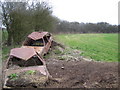
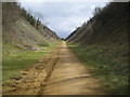
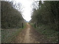
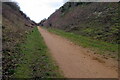
Nearby Images from Geograph Britain and Ireland:
©2006(licence)
©2006(licence)
©2011(licence)
©2020(licence)
©2020(licence)
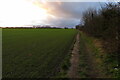
The above images may not be of the site on this page, they are loaded from Geograph.
Please Submit an Image of this site or go out and take one for us!
Click here to see more info for this site
Nearby sites
Key: Red: member's photo, Blue: 3rd party photo, Yellow: other image, Green: no photo - please go there and take one, Grey: site destroyed
Download sites to:
KML (Google Earth)
GPX (GPS waypoints)
CSV (Garmin/Navman)
CSV (Excel)
To unlock full downloads you need to sign up as a Contributory Member. Otherwise downloads are limited to 50 sites.
Turn off the page maps and other distractions
Nearby sites listing. In the following links * = Image available
162m WNW 282° Maiden Bower* Hillfort (SP995225)
1.7km SSE 147° Five Knolls* Barrow Cemetery (TL00632103)
4.4km SW 219° Edlesborough* Artificial Mound (SP970190)
6.0km SSW 208° Ivinghoe Beacon Barrow* Round Barrow(s) (SP96931709)
6.6km NNE 14° Conger Hill* Hillfort (TL011289)
6.7km SW 214° Ivinghoe Beacon* Hillfort (SP960169)
6.9km ENE 72° Waulud's Bank* Henge (TL062247)
7.1km SSW 212° Ivinghoe Beacon Hill Barrows* Barrow Cemetery (SP95961638)
7.2km SSW 203° Mead's Plantation Ancient Village or Settlement (SP97021576)
8.9km WNW 302° Shepherd's Race (Heath)* Turf Maze (SP9227)
9.2km SSW 197° Moneybury Hill Bell Barrow* Round Barrow(s) (SP97111361)
9.5km SSW 211° Pitstone Hill Causewayed Enclosure (SP949142)
9.7km SW 214° Northfield Settlement Ancient Village or Settlement (SP944143)
9.7km SSW 197° Moneybury Hill Round Barrow(s) (SP97031309)
9.8km ENE 67° Dray's Ditches* Misc. Earthwork (TL08642641)
9.9km WNW 298° Linslade Holy Well Holy Well or Sacred Spring (SP908270)
10.0km NE 47° Sharpenhoe Burial Mound* Round Barrow(s)
10.3km SSW 208° Aldbury Nowers Round Barrow(s) (SP95071324)
10.5km NE 42° Sharpenhoe Clappers* Hillfort (TL065304)
10.5km ENE 66° Galley Hill (Streatley)* Round Barrow(s) (TL092270)
11.6km SSE 165° Great Gaddesden church puddingstones* Natural Stone / Erratic / Other Natural Feature (TL02871127)
11.7km SSE 165° Great Gaddesden Puddingstone* Natural Stone / Erratic / Other Natural Feature (TL029112)
12.2km WNW 293° Soulbury Stone* Natural Stone / Erratic / Other Natural Feature (SP88292709)
12.4km ENE 57° Ravensburgh Castle* Hillfort (TL099295)
13.2km NE 55° St Faith's Well* Holy Well or Sacred Spring (TL103303)
View more nearby sites and additional images


 We would like to know more about this location. Please feel free to add a brief description and any relevant information in your own language.
 Wir möchten mehr über diese Stätte erfahren. Bitte zögern Sie nicht, eine kurze Beschreibung und relevante Informationen in Deutsch hinzuzufügen.
 Nous aimerions en savoir encore un peu sur les lieux. S'il vous plaît n'hesitez pas à ajouter une courte description et tous les renseignements pertinents dans votre propre langue.
 Quisieramos informarnos un poco más de las lugares. No dude en añadir una breve descripción y otros datos relevantes en su propio idioma.