


<< Our Photo Pages >> Towerhill (Herts) Puddingstone - Natural Stone / Erratic / Other Natural Feature in England in Hertfordshire
Submitted by Thorgrim on Friday, 21 January 2005 Page Views: 7200
Natural PlacesSite Name: Towerhill (Herts) PuddingstoneCountry: England
NOTE: This site is 2.304 km away from the location you searched for.
County: Hertfordshire Type: Natural Stone / Erratic / Other Natural Feature
Nearest Town: Kings Langley
Map Ref: TL0363802375
Latitude: 51.710546N Longitude: 0.501414W
Condition:
| 5 | Perfect |
| 4 | Almost Perfect |
| 3 | Reasonable but with some damage |
| 2 | Ruined but still recognisable as an ancient site |
| 1 | Pretty much destroyed, possibly visible as crop marks |
| 0 | No data. |
| -1 | Completely destroyed |
| 5 | Superb |
| 4 | Good |
| 3 | Ordinary |
| 2 | Not Good |
| 1 | Awful |
| 0 | No data. |
| 5 | Can be driven to, probably with disabled access |
| 4 | Short walk on a footpath |
| 3 | Requiring a bit more of a walk |
| 2 | A long walk |
| 1 | In the middle of nowhere, a nightmare to find |
| 0 | No data. |
| 5 | co-ordinates taken by GPS or official recorded co-ordinates |
| 4 | co-ordinates scaled from a detailed map |
| 3 | co-ordinates scaled from a bad map |
| 2 | co-ordinates of the nearest village |
| 1 | co-ordinates of the nearest town |
| 0 | no data |
Internal Links:
External Links:
I have visited· I would like to visit
victoria5 would like to visit
willowman1 visited on 20th Sep 2017 - their rating: Cond: 5 Amb: 3 Access: 5
 Puddingstone (PID:171318)")
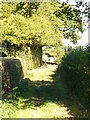
The last stone in Hertfordshire rests against the north verge of Scatterdell Lane where it joins the road to Kings Langley. Site No. 71 on the Puddingstone Trail.
You may be viewing yesterday's version of this page. To see the most up to date information please register for a free account.
Do not use the above information on other web sites or publications without permission of the contributor.
willowman1 has found this location on Google Street View:
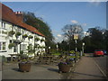
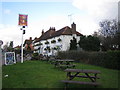
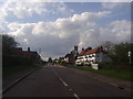
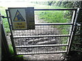
Nearby Images from Geograph Britain and Ireland:
©2012(licence)
©2006(licence)
©2012(licence)
©2023(licence)
©2009(licence)
The above images may not be of the site on this page, they are loaded from Geograph.
Please Submit an Image of this site or go out and take one for us!
Click here to see more info for this site
Nearby sites
Key: Red: member's photo, Blue: 3rd party photo, Yellow: other image, Green: no photo - please go there and take one, Grey: site destroyed
Download sites to:
KML (Google Earth)
GPX (GPS waypoints)
CSV (Garmin/Navman)
CSV (Excel)
To unlock full downloads you need to sign up as a Contributory Member. Otherwise downloads are limited to 50 sites.
Turn off the page maps and other distractions
Nearby sites listing. In the following links * = Image available
1.5km SE 140° Chipperfield Common Round Barrows* Round Barrow(s) (TL04620126)
2.7km NE 41° Kings Langley Cursus Cursus (TL0535804425)
4.0km S 178° Church Hill puddingstones Natural Stone / Erratic / Other Natural Feature (TQ03899840)
4.3km WNW 293° Whelpley Hill* Hillfort (SP99680397)
5.3km W 270° Botley Puddingstones Natural Stone / Erratic / Other Natural Feature (SP983023)
5.5km ENE 68° Bedmond Puddingstone Natural Stone / Erratic / Other Natural Feature (TL087045)
7.8km SE 134° Cassiobury Park barrow* Round Barrow(s) (TQ094971)
8.0km W 265° St Mary's Church (Chesham)* Natural Stone / Erratic / Other Natural Feature (SP9566801521)
8.4km ENE 72° Potterscrouch Puddingstones Natural Stone / Erratic / Other Natural Feature (TL116052)
8.9km N 356° Great Gaddesden Puddingstone* Natural Stone / Erratic / Other Natural Feature (TL029112)
8.9km N 356° Great Gaddesden church puddingstones* Natural Stone / Erratic / Other Natural Feature (TL02871127)
10.5km ENE 56° Devil's Ditch (Hertfordshire) Ancient Village or Settlement (TL123084)
10.7km NE 34° The Aubreys* Hillfort (TL095113)
11.0km ENE 64° Verulamium Puddingstone Natural Stone / Erratic / Other Natural Feature (TL134074)
11.4km ENE 65° St Albans Puddingstones* Natural Stone / Erratic / Other Natural Feature (TL139075)
11.7km WNW 296° Cholesbury Camp* Hillfort (SP930072)
11.8km ENE 70° Holy Well (St. Albans)* Holy Well or Sacred Spring (TL14640670)
12.0km NW 307° Grim’s Ditch (Hertfordshire) Misc. Earthwork (SP93850938)
12.3km W 263° Great Missenden Puddingstone* Natural Stone / Erratic / Other Natural Feature (SP9142700686)
12.6km NNW 330° Moneybury Hill Round Barrow(s) (SP97031309)
13.0km NNW 331° Moneybury Hill Bell Barrow* Round Barrow(s) (SP97111361)
13.7km ENE 61° Beech Bottom Dyke* Ancient Village or Settlement (TL155093)
13.8km NW 323° Aldbury Nowers Round Barrow(s) (SP95071324)
14.0km SE 137° Grim's Ditch (Greater London) Ancient Village or Settlement (TQ134923)
14.0km SW 216° The Mount (Beaconsfield)* Round Barrow(s) (SU95549089)
View more nearby sites and additional images


 We would like to know more about this location. Please feel free to add a brief description and any relevant information in your own language.
 Wir möchten mehr über diese Stätte erfahren. Bitte zögern Sie nicht, eine kurze Beschreibung und relevante Informationen in Deutsch hinzuzufügen.
 Nous aimerions en savoir encore un peu sur les lieux. S'il vous plaît n'hesitez pas à ajouter une courte description et tous les renseignements pertinents dans votre propre langue.
 Quisieramos informarnos un poco más de las lugares. No dude en añadir una breve descripción y otros datos relevantes en su propio idioma.