 with our Megalithic Portal iPhone app")


<< Text Pages >> Iserias Chromlech 1 - Stone Circle in Spain in Aragón
Submitted by holger_rix on Thursday, 31 December 2015 Page Views: 489
Neolithic and Bronze AgeSite Name: Iserias Chromlech 1Country: Spain
NOTE: This site is 3.273 km away from the location you searched for.
Region: Aragón Type: Stone Circle
Latitude: 42.756351N Longitude: 0.475214W
Condition:
| 5 | Perfect |
| 4 | Almost Perfect |
| 3 | Reasonable but with some damage |
| 2 | Ruined but still recognisable as an ancient site |
| 1 | Pretty much destroyed, possibly visible as crop marks |
| 0 | No data. |
| -1 | Completely destroyed |
| 5 | Superb |
| 4 | Good |
| 3 | Ordinary |
| 2 | Not Good |
| 1 | Awful |
| 0 | No data. |
| 5 | Can be driven to, probably with disabled access |
| 4 | Short walk on a footpath |
| 3 | Requiring a bit more of a walk |
| 2 | A long walk |
| 1 | In the middle of nowhere, a nightmare to find |
| 0 | No data. |
| 5 | co-ordinates taken by GPS or official recorded co-ordinates |
| 4 | co-ordinates scaled from a detailed map |
| 3 | co-ordinates scaled from a bad map |
| 2 | co-ordinates of the nearest village |
| 1 | co-ordinates of the nearest town |
| 0 | no data |
Be the first person to rate this site - see the 'Contribute!' box in the right hand menu.
Internal Links:
External Links:
Stone Circle in Aragón
Source: euskal-herria.org
You may be viewing yesterday's version of this page. To see the most up to date information please register for a free account.
Do not use the above information on other web sites or publications without permission of the contributor.
Nearby Images from Flickr
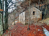
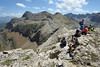
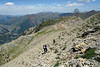
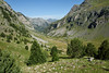
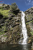
The above images may not be of the site on this page, but were taken nearby. They are loaded from Flickr so please click on them for image credits.
Click here to see more info for this site
Nearby sites
Click here to view sites on an interactive map of the areaKey: Red: member's photo, Blue: 3rd party photo, Yellow: other image, Green: no photo - please go there and take one, Grey: site destroyed
Download sites to:
KML (Google Earth)
GPX (GPS waypoints)
CSV (Garmin/Navman)
CSV (Excel)
To unlock full downloads you need to sign up as a Contributory Member. Otherwise downloads are limited to 50 sites.
Turn off the page maps and other distractions
Nearby sites listing. In the following links * = Image available
96m E 101° Iserias Chromlech 2* Stone Circle
344m E 92° Iserias Chromlech 4 Stone Circle
344m E 93° Iserias Chromlech 3 Stone Circle
535m ENE 76° Iserias Túmulo Round Barrow(s)
637m E 85° Iserias Cista Cist
1.6km E 85° Barranco Las Negras Túmulo 1* Round Barrow(s)
1.8km E 85° Barranco Las Negras Túmulo 2 Round Barrow(s)
2.5km E 89° Barranco De Blancas Norte Chromlech Stone Circle
2.6km E 93° Barranco De Blancas Dolmen 1* Burial Chamber or Dolmen
2.7km E 94° Barranco De Blancas Dolmen 2* Burial Chamber or Dolmen
3.1km E 98° Barranco de Blancas Túmulo* Round Barrow(s)
3.2km SSE 155° Barranco De Ip Chromlech Stone Circle
3.5km ESE 107° Escarra Dolmen* Burial Chamber or Dolmen
3.5km ESE 104° Barranco De Blancas Sur Chromlech Stone Circle
3.9km N 355° Mal Paso Dolmen Burial Chamber or Dolmen
4.0km N 358° Mal Paso Cromlech Stone Circle
4.2km NNE 31° La Rinconada Dolmen* Ring Cairn
4.2km NNE 31° La Rinconada Chromlech Stone Circle
4.2km NNE 31° La Rinconada Túmulo Round Barrow(s)
4.3km ENE 57° Ibón De La Glera Chromlech Stone Circle
4.3km NNE 30° La Rinconada Menhir Standing Stone (Menhir)
4.3km NNE 27° Circo Canal Roya Chromlech* Stone Circle
4.4km NNE 21° Canal Roya Sur Chromlech* Stone Circle
4.5km NNE 20° Canal Roya Norte Chromlech* Stone Circle
5.4km ESE 109° Ibón De La Sierra Chromlech Stone Circle
View more nearby sites and additional images

")
 We would like to know more about this location. Please feel free to add a brief description and any relevant information in your own language.
 Wir möchten mehr über diese Stätte erfahren. Bitte zögern Sie nicht, eine kurze Beschreibung und relevante Informationen in Deutsch hinzuzufügen.
 Nous aimerions en savoir encore un peu sur les lieux. S'il vous plaît n'hesitez pas à ajouter une courte description et tous les renseignements pertinents dans votre propre langue.
 Quisieramos informarnos un poco más de las lugares. No dude en añadir una breve descripción y otros datos relevantes en su propio idioma.