 with our Megalithic Portal iPhone app")

<< Text Pages >> Titchmarch Cursus - Cursus in England in Northamptonshire
Submitted by EssexMan on Wednesday, 07 April 2010 Page Views: 3181
Neolithic and Bronze AgeSite Name: Titchmarch CursusCountry: England
NOTE: This site is 3.237 km away from the location you searched for.
County: Northamptonshire Type: Cursus
Nearest Town: Kettering Nearest Village: Titchmarch
Map Ref: TL016798 Landranger Map Number: 141
Latitude: 52.406784N Longitude: 0.507892W
Condition:
| 5 | Perfect |
| 4 | Almost Perfect |
| 3 | Reasonable but with some damage |
| 2 | Ruined but still recognisable as an ancient site |
| 1 | Pretty much destroyed, possibly visible as crop marks |
| 0 | No data. |
| -1 | Completely destroyed |
| 5 | Superb |
| 4 | Good |
| 3 | Ordinary |
| 2 | Not Good |
| 1 | Awful |
| 0 | No data. |
| 5 | Can be driven to, probably with disabled access |
| 4 | Short walk on a footpath |
| 3 | Requiring a bit more of a walk |
| 2 | A long walk |
| 1 | In the middle of nowhere, a nightmare to find |
| 0 | No data. |
| 5 | co-ordinates taken by GPS or official recorded co-ordinates |
| 4 | co-ordinates scaled from a detailed map |
| 3 | co-ordinates scaled from a bad map |
| 2 | co-ordinates of the nearest village |
| 1 | co-ordinates of the nearest town |
| 0 | no data |
Internal Links:
External Links:
Minor Cursus in Northhants.
Status: Doubtful
Extent: 500mx75m
You may be viewing yesterday's version of this page. To see the most up to date information please register for a free account.
Do not use the above information on other web sites or publications without permission of the contributor.
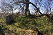
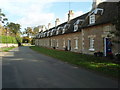
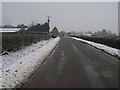
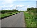
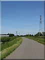
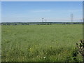
Nearby Images from Geograph Britain and Ireland:
©2008(licence)
©2015(licence)
©2012(licence)
©2009(licence)
©2009(licence)
The above images may not be of the site on this page, they are loaded from Geograph.
Please Submit an Image of this site or go out and take one for us!
Click here to see more info for this site
Nearby sites
Key: Red: member's photo, Blue: 3rd party photo, Yellow: other image, Green: no photo - please go there and take one, Grey: site destroyed
Download sites to:
KML (Google Earth)
GPX (GPS waypoints)
CSV (Garmin/Navman)
CSV (Excel)
To unlock full downloads you need to sign up as a Contributory Member. Otherwise downloads are limited to 50 sites.
Turn off the page maps and other distractions
Nearby sites listing. In the following links * = Image available
6.7km WSW 236° Three Hills Barrows, Woodford* Barrow Cemetery (SP961760)
8.0km SSW 205° Cotton Henge* Henge (SP983725)
8.3km SSW 210° West Cotton Monument Complex Long Barrow (SP97577248)
9.0km SW 217° Irthlingborough and Stanwick Barrows* Barrow Cemetery (SP963725)
9.3km SSW 209° Raunds Ring Ditch Misc. Earthwork (SP972716)
9.6km SSW 212° Stanwick Lakes* Museum (SP96707150)
10.2km SSW 211° Redlands Farm Long Barrow Long Barrow (SP965710)
10.5km ESE 115° Seat of Judgement - Leighton Bromswold* Marker Stone (TL112756)
12.7km SW 233° Finedon Stone Marker Stone (SP9161871928)
12.9km SSE 166° Harrowick, Upper Dean Natural Stone / Erratic / Other Natural Feature (TL0507267416)
16.2km NW 309° Parliament Stone* Natural Stone / Erratic / Other Natural Feature (SP888898)
17.3km E 91° Monk's Hole Barrow Round Barrow(s) (TL1896479957)
17.3km N 352° Blatherwycke stone cross Marker Stone (SP988969)
18.3km NW 322° The Jo Stone* Natural Stone / Erratic / Other Natural Feature (SP8995293949)
20.3km NNE 29° Water Newton Mill Bowl Barrow* Round Barrow(s) (TL11269770)
20.4km ESE 115° Brampton Cursus Cursus (TL203716)
20.5km ESE 115° Brampton Long Barrow (TL204715)
21.0km S 184° Felmersham Cursus Cursus (TL004588)
21.2km NE 49° Stone Circle, James' Pond* Modern Stone Circle etc (TL17309405)
21.2km SSE 163° Bolnhurst Earthwork Misc. Earthwork (TL084597)
21.4km NW 310° Great Easton Roman Well* Holy Well or Sacred Spring (SP850933)
21.6km NNE 15° Thornhaugh Henge Henge (TF066008)
22.1km NNE 22° Upton Causewayed Enclosure Causewayed Enclosure (TF095005)
22.3km NE 35° Robin Hood and Little John* Standing Stones (TL1395098389)
22.8km N 352° Tixover Grange Long Barrow (SK981023)
View more nearby sites and additional images


 We would like to know more about this location. Please feel free to add a brief description and any relevant information in your own language.
 Wir möchten mehr über diese Stätte erfahren. Bitte zögern Sie nicht, eine kurze Beschreibung und relevante Informationen in Deutsch hinzuzufügen.
 Nous aimerions en savoir encore un peu sur les lieux. S'il vous plaît n'hesitez pas à ajouter une courte description et tous les renseignements pertinents dans votre propre langue.
 Quisieramos informarnos un poco más de las lugares. No dude en añadir una breve descripción y otros datos relevantes en su propio idioma.