


<< Text Pages >> Newell's Well (Glentham) - Holy Well or Sacred Spring in England in Lincolnshire
Submitted by Anne T on Thursday, 07 December 2017 Page Views: 1465
Springs and Holy WellsSite Name: Newell''s Well (Glentham)Country: England
NOTE: This site is 3.299 km away from the location you searched for.
County: Lincolnshire Type: Holy Well or Sacred Spring
Nearest Town: Gainsborough / Market Rasen Nearest Village: Glentham
Map Ref: SK981897
Latitude: 53.395028N Longitude: 0.52619W
Condition:
| 5 | Perfect |
| 4 | Almost Perfect |
| 3 | Reasonable but with some damage |
| 2 | Ruined but still recognisable as an ancient site |
| 1 | Pretty much destroyed, possibly visible as crop marks |
| 0 | No data. |
| -1 | Completely destroyed |
| 5 | Superb |
| 4 | Good |
| 3 | Ordinary |
| 2 | Not Good |
| 1 | Awful |
| 0 | No data. |
| 5 | Can be driven to, probably with disabled access |
| 4 | Short walk on a footpath |
| 3 | Requiring a bit more of a walk |
| 2 | A long walk |
| 1 | In the middle of nowhere, a nightmare to find |
| 0 | No data. |
| 5 | co-ordinates taken by GPS or official recorded co-ordinates |
| 4 | co-ordinates scaled from a detailed map |
| 3 | co-ordinates scaled from a bad map |
| 2 | co-ordinates of the nearest village |
| 1 | co-ordinates of the nearest town |
| 0 | no data |
Be the first person to rate this site - see the 'Contribute!' box in the right hand menu.
Internal Links:
External Links:
Holy Well or Sacred Spring in Lincolnshire
Situated just south of the A631 between the villages of Glentham and Caenby Corner, The Northern Antiquarian (TNA) features a page for this holy well - see their entry for Newell’s Well, Glentham, Lincolnshire.
TNA give directions for finding this well, together with a photograph and a brief archaeology & history and local folklore. TNA add that the site is now enveloped in scrub and a report by Sutton from 1997 states: "An old boy told me about the ‘healing well of Glentham. It was named after a saint but I can’t remember the name he used. Some folk call it Newell’s well. Many people came to take the healing waters and in the spring of the year, the Church held an annual service for ‘good water for the rest of the year’, the service marked a new year of the waters. The well was dressed in a traditional way using clay and flower petals to make some kind of picture, usually a saint. I’m told it look very impressive."
Note: Have you visited this site? Do you have any photographs or information to add?
You may be viewing yesterday's version of this page. To see the most up to date information please register for a free account.
Do not use the above information on other web sites or publications without permission of the contributor.
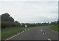
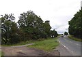
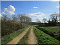
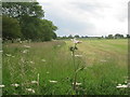
Nearby Images from Geograph Britain and Ireland:

©2011(licence)
©2012(licence)
©2015(licence)
©2021(licence)
©2012(licence)
The above images may not be of the site on this page, they are loaded from Geograph.
Please Submit an Image of this site or go out and take one for us!
Click here to see more info for this site
Nearby sites
Key: Red: member's photo, Blue: 3rd party photo, Yellow: other image, Green: no photo - please go there and take one, Grey: site destroyed
Download sites to:
KML (Google Earth)
GPX (GPS waypoints)
CSV (Garmin/Navman)
CSV (Excel)
To unlock full downloads you need to sign up as a Contributory Member. Otherwise downloads are limited to 50 sites.
Turn off the page maps and other distractions
Nearby sites listing. In the following links * = Image available
2.5km W 276° Aisthorpe springs Holy Well or Sacred Spring (SK956899)
5.1km WNW 287° St. Helen's Well (Hemswell)* Holy Well or Sacred Spring (SK932911)
9.9km NNW 334° Ashwell* Holy Well or Sacred Spring (SK936985)
11.5km SSW 195° St Pancras Well* Holy Well or Sacred Spring (SK954785)
12.8km ESE 121° Wickenby Ancient Village or Settlement (TF0928883432)
13.4km NNE 30° The Maiden-Well Holy Well or Sacred Spring (TA045015)
13.5km NNE 30° Maiden Well (Maidenwell) Holy Well or Sacred Spring (TA047015)
15.5km SW 215° South Ingleby Tumulus Misc. Earthwork (SK8946576860)
15.9km E 81° Walesby All Saints church carvings* Sculptured Stone (TF1382892388)
16.6km ENE 67° Hills Brough* Long Barrow (TF1337396415)
17.8km NE 51° Syfer Spring Holy Well or Sacred Spring (TA117012)
17.8km NE 51° Holy Well (Caistor) Holy Well or Sacred Spring (TA1172501229)
18.1km S 182° The Collection, Lincoln* Museum (SK9771471547)
18.3km NNE 11° St. Helen's Well (Wrawby) Holy Well or Sacred Spring (TA0137907720)
18.7km S 174° Lincoln Greetwell Henge/disc barrow* Barrow Cemetery (TF00407110)
19.0km N 355° Broughton Cross* Ancient Cross (SE960086)
19.2km S 170° Washingborough Ancient Settlement* Ancient Village or Settlement (TF019709)
19.3km E 84° Bully Hill (Tealby)* Round Barrow(s) (TF17279227)
19.4km SSE 160° Fiskerton Iron Age causeway* Ancient Village or Settlement (TF05007159)
19.6km NE 47° Fonaby Stone* Standing Stones (TA123033)
19.7km NE 35° Holy Wells (Barnetby le Wold) Holy Well or Sacred Spring (TA091061)
19.9km E 79° Lud well (Stainton-Le-Vale)* Holy Well or Sacred Spring (TF17629376)
20.9km S 186° Lincoln stone circle* Modern Stone Circle etc (SK962689)
21.0km N 350° Gokwell Priory (Broughton) Misc. Earthwork (SE94081028)
23.1km WNW 303° Holy Well (Lower Burnham)* Holy Well or Sacred Spring (SE78520205)
View more nearby sites and additional images


 We would like to know more about this location. Please feel free to add a brief description and any relevant information in your own language.
 Wir möchten mehr über diese Stätte erfahren. Bitte zögern Sie nicht, eine kurze Beschreibung und relevante Informationen in Deutsch hinzuzufügen.
 Nous aimerions en savoir encore un peu sur les lieux. S'il vous plaît n'hesitez pas à ajouter une courte description et tous les renseignements pertinents dans votre propre langue.
 Quisieramos informarnos un poco más de las lugares. No dude en añadir una breve descripción y otros datos relevantes en su propio idioma.