Featured: Hare and Tabor T Shirts for discerning antiquarians

Hare and Tabor T Shirts for discerning antiquarians

Random Image


Stonehenge.

Solving Stonehenge, the new key to an ancient enigma

Solving Stonehenge, the new key to an ancient enigma

Who's Online

There are currently, 270 guests and 0 members online.

You are a guest. To join in, please register for free by clicking here

Sponsors

<< Our Photo Pages >> Sharpenhoe Clappers - Hillfort in England in Bedfordshire

Submitted by bec-zog on Friday, 14 June 2019  Page Views: 43941

Iron Age and Later PrehistorySite Name: Sharpenhoe Clappers Alternative Name: Sharpenhoe Clapper
Country: England
NOTE: This site is 5.61 km away from the location you searched for.

County: Bedfordshire Type: Hillfort
Nearest Town: Barton-le-Clay
Map Ref: TL065304  Landranger Map Number: 166
Latitude: 51.961891N  Longitude: 0.45139W
Condition:
5Perfect
4Almost Perfect
3Reasonable but with some damage
2Ruined but still recognisable as an ancient site
1Pretty much destroyed, possibly visible as crop marks
0No data.
-1Completely destroyed
3 Ambience:
5Superb
4Good
3Ordinary
2Not Good
1Awful
0No data.
3 Access:
5Can be driven to, probably with disabled access
4Short walk on a footpath
3Requiring a bit more of a walk
2A long walk
1In the middle of nowhere, a nightmare to find
0No data.
3 Accuracy:
5co-ordinates taken by GPS or official recorded co-ordinates
4co-ordinates scaled from a detailed map
3co-ordinates scaled from a bad map
2co-ordinates of the nearest village
1co-ordinates of the nearest town
0no data
3

Internal Links:
External Links:

Sharpenhoe Clappers
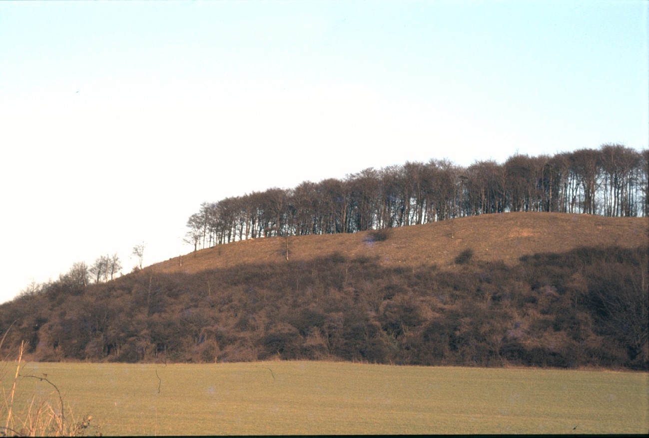
Sharpenhoe Clappers submitted by bec-zog : Sharpenhoe Clapper Iron Age Hill Fort @ TL 066302 Promontory Hill Fort. Located at the edge of the ice sheet formed during the last ice age, therefore, the view is over a flattened plain (Vote or comment on this photo)
A promontory fort in Bedfordshire, located at the edge of where the ice sheet formed during the last ice age. The Hillfort is within trees, but very clear from Harlington

(TL035307)

Parking at TL065305 (layby) and at TL065295 (car park)

Note: Beacons of the Past presents Pop-up Prehistory at Sharpenhoe Clappers, Saturday 20th July 2019, more details below on our page
You may be viewing yesterday's version of this page. To see the most up to date information please register for a free account.

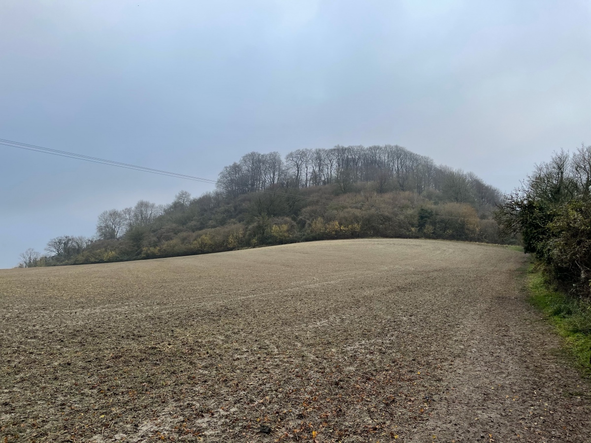
Sharpenhoe Clappers
Sharpenhoe Clappers submitted by bec-zog : Sharpenhoe Clapper Iron Age Hill Fort @ TL 066,302 Promontory Hill Fort. See J Dyer Bedfordshire magazine 8 (1963) 112 (Vote or comment on this photo)

Sharpenhoe Clappers
Sharpenhoe Clappers submitted by pjlythe1 : Sharpenhoe Clappers (Vote or comment on this photo)

Do not use the above information on other web sites or publications without permission of the contributor.

Andy B has found this location on Google Street View:

Nearby Images from Geograph Britain and Ireland:
TL0630 : Sharpenhoe Clapper from the north-west by Peter S
by Peter S
©2016(licence)
TL0630 : Countryside west of  Barton-le-Clay, Beds. by nick macneill
by nick macneill
©2010(licence)
TL0630 : Trees at the top of Sharpenhoe Clapper by Peter S
by Peter S
©2018(licence)
TL0630 : From Sharpenhoe Clappers towards Harlington by Marcus de Figueiredo
by Marcus de Figueiredo
©2007(licence)
TL0630 : On Sharpenhoe Clappers, Streatley by Humphrey Bolton
by Humphrey Bolton
©2016(licence)

The above images may not be of the site on this page, they are loaded from Geograph.
Please Submit an Image of this site or go out and take one for us!


Click here to see more info for this site

Nearby sites

Click here to view sites on an interactive OS map

Key: Red: member's photo, Blue: 3rd party photo, Yellow: other image, Green: no photo - please go there and take one, Grey: site destroyed

Download sites to:
KML (Google Earth)
GPX (GPS waypoints)
CSV (Garmin/Navman)
CSV (Excel)

To unlock full downloads you need to sign up as a Contributory Member. Otherwise downloads are limited to 50 sites.


Turn off the page maps and other distractions

Nearby sites listing. In the following links * = Image available
 1.1km SSE 160° Sharpenhoe Burial Mound* Round Barrow(s)
 3.5km ESE 106° Ravensburgh Castle* Hillfort (TL099295)
 3.8km E 93° St Faith's Well* Holy Well or Sacred Spring (TL103303)
 4.3km SE 143° Galley Hill (Streatley)* Round Barrow(s) (TL092270)
 4.5km SSE 153° Dray's Ditches* Misc. Earthwork (TL08642641)
 5.5km ESE 109° Telegraph Hill (Lilley Hoo) Bowl Barrow Round Barrow(s) (TL117287)
 5.6km WSW 256° Conger Hill* Hillfort (TL011289)
 5.7km S 184° Waulud's Bank* Henge (TL062247)
 6.1km E 97° Deacon Hill* Hillfort (TL12602982)
 6.7km E 91° Tingley Field Plantation Round Barrow* Round Barrow(s) (TL1324030475)
 6.8km E 86° Knocking Knoll* Long Barrow (TL133310)
 10.1km N 356° Houghton Conquest Long Barrow (TL055405)
 10.5km SW 222° Maiden Bower Causewayed Enclosure Causewayed Enclosure (SP99662247)
 10.5km SW 223° Maiden Bower* Hillfort (SP995225)
 11.0km SSW 213° Five Knolls* Barrow Cemetery (TL00632103)
 11.9km E 97° North Herts Museum* Museum (TL18342926)
 12.4km NNW 329° The Devil's stone (Bedfordshire)* Standing Stone (Menhir) (SP9989840865)
 13.8km E 82° Wilbury Hill* Hillfort (TL202325)
 14.8km SW 221° Edlesborough* Artificial Mound (SP970190)
 14.8km ENE 61° Etonbury Fort* Hillfort (TL1929637984)
 14.9km WSW 258° Shepherd's Race (Heath)* Turf Maze (SP9227)
 14.9km WNW 288° Danesborough Hillfort Hillfort (SP922348)
 15.4km E 101° Priory Well (Hertfordshire)* Holy Well or Sacred Spring (TL217279)
 15.9km NW 320° Holywell (Cranfield)* Holy Well or Sacred Spring (SP961424)
 16.0km W 259° Linslade Holy Well Holy Well or Sacred Spring (SP908270)
View more nearby sites and additional images

<< Heysham Rock-Cut tombs

Stenkirken Runddysse >>

Please add your thoughts on this site

Prehistoric Monuments of the Lake District

Prehistoric Monuments of the Lake District

Sponsors

Auto-Translation (Google)

Translate from English into:

"Sharpenhoe Clappers" | Login/Create an Account | 8 News and Comments
  
Go back to top of page    Comments are owned by the poster. We aren't responsible for their content.
Beacons of the Past presents Pop-up Prehistory at Sharpenhoe Clappers, 20th July 2019 by Andy B on Friday, 14 June 2019
(User Info | Send a Message)
Beacons of the Past presents Pop-up Prehistory at Sharpenhoe Clappers

Beacons of the Past, in celebration of the Festival of Archaeology, and in collaboration with the National Trust, presents Pop-up Prehistory at Sharpenhoe Clappers!

With Kim Biddulph:

Meet an Iron Age woman with lots of chores that need doing. The flax needs spinning, new bone needles need to be made, the grain needs to be ground into flour and the cream churned into butter. If you come and help out, maybe she'll share her meal of bean and seed stew, wild yeast baked bread, freshly made cheese and herb-flavoured ale. You might even be welcomed into the Catuvellauni tribe with woad face paint!

David Willis:

How did ancient people make rope and string? From nettles and other plants! Come make a bracelet to take home from plants that might surprise you! Learn how ancient people made fire and try your hand at ancient skills.

Pete Hommel:

Experience the magical transformation of the Metal Ages! Watch as ancient smelting techniques are used to turn copper ore from dull stone to shiny metal. Strike your own Celtic coin to take away.

We also have guided walks around the Ancient Hillfort led by National Trust rangers, ancient flint tool knapping, basket making, and much more!
Fees information

FREE EVENT
FREE PARKING

20 July, 11:00am - 4:00pm

https://festival.archaeologyuk.org/events/beacons-past-presents-pop-prehistory-sharpenhoe-clappers-1560242793
[ Reply to This ]

Re: Sharpenhoe Clappers by coldrum on Monday, 30 August 2010
(User Info | Send a Message)
Passtscape site entry:

http://www.pastscape.org.uk/hob.aspx?hob_id=360055
[ Reply to This ]

Sharpenhoe Clappers Street View by Andy B on Monday, 05 April 2010
(User Info | Send a Message)

View Larger Map
[ Reply to This ]

Re: Sharpenhoe Clappers by Anonymous on Saturday, 11 November 2006
Sharpenhoe Clappers.
I am beginning to think that there may be a Celtic core to the word Clappers. There is a place in Wales called Clap-yr-Arien, the White Lump Cairn. It is a round cairn, at Clap-yr-Arian, Llansanffraid Cwmteuddwr, near Rhayader. Clap-yr sounds a little like clapper.
‘Un clapier’ in Old French was a rabbit burrow (and also a house of ill-repute! Better not go down that road! Clapier went into English as claper and clapper.
Rabbits were a source of protein in the past and their skins were used for garments. The old medieval rabbit warren can still be seen at Sharpenhoe.
Elsewhere in the UK there is Clapper Bridge and it is said that ‘claperius’ can also mean a pile of stones (spread across a river).
I wonder if Sharpen comes not from sharp but from ‘shap’ a pile of stones. Drivers will be familiar with going up Shap, up north. If it does mean this, it may be evidence of standing stones having existed there in the past.
Looking at rabbit holes in the chalk of the Chilterns you can see mounds of rubble thrown out by burrowing rabbits.
Regarding the word Hoe I found this on the internet: HOE (through Fr. houe from O.H.G. houwd, mod. Ger. Haue; the root is seen in " hew," to cut, cleave; the word must be distinguished from " hoe," promontory, tongue of land, seen in place names, e.g. Morthoe, Luton Hoo.
[ Reply to This ]

Re: Sharpenhoe Clappers by Anonymous on Tuesday, 17 May 2005
Sharpenhoe clappers car parkat the top of moleskin hill near sharpenhoe village, and twinned with ravensburg castle was iron age and later medeval evedence of a single protective bank on south of clappers made by iron age people, and medieval rabbit warrens are still there.
[ Reply to This ]

Re: Sharpenhoe Clappers by Anonymous on Tuesday, 17 May 2005
An outpost of cassivelaunus the hill is haunted by cassavilaunus in the form of a cloud which was his cloak of invisibility which he could hide his army in and escape ceasars armies. A fierce battle took place there between ancient tribes.
james Wheeler
[ Reply to This ]

Re: Sharpenhoe Clappers by bec-zog on Friday, 10 October 2003
(User Info | Send a Message)
Nearest town is Barton-le-Clay, where Barton springs are located at the foot of an ancient (bronze-iron age) habitation site. An ancient flint trade route follows these Chiltern hills and valleys.
[ Reply to This ]

Re: Sharpenhoe Clappers by bec-zog on Friday, 10 October 2003
(User Info | Send a Message)
I believe this site is in Bedfordshire. County boundary with herts is ~2 miles east nr Ravensburg
[ Reply to This ]

Your Name: Anonymous [ Register Now ]
Subject:


Add your comment or contribution to this page. Spam or offensive posts are deleted immediately, don't even bother

<<< What is five plus one as a number? (Please type the answer to this question in the little box on the left)
You can also embed videos and other things. For Youtube please copy and paste the 'embed code'.
For Google Street View please include Street View in the text.
Create a web link like this: <a href="https://www.megalithic.co.uk">This is a link</a>  

Allowed HTML is:
<p> <b> <i> <a> <img> <em> <br> <strong> <blockquote> <tt> <li> <ol> <ul> <object> <param> <embed> <iframe>

We would like to know more about this location. Please feel free to add a brief description and any relevant information in your own language.
Wir möchten mehr über diese Stätte erfahren. Bitte zögern Sie nicht, eine kurze Beschreibung und relevante Informationen in Deutsch hinzuzufügen.
Nous aimerions en savoir encore un peu sur les lieux. S'il vous plaît n'hesitez pas à ajouter une courte description et tous les renseignements pertinents dans votre propre langue.
Quisieramos informarnos un poco más de las lugares. No dude en añadir una breve descripción y otros datos relevantes en su propio idioma.