


<< Our Photo Pages >> Moorland House (Staintondale) - Round Barrow(s) in England in Yorkshire (North)
Submitted by johndhunter on Thursday, 14 March 2019 Page Views: 1010
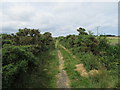
Neolithic and Bronze AgeSite Name: Moorland House (Staintondale)Country: England County: Yorkshire (North) Type: Round Barrow(s)
Nearest Village: Ravenscar
Map Ref: SE9731999578
Latitude: 54.382406N Longitude: 0.503066W
Condition:
| 5 | Perfect |
| 4 | Almost Perfect |
| 3 | Reasonable but with some damage |
| 2 | Ruined but still recognisable as an ancient site |
| 1 | Pretty much destroyed, possibly visible as crop marks |
| 0 | No data. |
| -1 | Completely destroyed |
| 5 | Superb |
| 4 | Good |
| 3 | Ordinary |
| 2 | Not Good |
| 1 | Awful |
| 0 | No data. |
| 5 | Can be driven to, probably with disabled access |
| 4 | Short walk on a footpath |
| 3 | Requiring a bit more of a walk |
| 2 | A long walk |
| 1 | In the middle of nowhere, a nightmare to find |
| 0 | No data. |
| 5 | co-ordinates taken by GPS or official recorded co-ordinates |
| 4 | co-ordinates scaled from a detailed map |
| 3 | co-ordinates scaled from a bad map |
| 2 | co-ordinates of the nearest village |
| 1 | co-ordinates of the nearest town |
| 0 | no data |
Internal Links:
External Links:
 (PID:194516)")
This is Historic England List Entry Number 1019893 which tells us that it is a steep sided earth and stone mound which measures 12m in diameter and stands 0.5m high. That it once was surrounded by a ditch up to 3m wide but this has become filled in over the years and is no longer visible. Also there is evidence in the centre of previous excavations in the past
You may be viewing yesterday's version of this page. To see the most up to date information please register for a free account.
Do not use the above information on other web sites or publications without permission of the contributor.
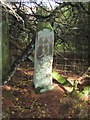
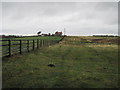
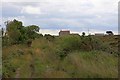
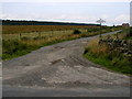
Nearby Images from Geograph Britain and Ireland:
©2020(licence)
©2014(licence)
©2010(licence)
©2006(licence)
©2018(licence)
The above images may not be of the site on this page, they are loaded from Geograph.
Please Submit an Image of this site or go out and take one for us!
Click here to see more info for this site
Nearby sites
Key: Red: member's photo, Blue: 3rd party photo, Yellow: other image, Green: no photo - please go there and take one, Grey: site destroyed
Download sites to:
KML (Google Earth)
GPX (GPS waypoints)
CSV (Garmin/Navman)
CSV (Excel)
To unlock full downloads you need to sign up as a Contributory Member. Otherwise downloads are limited to 50 sites.
Turn off the page maps and other distractions
Nearby sites listing. In the following links * = Image available
729m NW 313° Pye Rigg Howe (Staintondale Moor)* Round Barrow(s) (NZ9677400065)
1.0km NNW 343° Green Dike and Three Lords’ Stones (Staintondale)* Misc. Earthwork (NZ9700000538)
1.5km N 1° Beacon Howes (Staintondale)* Round Barrow(s) (NZ9730301095)
1.6km NNW 338° Brow Moor - Rock 104* Rock Art (NZ9670501011)
1.7km SSW 206° Three Howes (Hallow Rigg)* Barrow Cemetery (SE9659998032)
1.8km NNW 335° Brow Moor - Rock 83* Rock Art (NZ9651601226)
1.8km NNW 335° Brow Moor - Rock 82* Rock Art (NZ9649401219)
1.8km NNW 335° Brow Moor - Rock 80* Rock Art (NZ9650801226)
1.9km NNW 336° Brow Moor - Rock 78* Rock Art (NZ9652701270)
1.9km NNW 335° Brow Moor - Rock 79* Rock Art (NZ9649801261)
1.9km NNW 336° Robin Hood's Bay Cup and Ring Stone (Whitby)* Rock Art (NZ9652501274)
1.9km NNW 336° Hugh Kendall Stone* Rock Art (NZ9652101275)
1.9km NNW 335° Brow Moor - Rock 76* Rock Art (NZ9648201282)
1.9km NNW 336° Brow Moor - Rock 74* Rock Art (NZ9650801316)
1.9km NNW 335° Brow Moor - Rock 72* Rock Art (NZ9645001320)
1.9km NNW 334° Fylingdales Moor, Brow Moor, East Butts, (Area E)* Rock Art (NZ9642001307)
2.0km NNW 334° Brow Moor - Rock 87* Rock Art (NZ9642501323)
2.0km NW 307° Stony Marl Howes* Barrow Cemetery (NZ9569900725)
2.0km NNW 340° Halifax LW585 Stone* Marker Stone (NZ9657401486)
2.2km NNW 340° Brow Moor RB1* Round Barrow(s) (NZ9654801606)
2.3km NW 316° The Map Stone (Fylingdales Moor) Rock Art (NZ957012)
2.4km NNW 336° Brow Moor SS2* Marker Stone (NZ9629901740)
2.4km NNW 340° Stoupe Brow Rock Art* Rock Art (NZ96430182)
2.5km NW 305° Grey Horse Stone (Stony Marl Moor)* Standing Stone (Menhir) (NZ9525200936)
2.5km NNW 336° Brow Moor CC1* Cairn (NZ9623101859)
View more nearby sites and additional images


 We would like to know more about this location. Please feel free to add a brief description and any relevant information in your own language.
 Wir möchten mehr über diese Stätte erfahren. Bitte zögern Sie nicht, eine kurze Beschreibung und relevante Informationen in Deutsch hinzuzufügen.
 Nous aimerions en savoir encore un peu sur les lieux. S'il vous plaît n'hesitez pas à ajouter une courte description et tous les renseignements pertinents dans votre propre langue.
 Quisieramos informarnos un poco más de las lugares. No dude en añadir una breve descripción y otros datos relevantes en su propio idioma.