

<< Our Photo Pages >> Mégalithe du Pré-du-Vivret - Burial Chamber or Dolmen in France in Normandie:Calvados (14)
Submitted by Rida on Thursday, 24 March 2011 Page Views: 3935
Neolithic and Bronze AgeSite Name: Mégalithe du Pré-du-VivretCountry: France
NOTE: This site is 4.341 km away from the location you searched for.
Département: Normandie:Calvados (14) Type: Burial Chamber or Dolmen
Nearest Town: saint-Omer Nearest Village: Saint-Omer
Latitude: 48.928407N Longitude: 0.432887W
Condition:
| 5 | Perfect |
| 4 | Almost Perfect |
| 3 | Reasonable but with some damage |
| 2 | Ruined but still recognisable as an ancient site |
| 1 | Pretty much destroyed, possibly visible as crop marks |
| 0 | No data. |
| -1 | Completely destroyed |
| 5 | Superb |
| 4 | Good |
| 3 | Ordinary |
| 2 | Not Good |
| 1 | Awful |
| 0 | No data. |
| 5 | Can be driven to, probably with disabled access |
| 4 | Short walk on a footpath |
| 3 | Requiring a bit more of a walk |
| 2 | A long walk |
| 1 | In the middle of nowhere, a nightmare to find |
| 0 | No data. |
| 5 | co-ordinates taken by GPS or official recorded co-ordinates |
| 4 | co-ordinates scaled from a detailed map |
| 3 | co-ordinates scaled from a bad map |
| 2 | co-ordinates of the nearest village |
| 1 | co-ordinates of the nearest town |
| 0 | no data |
Internal Links:
External Links:
")
This imposing stone was reported in 1939
This is a huge block of shale with an oblate ellipsoid shape. It measures nearly 5 metres long, 3 m wide and 1.50 m thick. Its weight is estimated at 15 tons. It is based on its large face on the bank left edge of a creek. It seems that the rock had rolled down the slope. Could this be the cap stone of a dolmen?
You may be viewing yesterday's version of this page. To see the most up to date information please register for a free account.
")
Do not use the above information on other web sites or publications without permission of the contributor.
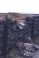
Nearby Images from Flickr
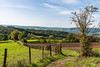

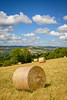
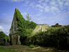
The above images may not be of the site on this page, but were taken nearby. They are loaded from Flickr so please click on them for image credits.
Click here to see more info for this site
Nearby sites
Click here to view sites on an interactive map of the areaKey: Red: member's photo, Blue: 3rd party photo, Yellow: other image, Green: no photo - please go there and take one, Grey: site destroyed
Download sites to:
KML (Google Earth)
GPX (GPS waypoints)
CSV (Garmin/Navman)
CSV (Excel)
To unlock full downloads you need to sign up as a Contributory Member. Otherwise downloads are limited to 50 sites.
Turn off the page maps and other distractions
Nearby sites listing. In the following links * = Image available
9.0km WNW 285° Menhir de la Belle Roche* Standing Stone (Menhir)
9.3km E 88° Menhir dit Pierre de la Hoberie* Standing Stone (Menhir)
10.8km S 176° La Demoiselle de Roufit Standing Stone (Menhir)
11.0km ENE 78° Pierre du Pôt* Standing Stone (Menhir)
11.2km NE 47° La Roche Piquée (St-Germain-le-Vasson)* Standing Stone (Menhir)
11.7km E 87° Menhir de la Grurie* Standing Stone (Menhir)
11.8km W 267° Pierres Druidiques de Becquerel Rock Art
13.5km NE 36° Pierre Tourneresse (Gouvix)* Standing Stone (Menhir)
14.5km SSE 148° Val d'Orne menhir Standing Stone (Menhir)
14.6km SSE 148° Pierre de la Roussellière* Standing Stone (Menhir)
15.1km NNE 20° Pierre Tournante (Fresnay-le-Puceux)* Standing Stone (Menhir)
16.0km ENE 73° Bons Tassilly polissoirs* Polissoir
16.1km ENE 73° Mont Joly* Ancient Village or Settlement
16.3km E 87° Menhir de Soulangy* Standing Stone (Menhir)
16.8km NE 50° Bretteville-le-Rabet* Ancient Mine, Quarry or other Industry
16.9km ENE 75° Langrais menhirs* Standing Stones
17.8km W 266° Menhir de la Pierre Grise (Lassy) Standing Stone (Menhir)
17.9km S 171° Dolmen du Bois de la Mousse Burial Chamber or Dolmen
18.1km SSE 163° Menhir dit la Droite Pierre (Chênedouit)* Standing Stone (Menhir)
19.2km S 189° Menhir de la Croix Carrée (Landigou)* Standing Stone (Menhir)
19.3km NNE 15° La Hogue* Chambered Tomb
19.5km ENE 77° Menhir d'Olendon* Standing Stone (Menhir)
19.6km NNE 17° La Hoguette* Chambered Tomb
19.8km SSW 191° Landigou Menhir Standing Stone (Menhir)
19.9km SSE 164° L'Affiloire de Gargantua* Standing Stone (Menhir)
View more nearby sites and additional images


 We would like to know more about this location. Please feel free to add a brief description and any relevant information in your own language.
 Wir möchten mehr über diese Stätte erfahren. Bitte zögern Sie nicht, eine kurze Beschreibung und relevante Informationen in Deutsch hinzuzufügen.
 Nous aimerions en savoir encore un peu sur les lieux. S'il vous plaît n'hesitez pas à ajouter une courte description et tous les renseignements pertinents dans votre propre langue.
 Quisieramos informarnos un poco más de las lugares. No dude en añadir una breve descripción y otros datos relevantes en su propio idioma.