


<< Text Pages >> Holy Wells (Barnetby le Wold) - Holy Well or Sacred Spring in England in Lincolnshire
Submitted by HOLYWELL on Tuesday, 25 January 2011 Page Views: 5600
Springs and Holy WellsSite Name: Holy Wells (Barnetby le Wold)Country: England
NOTE: This site is 2.258 km away from the location you searched for.
County: Lincolnshire Type: Holy Well or Sacred Spring
Nearest Town: Scunthorpe Nearest Village: Barnetby
Map Ref: TA091061
Latitude: 53.540222N Longitude: 0.355151W
Condition:
| 5 | Perfect |
| 4 | Almost Perfect |
| 3 | Reasonable but with some damage |
| 2 | Ruined but still recognisable as an ancient site |
| 1 | Pretty much destroyed, possibly visible as crop marks |
| 0 | No data. |
| -1 | Completely destroyed |
| 5 | Superb |
| 4 | Good |
| 3 | Ordinary |
| 2 | Not Good |
| 1 | Awful |
| 0 | No data. |
| 5 | Can be driven to, probably with disabled access |
| 4 | Short walk on a footpath |
| 3 | Requiring a bit more of a walk |
| 2 | A long walk |
| 1 | In the middle of nowhere, a nightmare to find |
| 0 | No data. |
| 5 | co-ordinates taken by GPS or official recorded co-ordinates |
| 4 | co-ordinates scaled from a detailed map |
| 3 | co-ordinates scaled from a bad map |
| 2 | co-ordinates of the nearest village |
| 1 | co-ordinates of the nearest town |
| 0 | no data |
Internal Links:
External Links:
Holy Well in Lincolnshire
Near the old Church is a spring called the Holy Wells and indeed it may have caused the site to be built here. Although there are two springs here the lower one is that recorded being the said site. Local historian Street (1887) notes that:
“I have known of persons resorting to the spring, and applying the water to the diseased eyes of children for sanitary purposes”.
It fills a rough hewn circular basin and those flows out of a hole near the top forming a small stream. The water was used domestically in later years. The spring lays on private land but the owner will give permission.
You may be viewing yesterday's version of this page. To see the most up to date information please register for a free account.
Do not use the above information on other web sites or publications without permission of the contributor.
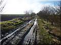
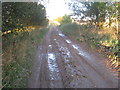
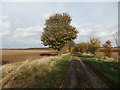
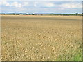
Nearby Images from Geograph Britain and Ireland:
©2011(licence)
©2010(licence)
©2019(licence)
©2011(licence)
©2011(licence)
The above images may not be of the site on this page, they are loaded from Geograph.
Please Submit an Image of this site or go out and take one for us!
Click here to see more info for this site
Nearby sites
Key: Red: member's photo, Blue: 3rd party photo, Yellow: other image, Green: no photo - please go there and take one, Grey: site destroyed
Download sites to:
KML (Google Earth)
GPX (GPS waypoints)
CSV (Garmin/Navman)
CSV (Excel)
To unlock full downloads you need to sign up as a Contributory Member. Otherwise downloads are limited to 50 sites.
Turn off the page maps and other distractions
Nearby sites listing. In the following links * = Image available
4.2km SE 133° Fonaby Stone* Standing Stones (TA123033)
5.1km ENE 58° Brocklesby Park (Great Limber) Cairn (TA1332708902)
5.5km SSE 153° Holy Well (Caistor) Holy Well or Sacred Spring (TA1172501229)
5.5km SSE 153° Syfer Spring Holy Well or Sacred Spring (TA117012)
6.0km N 352° Yarborough Camp Hillfort (TA081120)
6.4km SW 225° Maiden Well (Maidenwell) Holy Well or Sacred Spring (TA047015)
6.5km SW 226° The Maiden-Well Holy Well or Sacred Spring (TA045015)
7.9km WNW 283° St. Helen's Well (Wrawby) Holy Well or Sacred Spring (TA0137907720)
9.1km N 352° Howe Hill (Lincolnshire) Round Barrow(s) (TA07631510)
10.6km SSE 158° Hills Brough* Long Barrow (TF1337396415)
11.0km ESE 118° Ash Holt Long Barrow* Long Barrow (TA1898001112)
11.3km ENE 73° Ragged Spring (Healing) Holy Well or Sacred Spring (TA199096)
13.1km ENE 74° Toot Hill Bowl Barrow Round Barrow(s) (TA21601011)
13.3km WNW 282° Broughton Cross* Ancient Cross (SE960086)
14.5km SSE 162° Walesby All Saints church carvings* Sculptured Stone (TF1382892388)
15.0km SSE 147° Lud well (Stainton-Le-Vale)* Holy Well or Sacred Spring (TF17629376)
15.4km SE 132° Ash Hill Long Barrow* Long Barrow (TF20889612)
15.5km WNW 287° Gokwell Priory (Broughton) Misc. Earthwork (SE94081028)
15.9km E 81° Toot Hill Round Barrow* Round Barrow(s) (TA24800888)
16.0km SSE 151° Bully Hill (Tealby)* Round Barrow(s) (TF17279227)
16.4km SE 132° Hoe Hill Long Barrow* Long Barrow (TF215953)
17.2km WSW 245° Ashwell* Holy Well or Sacred Spring (SK936985)
18.7km NW 310° Holy Well (Winterton) Holy Well or Sacred Spring (SE944178)
19.7km SW 215° Newell's Well (Glentham) Holy Well or Sacred Spring (SK981897)
20.2km WNW 295° Dragonby* Natural Stone / Erratic / Other Natural Feature (SE905142)
View more nearby sites and additional images


 We would like to know more about this location. Please feel free to add a brief description and any relevant information in your own language.
 Wir möchten mehr über diese Stätte erfahren. Bitte zögern Sie nicht, eine kurze Beschreibung und relevante Informationen in Deutsch hinzuzufügen.
 Nous aimerions en savoir encore un peu sur les lieux. S'il vous plaît n'hesitez pas à ajouter une courte description et tous les renseignements pertinents dans votre propre langue.
 Quisieramos informarnos un poco más de las lugares. No dude en añadir una breve descripción y otros datos relevantes en su propio idioma.