


<< Other Photo Pages >> Cave à Margot - Cave or Rock Shelter in France in Pays de la Loire:Mayenne (53)
Submitted by TheCaptain on Saturday, 16 April 2005 Page Views: 2893
Natural PlacesSite Name: Cave à Margot Alternative Name: Grotte MargotCountry: France Département: Pays de la Loire:Mayenne (53) Type: Cave or Rock Shelter
Nearest Town: Laval Nearest Village: Thorigné-en-Charnie
Latitude: 47.992852N Longitude: 0.400918W
Condition:
| 5 | Perfect |
| 4 | Almost Perfect |
| 3 | Reasonable but with some damage |
| 2 | Ruined but still recognisable as an ancient site |
| 1 | Pretty much destroyed, possibly visible as crop marks |
| 0 | No data. |
| -1 | Completely destroyed |
| 5 | Superb |
| 4 | Good |
| 3 | Ordinary |
| 2 | Not Good |
| 1 | Awful |
| 0 | No data. |
| 5 | Can be driven to, probably with disabled access |
| 4 | Short walk on a footpath |
| 3 | Requiring a bit more of a walk |
| 2 | A long walk |
| 1 | In the middle of nowhere, a nightmare to find |
| 0 | No data. |
| 5 | co-ordinates taken by GPS or official recorded co-ordinates |
| 4 | co-ordinates scaled from a detailed map |
| 3 | co-ordinates scaled from a bad map |
| 2 | co-ordinates of the nearest village |
| 1 | co-ordinates of the nearest town |
| 0 | no data |
Be the first person to rate this site - see the 'Contribute!' box in the right hand menu.
Internal Links:
External Links:
")
Location Source: OpenStreetMap
Information with Pictures
hominides.com
You may be viewing yesterday's version of this page. To see the most up to date information please register for a free account.
")
Do not use the above information on other web sites or publications without permission of the contributor.
Nearby Images from Flickr
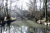

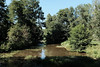
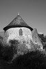
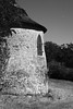
The above images may not be of the site on this page, but were taken nearby. They are loaded from Flickr so please click on them for image credits.
Click here to see more info for this site
Nearby sites
Click here to view sites on an interactive map of the areaKey: Red: member's photo, Blue: 3rd party photo, Yellow: other image, Green: no photo - please go there and take one, Grey: site destroyed
Download sites to:
KML (Google Earth)
GPX (GPS waypoints)
CSV (Garmin/Navman)
CSV (Excel)
To unlock full downloads you need to sign up as a Contributory Member. Otherwise downloads are limited to 50 sites.
Turn off the page maps and other distractions
Nearby sites listing. In the following links * = Image available
312m WSW 242° Grotte de la Dérouine Cave or Rock Shelter
12.5km NE 35° La Table des Diables* Burial Chamber or Dolmen
14.7km NNE 20° Dolmen des Erves* Burial Chamber or Dolmen
14.9km NNE 22° Dolmen des Iles* Burial Chamber or Dolmen
17.1km NNE 30° Stele des Trois Poiriers* Sculptured Stone
17.3km W 280° Menhir de la Hune* Standing Stone (Menhir)
18.2km N 359° Menhir Basilique Notre Dame de L'épine* Standing Stone (Menhir)
18.2km N 0° Menhir Marie d'Évron* Standing Stone (Menhir)
21.9km NNE 13° Dolmen de la Pierre au Renard Burial Chamber or Dolmen
22.9km N 9° La Chaise du Diable* Natural Stone / Erratic / Other Natural Feature
23.2km N 10° Pierres dit Palais du Diable* Natural Stone / Erratic / Other Natural Feature
23.4km W 270° Entrammes Oppidum Ancient Village or Settlement
24.0km N 359° Pierre Aigue, Richebourg* Passage Grave
24.0km N 360° Dolmen des Pierres Jumelles* Burial Chamber or Dolmen
24.9km N 6° Fort de Rubricaire* Ancient Village or Settlement
25.1km NNE 15° La Fosses* Standing Stones
26.1km W 277° Menhir du Haut-Fougeray Standing Stone (Menhir)
26.2km NNE 18° La Championnière* Standing Stone (Menhir)
26.6km SSW 194° Maison des Fées (Miré)* Burial Chamber or Dolmen
28.3km NE 40° La Croix Morfondue* Ancient Cross
28.7km NNE 27° Croix de Chantemesle* Ancient Cross
28.8km NE 41° Le Grez Cemetery Cross* Ancient Cross
28.8km NE 43° Dolmen de Trouesses* Burial Chamber or Dolmen
28.8km NNE 24° La Chapelle du Chene* Modern Stone Circle etc
28.9km NNE 24° La Croix de la Motte* Ancient Cross
View more nearby sites and additional images


 We would like to know more about this location. Please feel free to add a brief description and any relevant information in your own language.
 Wir möchten mehr über diese Stätte erfahren. Bitte zögern Sie nicht, eine kurze Beschreibung und relevante Informationen in Deutsch hinzuzufügen.
 Nous aimerions en savoir encore un peu sur les lieux. S'il vous plaît n'hesitez pas à ajouter une courte description et tous les renseignements pertinents dans votre propre langue.
 Quisieramos informarnos un poco más de las lugares. No dude en añadir una breve descripción y otros datos relevantes en su propio idioma.