


<< Our Photo Pages >> Roundhill Barrow - Round Barrow(s) in England in Bedfordshire
Submitted by Anonymous on Tuesday, 13 January 2009 Page Views: 3820
Neolithic and Bronze AgeSite Name: Roundhill Barrow Alternative Name: Roxton Round BarrowCountry: England
NOTE: This site is 2.269 km away from the location you searched for.
County: Bedfordshire Type: Round Barrow(s)
Nearest Town: Bedford Nearest Village: Roxton
Map Ref: TL1487755016
Latitude: 52.181442N Longitude: 0.321247W
Condition:
| 5 | Perfect |
| 4 | Almost Perfect |
| 3 | Reasonable but with some damage |
| 2 | Ruined but still recognisable as an ancient site |
| 1 | Pretty much destroyed, possibly visible as crop marks |
| 0 | No data. |
| -1 | Completely destroyed |
| 5 | Superb |
| 4 | Good |
| 3 | Ordinary |
| 2 | Not Good |
| 1 | Awful |
| 0 | No data. |
| 5 | Can be driven to, probably with disabled access |
| 4 | Short walk on a footpath |
| 3 | Requiring a bit more of a walk |
| 2 | A long walk |
| 1 | In the middle of nowhere, a nightmare to find |
| 0 | No data. |
| 5 | co-ordinates taken by GPS or official recorded co-ordinates |
| 4 | co-ordinates scaled from a detailed map |
| 3 | co-ordinates scaled from a bad map |
| 2 | co-ordinates of the nearest village |
| 1 | co-ordinates of the nearest town |
| 0 | no data |
Internal Links:
External Links:
")
Impressive looking Neolithic round barrow, but spoilt by the new bypass which runs next to it cutting off access to the site from Roxton.
You may be viewing yesterday's version of this page. To see the most up to date information please register for a free account.
")
Do not use the above information on other web sites or publications without permission of the contributor.
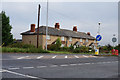
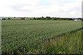
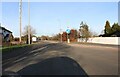
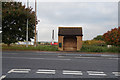
Nearby Images from Geograph Britain and Ireland:
©2017(licence)
©2015(licence)
©2023(licence)
©2017(licence)
©2023(licence)
The above images may not be of the site on this page, they are loaded from Geograph.
Please Submit an Image of this site or go out and take one for us!
Click here to see more info for this site
Nearby sites
Key: Red: member's photo, Blue: 3rd party photo, Yellow: other image, Green: no photo - please go there and take one, Grey: site destroyed
Download sites to:
KML (Google Earth)
GPX (GPS waypoints)
CSV (Garmin/Navman)
CSV (Excel)
To unlock full downloads you need to sign up as a Contributory Member. Otherwise downloads are limited to 50 sites.
Turn off the page maps and other distractions
Nearby sites listing. In the following links * = Image available
1.4km ESE 109° Willow Row Barrow* Barrow Cemetery (TL162546)
3.5km ESE 114° Eynesbury Hodwick 2 Long Barrow (TL181537)
4.5km NE 47° Eynesbury Hardwicke A Cursus Cursus (TL181582)
4.7km NE 43° Eynesbury Hodwick 1 Long Barrow (TL180585)
4.9km NE 47° Eynesbury Hardwicke B Cursus Cursus (TL184584)
6.8km SSE 154° Caesar's Camp (Bedfordshire)* Hillfort (TL180490)
7.2km SSW 207° Willington Cursus (TL117485)
7.4km SW 229° Willington N/W cursus Cursus (TL094500)
7.5km SW 229° Cople Cursus Cursus (TL09325000)
7.5km SSW 211° Willington Cursus (TL112485)
7.8km SW 229° Cardington E Cursus Cursus (TL091498)
7.9km SW 231° Cardington E Cursus Cursus (TL089499)
7.9km SW 229° Cardington C Cursus Cursus (TL090497)
8.0km NW 307° Bolnhurst Earthwork Misc. Earthwork (TL084597)
8.0km SW 230° Cardington B Cursus Cursus (TL089497)
8.2km SSE 153° Sandy Lodge Promontory Fort / Cliff Castle (TL187478)
8.4km WSW 238° Goldington* Timber Circle (TL0784050440)
8.4km W 259° Mowsbury Hill Hillfort (TL066532)
9.5km SSE 153° Biggleswade Cursus Cursus (TL194467)
9.7km SSE 152° Biggleswade Cursus Cursus (TL197466)
11.0km WSW 243° Bedford Museum* Museum (TL0522349738)
12.6km NNE 26° Buckden C Cursus Cursus (TL202664)
12.8km NNE 26° Buckden B Cursus Cursus (TL20266659)
13.0km NNE 30° Buckden A Cursus Cursus (TL212664)
13.3km WSW 244° Kempston Cursus Cursus (TL030489)
View more nearby sites and additional images


 We would like to know more about this location. Please feel free to add a brief description and any relevant information in your own language.
 Wir möchten mehr über diese Stätte erfahren. Bitte zögern Sie nicht, eine kurze Beschreibung und relevante Informationen in Deutsch hinzuzufügen.
 Nous aimerions en savoir encore un peu sur les lieux. S'il vous plaît n'hesitez pas à ajouter une courte description et tous les renseignements pertinents dans votre propre langue.
 Quisieramos informarnos un poco más de las lugares. No dude en añadir una breve descripción y otros datos relevantes en su propio idioma.