

<< Our Photo Pages >> Cherkley Court Barrows - Round Barrow(s) in England in Surrey
Submitted by Andy B on Tuesday, 26 December 2023 Page Views: 6374
Neolithic and Bronze AgeSite Name: Cherkley Court Barrows Alternative Name: Stane StreetCountry: England
NOTE: This site is 1.821 km away from the location you searched for.
County: Surrey Type: Round Barrow(s)
Nearest Town: Leatherhead Nearest Village: Ashtead
Map Ref: TQ18385467
Latitude: 51.278884N Longitude: 0.30413W
Condition:
| 5 | Perfect |
| 4 | Almost Perfect |
| 3 | Reasonable but with some damage |
| 2 | Ruined but still recognisable as an ancient site |
| 1 | Pretty much destroyed, possibly visible as crop marks |
| 0 | No data. |
| -1 | Completely destroyed |
| 5 | Superb |
| 4 | Good |
| 3 | Ordinary |
| 2 | Not Good |
| 1 | Awful |
| 0 | No data. |
| 5 | Can be driven to, probably with disabled access |
| 4 | Short walk on a footpath |
| 3 | Requiring a bit more of a walk |
| 2 | A long walk |
| 1 | In the middle of nowhere, a nightmare to find |
| 0 | No data. |
| 5 | co-ordinates taken by GPS or official recorded co-ordinates |
| 4 | co-ordinates scaled from a detailed map |
| 3 | co-ordinates scaled from a bad map |
| 2 | co-ordinates of the nearest village |
| 1 | co-ordinates of the nearest town |
| 0 | no data |
Internal Links:
External Links:
I have visited· I would like to visit
SolarMegalith Jacquettafewster would like to visit
Andy B has visited here
")
About 1800 B.C. a new wave of immigrants, able to work metals and in particular bronze, arrived. Bronze was scarce and a trading system had to be set up to maintain supplies of ore and to sell the products. A trackway, known as the Harroway, came into use. It extended from Kent as far as Hampshire and Wiltshire. In Surrey, it roughly followed the line of the present-day towns and villages between Croydon and Farnham. It probably entered Leatherhead from the east along Green Lane, turning south-west along the Epsom Road to cross the river about where the Leisure Centre is now and climb Hawks Hill through the waterworks land.
Aerial views show many burial mounds (barrows or tumuli) near Thirty Acres Barn. All these barrows probably date from the Bronze or Iron Age. The only true Bronze-Age finds come from the floodplain near Young Street near Leatherhead: some flint arrowheads and a disc-knife; scratches in the flint contain iron pyrites, probably from the Wealden ironstone pebble used to smooth it.
Note: Excavations find evidence for quarrying, crop processing and potential ritual activity - and the possibility that Stane Street runs along the line of a pre-existing route, possibly dating back to the Bronze Age or earlier.
You may be viewing yesterday's version of this page. To see the most up to date information please register for a free account.
")
")
")
Do not use the above information on other web sites or publications without permission of the contributor.
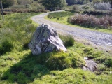
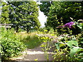
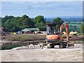
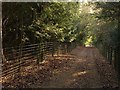
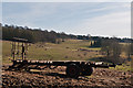
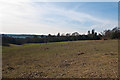
Nearby Images from Geograph Britain and Ireland:
©2009(licence)
©2017(licence)
©2011(licence)
©2012(licence)
©2012(licence)
The above images may not be of the site on this page, they are loaded from Geograph.
Please Submit an Image of this site or go out and take one for us!
Click here to see more info for this site
Nearby sites
Key: Red: member's photo, Blue: 3rd party photo, Yellow: other image, Green: no photo - please go there and take one, Grey: site destroyed
Download sites to:
KML (Google Earth)
GPX (GPS waypoints)
CSV (Garmin/Navman)
CSV (Excel)
To unlock full downloads you need to sign up as a Contributory Member. Otherwise downloads are limited to 50 sites.
Turn off the page maps and other distractions
Nearby sites listing. In the following links * = Image available
1.4km NE 37° Thirty Acre Barn Barrows Round Barrow(s) (TQ192558)
2.0km NW 305° Thorncroft Spring (Leatherhead)* Holy Well or Sacred Spring (TQ167558)
3.4km S 178° Box Hill Bowl Barrow 2* Round Barrow(s) (TQ18575132)
3.5km S 187° Box Hill Bowl Barrow 1* Round Barrow(s) (TQ18065121)
5.4km N 353° Ashtead Common Earthwork* Misc. Earthwork (TQ176600)
6.3km SSW 193° Glory Wood Bowl Barrow* Round Barrow(s) (TQ1712248542)
6.5km SSW 209° Milton Heath* Round Barrow(s) (TQ15294890)
6.8km SE 130° Reigate Heath Barrows* Barrow Cemetery (TQ23725042)
7.4km E 86° St. Margaret's Well (Mugswell)* Holy Well or Sacred Spring (TQ258553)
8.7km NNE 24° Bourne Hall Museum* Museum (TQ218627)
8.7km NNE 28° Hatch Furlong Ritual Shafts* Misc. Earthwork (TQ223625)
8.8km NNE 25° Ewell Springs (Surrey)* Holy Well or Sacred Spring (TQ219627)
8.9km NE 48° Gally Hills Barrow Cemetery (TQ249607)
8.9km ESE 104° Gatton Park, The Millennium Stones* Modern Stone Circle etc (TQ271527)
9.4km SW 226° Deerleap Wood* Round Barrow(s) (TQ118480)
9.6km ENE 79° Chipstead Well Holy Well or Sacred Spring (TQ278568)
9.9km ESE 118° Waterslade Spring Holy Well or Sacred Spring (TQ272502)
9.9km SSW 204° Mag's Well (Abinger Forest)* Holy Well or Sacred Spring (TQ145455)
10.0km ESE 119° Whitepost Hill Spring Holy Well or Sacred Spring (TQ273501)
10.2km SE 128° Earlswood Common Barrow Cemetery Barrow Cemetery (TQ266486)
10.3km ESE 121° Redhill Common* Round Barrow(s) (TQ274496)
11.0km WNW 298° Red Hill (Surrey)* Henge (TQ08505961)
11.1km SSW 197° Anstiebury Camp* Hillfort (TQ1534244008)
11.4km WNW 295° Cockrow Hill Bell Barrow* Round Barrow(s) (TQ07905915)
11.4km SW 220° Abinger Manor* Ancient Village or Settlement (TQ112458)
View more nearby sites and additional images


 We would like to know more about this location. Please feel free to add a brief description and any relevant information in your own language.
 Wir möchten mehr über diese Stätte erfahren. Bitte zögern Sie nicht, eine kurze Beschreibung und relevante Informationen in Deutsch hinzuzufügen.
 Nous aimerions en savoir encore un peu sur les lieux. S'il vous plaît n'hesitez pas à ajouter une courte description et tous les renseignements pertinents dans votre propre langue.
 Quisieramos informarnos un poco más de las lugares. No dude en añadir una breve descripción y otros datos relevantes en su propio idioma.