 with our Megalithic Portal iPhone app")


<< Our Photo Pages >> Celles-sur-Belle menhirs - Natural Stone / Erratic / Other Natural Feature in France in Poitou:Deux-Sèvres (79)
Submitted by TheCaptain on Saturday, 16 April 2005 Page Views: 7340
Natural PlacesSite Name: Celles-sur-Belle menhirs Alternative Name: Roc l'AbbesseCountry: France
NOTE: This site is 7.493 km away from the location you searched for.
Département: Poitou:Deux-Sèvres (79) Type: Natural Stone / Erratic / Other Natural Feature
Nearest Town: Niort Nearest Village: Celles-sur-Belle
Latitude: 46.268000N Longitude: 0.19W
Condition:
| 5 | Perfect |
| 4 | Almost Perfect |
| 3 | Reasonable but with some damage |
| 2 | Ruined but still recognisable as an ancient site |
| 1 | Pretty much destroyed, possibly visible as crop marks |
| 0 | No data. |
| -1 | Completely destroyed |
| 5 | Superb |
| 4 | Good |
| 3 | Ordinary |
| 2 | Not Good |
| 1 | Awful |
| 0 | No data. |
| 5 | Can be driven to, probably with disabled access |
| 4 | Short walk on a footpath |
| 3 | Requiring a bit more of a walk |
| 2 | A long walk |
| 1 | In the middle of nowhere, a nightmare to find |
| 0 | No data. |
| 5 | co-ordinates taken by GPS or official recorded co-ordinates |
| 4 | co-ordinates scaled from a detailed map |
| 3 | co-ordinates scaled from a bad map |
| 2 | co-ordinates of the nearest village |
| 1 | co-ordinates of the nearest town |
| 0 | no data |
Internal Links:
External Links:
I have visited· I would like to visit
davidmulder would like to visit
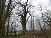
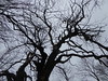
TheCaptain visited on 15th May 2005 - their rating: Cond: 2 Amb: 3 Access: 3 After a fairly long struggle to find these which are marked on my ign map I eventually found a sign pointing through the woods to menhirs 180 metres but not very close to the position on the map. The best I found was two big lumps of rock on a hillside which looked very much like they may be natural rocks to me. Its possible there is a third nearby. I could not get a gps fix in the dense woodland.
")
After a fairly long struggle to find these which are marked on my ign map I eventually found a sign pointing through the woods to "menhirs 180 metres" but not very close to the position marked on the map.
The best I found was two big lumps of rock on a hillside which looked very much like they may be natural rocks to me. Its possible there is a third nearby.
I could not get a gps fix in the dense woodland.
IMPORTANT NOTE: Positional co-ordinates scaled from a detailed map source
You may be viewing yesterday's version of this page. To see the most up to date information please register for a free account.
")
Do not use the above information on other web sites or publications without permission of the contributor.
Nearby Images from Flickr
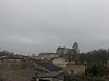
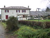
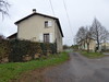

The above images may not be of the site on this page, but were taken nearby. They are loaded from Flickr so please click on them for image credits.
Click here to see more info for this site
Nearby sites
Click here to view sites on an interactive map of the areaKey: Red: member's photo, Blue: 3rd party photo, Yellow: other image, Green: no photo - please go there and take one, Grey: site destroyed
Download sites to:
KML (Google Earth)
GPX (GPS waypoints)
CSV (Garmin/Navman)
CSV (Excel)
To unlock full downloads you need to sign up as a Contributory Member. Otherwise downloads are limited to 50 sites.
Turn off the page maps and other distractions
Nearby sites listing. In the following links * = Image available
9.9km NNE 27° Dame de Chambrille* Rock Outcrop
12.1km NE 45° Dolmen du Bourg (Exoudun)* Burial Chamber or Dolmen
13.2km NNE 24° Dolmen de la Garenne (La Mothe)* Burial Chamber or Dolmen
13.6km NE 41° Dolmen des Sept Chemins* Burial Chamber or Dolmen
14.7km NE 40° Pierre Levée de Bougon Burial Chamber or Dolmen
14.9km NNE 24° Menhir Salles Vallee cluzay* Standing Stone (Menhir)
15.0km NNE 25° Les Doignons* Burial Chamber or Dolmen
15.0km NE 39° Bougon Tumulus A* Chambered Tomb
15.1km NE 39° Bougon Tumulus C* Chambered Tomb
15.1km NE 39° Bougon Tumulus B* Chambered Tomb
15.1km NE 39° Bougon Tumulus D* Cairn
15.1km NE 39° Bougon Tumulus E* Chambered Tomb
15.1km NE 39° Bougon Tumulus F* Chambered Tomb
15.1km NE 38° Bougon Tumulus* Barrow Cemetery
15.5km NE 37° Musée des Tumulus de Bougon* Museum
15.9km NNE 27° Les Vinettes Burial Chamber or Dolmen
16.0km N 6° Croissonnière Dolmen* Burial Chamber or Dolmen
17.8km NE 36° Les Lisieres A Burial Chamber or Dolmen
18.7km NE 48° Roche d'Avon Burial Chamber or Dolmen
19.6km E 97° Tumulus du Montiou* Chambered Tomb
23.3km E 94° Dolmen de Messé* Burial Chamber or Dolmen
25.0km SSW 204° La Pierre l'Abbé Modern Stone Circle etc
28.2km NNE 27° Sanxay* Ancient Village or Settlement
29.4km WSW 243° Tumulus du Péré* Chambered Tomb
29.8km SSW 213° La Longue Pierre and the little menhirs Standing Stones
View more nearby sites and additional images


 We would like to know more about this location. Please feel free to add a brief description and any relevant information in your own language.
 Wir möchten mehr über diese Stätte erfahren. Bitte zögern Sie nicht, eine kurze Beschreibung und relevante Informationen in Deutsch hinzuzufügen.
 Nous aimerions en savoir encore un peu sur les lieux. S'il vous plaît n'hesitez pas à ajouter une courte description et tous les renseignements pertinents dans votre propre langue.
 Quisieramos informarnos un poco más de las lugares. No dude en añadir una breve descripción y otros datos relevantes en su propio idioma.