


<< Our Photo Pages >> Baumber Cursus - Cursus in England in Lincolnshire
Submitted by EssexMan on Wednesday, 07 April 2010 Page Views: 4651
Neolithic and Bronze AgeSite Name: Baumber CursusCountry: England
NOTE: This site is 5.369 km away from the location you searched for.
County: Lincolnshire Type: Cursus
Nearest Town: Market Rasen Nearest Village: Baumber
Map Ref: TF22067350 Landranger Map Number: 122
Latitude: 53.244496N Longitude: 0.17228W
Condition:
| 5 | Perfect |
| 4 | Almost Perfect |
| 3 | Reasonable but with some damage |
| 2 | Ruined but still recognisable as an ancient site |
| 1 | Pretty much destroyed, possibly visible as crop marks |
| 0 | No data. |
| -1 | Completely destroyed |
| 5 | Superb |
| 4 | Good |
| 3 | Ordinary |
| 2 | Not Good |
| 1 | Awful |
| 0 | No data. |
| 5 | Can be driven to, probably with disabled access |
| 4 | Short walk on a footpath |
| 3 | Requiring a bit more of a walk |
| 2 | A long walk |
| 1 | In the middle of nowhere, a nightmare to find |
| 0 | No data. |
| 5 | co-ordinates taken by GPS or official recorded co-ordinates |
| 4 | co-ordinates scaled from a detailed map |
| 3 | co-ordinates scaled from a bad map |
| 2 | co-ordinates of the nearest village |
| 1 | co-ordinates of the nearest town |
| 0 | no data |
Internal Links:
External Links:
I have visited· I would like to visit
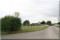
oldman visited on 26th Oct 2018 (Almost?) entirely ploughed out
")
Status: Possible
NMR No. TF 27 SW 44
You may be viewing yesterday's version of this page. To see the most up to date information please register for a free account.
")
")
Do not use the above information on other web sites or publications without permission of the contributor.
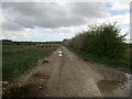
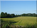
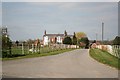
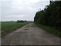
Nearby Images from Geograph Britain and Ireland:
©2023(licence)
©2020(licence)
©2007(licence)
©2011(licence)
©2013(licence)
The above images may not be of the site on this page, they are loaded from Geograph.
Please Submit an Image of this site or go out and take one for us!
Click here to see more info for this site
Nearby sites
Key: Red: member's photo, Blue: 3rd party photo, Yellow: other image, Green: no photo - please go there and take one, Grey: site destroyed
Download sites to:
KML (Google Earth)
GPX (GPS waypoints)
CSV (Garmin/Navman)
CSV (Excel)
To unlock full downloads you need to sign up as a Contributory Member. Otherwise downloads are limited to 50 sites.
Turn off the page maps and other distractions
Nearby sites listing. In the following links * = Image available
3.7km ESE 121° West Ashby Henge (TF25347168)
8.9km ESE 111° Newell Spring* Holy Well or Sacred Spring (TF3041770472)
10.6km N 358° Burgh Top* Round Barrow(s) (TF21458406)
11.4km NE 42° Tathwell Long Barrow* Long Barrow (TF29458225)
11.5km N 358° Burgh on Bain* Long Barrow (TF21298497)
13.5km N 7° Grims Mound* Round Barrow(s) (TF23258693)
14.4km NE 52° Bully Hills* Barrow Cemetery (TF33128272)
14.4km SSE 147° Revesby Barrows* Round Barrow(s) (TF3029361632)
15.6km ENE 76° Beacon Plantation Long Barrow* Long Barrow (TF372776)
15.9km ESE 118° Holy well (Mavis Enderby) Holy Well or Sacred Spring (TF363663)
16.1km NW 309° Wickenby Ancient Village or Settlement (TF0928883432)
17.1km W 265° Fiskerton Iron Age causeway* Ancient Village or Settlement (TF05007159)
17.9km ESE 118° Virgin's Well (Spilsby) Holy Well or Sacred Spring (TF381654)
18.1km E 95° Spellow Hills* Long Barrow (TF4014272239)
19.4km NNW 347° Bully Hill (Tealby)* Round Barrow(s) (TF17279227)
19.7km E 98° Fordington Barrows Round Barrow(s) (TF417714)
20.3km W 264° Washingborough Ancient Settlement* Ancient Village or Settlement (TF019709)
20.6km NNW 338° Walesby All Saints church carvings* Sculptured Stone (TF1382892388)
20.7km N 349° Lud well (Stainton-Le-Vale)* Holy Well or Sacred Spring (TF17629376)
20.8km E 98° Giant's Hill Skendleby* Long Barrow (TF428711)
20.9km E 98° Giants' Hills Barrow Cemetery (TF429712)
21.0km E 99° Giant's Hill II Long Barrow Long Barrow (TF42927088)
21.7km W 265° Lincoln Greetwell Henge/disc barrow* Barrow Cemetery (TF00407110)
21.8km N 360° Hoe Hill Long Barrow* Long Barrow (TF215953)
22.3km E 95° Deadmen's Graves* Long Barrow (TF444720)
View more nearby sites and additional images


 We would like to know more about this location. Please feel free to add a brief description and any relevant information in your own language.
 Wir möchten mehr über diese Stätte erfahren. Bitte zögern Sie nicht, eine kurze Beschreibung und relevante Informationen in Deutsch hinzuzufügen.
 Nous aimerions en savoir encore un peu sur les lieux. S'il vous plaît n'hesitez pas à ajouter une courte description et tous les renseignements pertinents dans votre propre langue.
 Quisieramos informarnos un poco más de las lugares. No dude en añadir una breve descripción y otros datos relevantes en su propio idioma.