


<< Text Pages >> Monk's Hole Barrow - Round Barrow(s) in England in Cambridgeshire
Submitted by SolarMegalith on Saturday, 05 March 2011 Page Views: 5820
Neolithic and Bronze AgeSite Name: Monk''s Hole BarrowCountry: England County: Cambridgeshire Type: Round Barrow(s)
Nearest Town: Hutindgon Nearest Village: Updon
Map Ref: TL1896479957
Latitude: 52.404699N Longitude: 0.252703W
Condition:
| 5 | Perfect |
| 4 | Almost Perfect |
| 3 | Reasonable but with some damage |
| 2 | Ruined but still recognisable as an ancient site |
| 1 | Pretty much destroyed, possibly visible as crop marks |
| 0 | No data. |
| -1 | Completely destroyed |
| 5 | Superb |
| 4 | Good |
| 3 | Ordinary |
| 2 | Not Good |
| 1 | Awful |
| 0 | No data. |
| 5 | Can be driven to, probably with disabled access |
| 4 | Short walk on a footpath |
| 3 | Requiring a bit more of a walk |
| 2 | A long walk |
| 1 | In the middle of nowhere, a nightmare to find |
| 0 | No data. |
| 5 | co-ordinates taken by GPS or official recorded co-ordinates |
| 4 | co-ordinates scaled from a detailed map |
| 3 | co-ordinates scaled from a bad map |
| 2 | co-ordinates of the nearest village |
| 1 | co-ordinates of the nearest town |
| 0 | no data |
Internal Links:
External Links:
Round Barrow(s) in Cambridgeshire
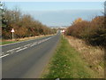
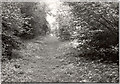
Remains of a Bronze Age saucer barrow near the road from Huntingdon to Peterborough.
Read More at Pastscape.
You may be viewing yesterday's version of this page. To see the most up to date information please register for a free account.
")
")
")
Do not use the above information on other web sites or publications without permission of the contributor.
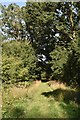
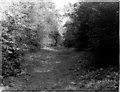
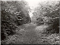
Nearby Images from Geograph Britain and Ireland:
©2020(licence)
©2008(licence)
©2011(licence)
©2011(licence)
©2011(licence)
The above images may not be of the site on this page, they are loaded from Geograph.
Please Submit an Image of this site or go out and take one for us!
Click here to see more info for this site
Nearby sites
Key: Red: member's photo, Blue: 3rd party photo, Yellow: other image, Green: no photo - please go there and take one, Grey: site destroyed
Download sites to:
KML (Google Earth)
GPX (GPS waypoints)
CSV (Garmin/Navman)
CSV (Excel)
To unlock full downloads you need to sign up as a Contributory Member. Otherwise downloads are limited to 50 sites.
Turn off the page maps and other distractions
Nearby sites listing. In the following links * = Image available
8.5km S 172° Brampton Cursus Cursus (TL203716)
8.6km S 172° Brampton Long Barrow (TL204715)
8.9km WSW 242° Seat of Judgement - Leighton Bromswold* Marker Stone (TL112756)
9.4km SSE 149° Horse Common Spring* Holy Well or Sacred Spring (TL2472)
11.2km SE 145° Godmanchester Cursus Cursus (TL25557092)
11.2km SE 145° Godmanchester Cursus Cursus (TL25557092)
13.4km S 176° Buckden B Cursus Cursus (TL20266659)
13.6km S 176° Buckden C Cursus Cursus (TL202664)
13.7km S 172° Buckden A Cursus Cursus (TL212664)
14.2km N 355° Stone Circle, James' Pond* Modern Stone Circle etc (TL17309405)
17.1km SE 144° Hilton (Cambridgeshire)* Turf Maze (TL293663)
17.2km N 4° Fletton Cross* Ancient Cross (TL198971)
17.3km SE 124° Holywell (Cambridgeshire)* Holy Well or Sacred Spring (TL336707)
17.3km W 271° Titchmarch Cursus Cursus (TL016798)
17.5km SE 130° Fenstanton Cursus Cursus (TL326689)
17.7km SE 127° Low Hill Bowl Barrow, Fen Drayton RSPB Reserve* Round Barrow(s) (TL33336960)
18.3km NNE 16° Must Farm* Ancient Village or Settlement (TL237976)
18.3km N 355° St. Cloud's Well (Longthorpe)* Holy Well or Sacred Spring (TL16789815)
18.5km N 1° Peterborough Stone* Standing Stone (Menhir) (TL190985)
18.5km N 1° Peterborough Museum* Museum (TL189985)
18.7km SW 229° Harrowick, Upper Dean Natural Stone / Erratic / Other Natural Feature (TL0507267416)
18.7km N 3° Hedda Stone* Early Christian Sculptured Stone (TL194987)
19.1km NNW 346° Robin Hood and Little John* Standing Stones (TL1395098389)
19.1km SSE 157° Nill Well* Holy Well or Sacred Spring (TL26786248)
19.3km NNE 13° Flag Fen Visitors Centre* Museum (TL227989)
View more nearby sites and additional images


 We would like to know more about this location. Please feel free to add a brief description and any relevant information in your own language.
 Wir möchten mehr über diese Stätte erfahren. Bitte zögern Sie nicht, eine kurze Beschreibung und relevante Informationen in Deutsch hinzuzufügen.
 Nous aimerions en savoir encore un peu sur les lieux. S'il vous plaît n'hesitez pas à ajouter une courte description et tous les renseignements pertinents dans votre propre langue.
 Quisieramos informarnos un poco más de las lugares. No dude en añadir una breve descripción y otros datos relevantes en su propio idioma.