


<< Text Pages >> Toot Hill Bowl Barrow - Round Barrow(s) in England in Lincolnshire
Submitted by coldrum on Monday, 04 January 2010 Page Views: 4619
Neolithic and Bronze AgeSite Name: Toot Hill Bowl BarrowCountry: England
NOTE: This site is 11.281 km away from the location you searched for.
County: Lincolnshire Type: Round Barrow(s)
Map Ref: TA21601011
Latitude: 53.573505N Longitude: 0.165068W
Condition:
| 5 | Perfect |
| 4 | Almost Perfect |
| 3 | Reasonable but with some damage |
| 2 | Ruined but still recognisable as an ancient site |
| 1 | Pretty much destroyed, possibly visible as crop marks |
| 0 | No data. |
| -1 | Completely destroyed |
| 5 | Superb |
| 4 | Good |
| 3 | Ordinary |
| 2 | Not Good |
| 1 | Awful |
| 0 | No data. |
| 5 | Can be driven to, probably with disabled access |
| 4 | Short walk on a footpath |
| 3 | Requiring a bit more of a walk |
| 2 | A long walk |
| 1 | In the middle of nowhere, a nightmare to find |
| 0 | No data. |
| 5 | co-ordinates taken by GPS or official recorded co-ordinates |
| 4 | co-ordinates scaled from a detailed map |
| 3 | co-ordinates scaled from a bad map |
| 2 | co-ordinates of the nearest village |
| 1 | co-ordinates of the nearest town |
| 0 | no data |
Be the first person to rate this site - see the 'Contribute!' box in the right hand menu.
Internal Links:
External Links:
Round Barrow(s) in Lincolnshire
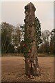
From Pastscape: "Possible round barrow. It is about 50 ft in diameter with a low profile which is offset by its siting on a hill crest, best appreciated from the south. If not a barrow it could be associated with the nearby manor earthworks."
You may be viewing yesterday's version of this page. To see the most up to date information please register for a free account.
Do not use the above information on other web sites or publications without permission of the contributor.
Nearby Images from Geograph Britain and Ireland:
©2014(licence)
©2013(licence)
©2013(licence)
©2013(licence)
©2020(licence)
The above images may not be of the site on this page, they are loaded from Geograph.
Please Submit an Image of this site or go out and take one for us!
Click here to see more info for this site
Nearby sites
Key: Red: member's photo, Blue: 3rd party photo, Yellow: other image, Green: no photo - please go there and take one, Grey: site destroyed
Download sites to:
KML (Google Earth)
GPX (GPS waypoints)
CSV (Garmin/Navman)
CSV (Excel)
To unlock full downloads you need to sign up as a Contributory Member. Otherwise downloads are limited to 50 sites.
Turn off the page maps and other distractions
Nearby sites listing. In the following links * = Image available
1.8km WSW 255° Ragged Spring (Healing) Holy Well or Sacred Spring (TA199096)
3.4km ESE 113° Toot Hill Round Barrow* Round Barrow(s) (TA24800888)
8.3km W 263° Brocklesby Park (Great Limber) Cairn (TA1332708902)
8.6km ESE 105° Beacon Hill Barrow (Cleethorpes)* Round Barrow(s) (TA2994408098)
9.4km SSW 198° Ash Holt Long Barrow* Long Barrow (TA1898001112)
11.5km SW 235° Fonaby Stone* Standing Stones (TA123033)
13.1km WSW 254° Holy Wells (Barnetby le Wold) Holy Well or Sacred Spring (TA091061)
13.3km SW 229° Holy Well (Caistor) Holy Well or Sacred Spring (TA1172501229)
13.3km SW 229° Syfer Spring Holy Well or Sacred Spring (TA117012)
13.6km W 279° Yarborough Camp Hillfort (TA081120)
14.0km S 184° Ash Hill Long Barrow* Long Barrow (TF20889612)
14.8km WNW 291° Howe Hill (Lincolnshire) Round Barrow(s) (TA07631510)
14.8km S 182° Hoe Hill Long Barrow* Long Barrow (TF215953)
16.0km SSW 212° Hills Brough* Long Barrow (TF1337396415)
16.8km SSW 195° Lud well (Stainton-Le-Vale)* Holy Well or Sacred Spring (TF17629376)
18.3km SSW 195° Bully Hill (Tealby)* Round Barrow(s) (TF17279227)
18.9km WSW 244° Maiden Well (Maidenwell) Holy Well or Sacred Spring (TA047015)
19.1km WSW 245° The Maiden-Well Holy Well or Sacred Spring (TA045015)
19.3km SSW 205° Walesby All Saints church carvings* Sculptured Stone (TF1382892388)
20.3km W 265° St. Helen's Well (Wrawby) Holy Well or Sacred Spring (TA0137907720)
21.0km ENE 67° Easington Beach Henge (TA408187)
21.3km ENE 71° Firtholme (Easington) Cairn (TA41601748)
21.7km NNW 330° Hull and East Riding Museum* Museum (TA101286)
23.2km S 177° Grims Mound* Round Barrow(s) (TF23258693)
25.1km S 182° Burgh on Bain* Long Barrow (TF21298497)
View more nearby sites and additional images


 We would like to know more about this location. Please feel free to add a brief description and any relevant information in your own language.
 Wir möchten mehr über diese Stätte erfahren. Bitte zögern Sie nicht, eine kurze Beschreibung und relevante Informationen in Deutsch hinzuzufügen.
 Nous aimerions en savoir encore un peu sur les lieux. S'il vous plaît n'hesitez pas à ajouter une courte description et tous les renseignements pertinents dans votre propre langue.
 Quisieramos informarnos un poco más de las lugares. No dude en añadir una breve descripción y otros datos relevantes en su propio idioma.