

, Aubrey Burl")
<< Our Photo Pages >> Nill Well - Holy Well or Sacred Spring in England in Cambridgeshire
Submitted by HOLYWELL on Wednesday, 27 February 2008 Page Views: 6805
Springs and Holy WellsSite Name: Nill Well Alternative Name: St. Agnes WellCountry: England
NOTE: This site is 6.868 km away from the location you searched for.
County: Cambridgeshire Type: Holy Well or Sacred Spring
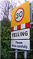
Nearest Village: Papworth St Agnes
Map Ref: TL26786248
Latitude: 52.245907N Longitude: 0.144457W
Condition:
| 5 | Perfect |
| 4 | Almost Perfect |
| 3 | Reasonable but with some damage |
| 2 | Ruined but still recognisable as an ancient site |
| 1 | Pretty much destroyed, possibly visible as crop marks |
| 0 | No data. |
| -1 | Completely destroyed |
| 5 | Superb |
| 4 | Good |
| 3 | Ordinary |
| 2 | Not Good |
| 1 | Awful |
| 0 | No data. |
| 5 | Can be driven to, probably with disabled access |
| 4 | Short walk on a footpath |
| 3 | Requiring a bit more of a walk |
| 2 | A long walk |
| 1 | In the middle of nowhere, a nightmare to find |
| 0 | No data. |
| 5 | co-ordinates taken by GPS or official recorded co-ordinates |
| 4 | co-ordinates scaled from a detailed map |
| 3 | co-ordinates scaled from a bad map |
| 2 | co-ordinates of the nearest village |
| 1 | co-ordinates of the nearest town |
| 0 | no data |
Internal Links:
External Links:
")
This chalybeate spring arises in a boggy hollow at the edge of a copse by the side of a ploughed field. It is obvious by the rich orange colouration of the water and it flows at a steep angle into the below stream. No structure is apparent or any traces of one, and its history is unclear. However it is believed that the name Nill refers to fairies.
You may be viewing yesterday's version of this page. To see the most up to date information please register for a free account.
Do not use the above information on other web sites or publications without permission of the contributor.
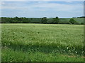
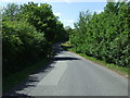
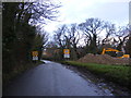
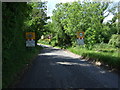
Nearby Images from Geograph Britain and Ireland:
©2015(licence)
©2015(licence)
©2012(licence)
©2012(licence)
©2015(licence)
The above images may not be of the site on this page, they are loaded from Geograph.
Please Submit an Image of this site or go out and take one for us!
Click here to see more info for this site
Nearby sites
Key: Red: member's photo, Blue: 3rd party photo, Yellow: other image, Green: no photo - please go there and take one, Grey: site destroyed
Download sites to:
KML (Google Earth)
GPX (GPS waypoints)
CSV (Garmin/Navman)
CSV (Excel)
To unlock full downloads you need to sign up as a Contributory Member. Otherwise downloads are limited to 50 sites.
Turn off the page maps and other distractions
Nearby sites listing. In the following links * = Image available
4.6km NE 35° Hilton (Cambridgeshire)* Turf Maze (TL293663)
6.8km NW 307° Buckden A Cursus Cursus (TL212664)
7.0km E 87° Knapwell* Holy Well or Sacred Spring (TL33816300)
7.6km WNW 302° Buckden C Cursus Cursus (TL202664)
7.7km NW 304° Buckden B Cursus Cursus (TL20266659)
8.5km N 353° Godmanchester Cursus Cursus (TL25557092)
8.5km N 353° Godmanchester Cursus Cursus (TL25557092)
8.7km NE 44° Fenstanton Cursus Cursus (TL326689)
9.3km WSW 245° Eynesbury Hardwicke B Cursus Cursus (TL184584)
9.6km WSW 247° Eynesbury Hodwick 1 Long Barrow (TL180585)
9.7km WSW 245° Eynesbury Hardwicke A Cursus Cursus (TL181582)
9.7km NE 44° Low Hill Bowl Barrow, Fen Drayton RSPB Reserve* Round Barrow(s) (TL33336960)
9.9km NNW 345° Horse Common Spring* Holy Well or Sacred Spring (TL2472)
10.7km NE 41° Holywell (Cambridgeshire)* Holy Well or Sacred Spring (TL336707)
11.0km NNW 326° Brampton Long Barrow (TL204715)
11.2km NW 326° Brampton Cursus Cursus (TL203716)
12.3km SW 226° Eynesbury Hodwick 2 Long Barrow (TL181537)
12.7km ESE 123° The Mazles Turf Maze (TL377559)
13.2km SW 235° Willow Row Barrow* Barrow Cemetery (TL162546)
13.9km ENE 78° St Michael's Well (Cambridge)* Holy Well or Sacred Spring (TL40326584)
14.0km WSW 239° Roundhill Barrow* Round Barrow(s) (TL1487755016)
16.1km SW 214° Caesar's Camp (Bedfordshire)* Hillfort (TL180490)
16.7km SSW 210° Sandy Lodge Promontory Fort / Cliff Castle (TL187478)
17.4km SSW 205° Biggleswade Cursus Cursus (TL197466)
17.4km SSW 206° Biggleswade Cursus Cursus (TL194467)
View more nearby sites and additional images


 We would like to know more about this location. Please feel free to add a brief description and any relevant information in your own language.
 Wir möchten mehr über diese Stätte erfahren. Bitte zögern Sie nicht, eine kurze Beschreibung und relevante Informationen in Deutsch hinzuzufügen.
 Nous aimerions en savoir encore un peu sur les lieux. S'il vous plaît n'hesitez pas à ajouter une courte description et tous les renseignements pertinents dans votre propre langue.
 Quisieramos informarnos un poco más de las lugares. No dude en añadir una breve descripción y otros datos relevantes en su propio idioma.