


<< Other Photo Pages >> Mesolithic settlement near Pulpit Rock - Ancient Village or Settlement in England in West Sussex
Submitted by Andy B on Wednesday, 06 November 2013 Page Views: 4853
Multi-periodSite Name: Mesolithic settlement near Pulpit Rock Alternative Name: Nymans National TrustCountry: England
NOTE: This site is 5.926 km away from the location you searched for.
County: West Sussex Type: Ancient Village or Settlement
Nearest Village: Handcross
Map Ref: TQ27362955
Latitude: 51.051185N Longitude: 0.184335W
Condition:
| 5 | Perfect |
| 4 | Almost Perfect |
| 3 | Reasonable but with some damage |
| 2 | Ruined but still recognisable as an ancient site |
| 1 | Pretty much destroyed, possibly visible as crop marks |
| 0 | No data. |
| -1 | Completely destroyed |
| 5 | Superb |
| 4 | Good |
| 3 | Ordinary |
| 2 | Not Good |
| 1 | Awful |
| 0 | No data. |
| 5 | Can be driven to, probably with disabled access |
| 4 | Short walk on a footpath |
| 3 | Requiring a bit more of a walk |
| 2 | A long walk |
| 1 | In the middle of nowhere, a nightmare to find |
| 0 | No data. |
| 5 | co-ordinates taken by GPS or official recorded co-ordinates |
| 4 | co-ordinates scaled from a detailed map |
| 3 | co-ordinates scaled from a bad map |
| 2 | co-ordinates of the nearest village |
| 1 | co-ordinates of the nearest town |
| 0 | no data |
Internal Links:
External Links:
")
All signs indicate this would have been an ideal site for Mesolithic settlement and planned archaeological investigations hope to reveal its secrets."
More at Nymans Things to See and Do
Note: Archaeological investigation into suspected Mesolithic settlement at Nymans Gardens in progress - Open Day this Saturday 9th November
You may be viewing yesterday's version of this page. To see the most up to date information please register for a free account.
Do not use the above information on other web sites or publications without permission of the contributor.
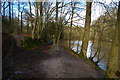
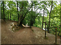
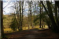
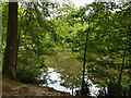
Nearby Images from Geograph Britain and Ireland:
©2016(licence)
©2018(licence)
©2016(licence)
©2018(licence)
©2024(licence)
The above images may not be of the site on this page, they are loaded from Geograph.
Please Submit an Image of this site or go out and take one for us!
Click here to see more info for this site
Nearby sites
Key: Red: member's photo, Blue: 3rd party photo, Yellow: other image, Green: no photo - please go there and take one, Grey: site destroyed
Download sites to:
KML (Google Earth)
GPX (GPS waypoints)
CSV (Garmin/Navman)
CSV (Excel)
To unlock full downloads you need to sign up as a Contributory Member. Otherwise downloads are limited to 50 sites.
Turn off the page maps and other distractions
Nearby sites listing. In the following links * = Image available
4.5km NW 321° Blackhill Barrow Round Barrow(s) (TQ244330)
5.0km NW 318° Shepherdsfield Barrow Round Barrow(s) (TQ239332)
6.6km NE 47° Ashdown Forest - Horsham ridgeway Ancient Trackway (TQ32153416)
7.8km ENE 73° Big on Little* Rock Outcrop (TQ348320)
7.9km ENE 71° Philpots Promontory Camp* Hillfort (TQ348323)
7.9km ENE 72° Philpots Camp Mesolithic Rock Shelters Cave or Rock Shelter (TQ34873212)
9.6km WSW 257° The Nun's Well (West Sussex) Holy Well or Sacred Spring (TQ1802227076)
10.3km W 275° Normandy Well (Horsham)* Holy Well or Sacred Spring (TQ1710130224)
10.7km ENE 77° St Mary's Rocks Cave or Rock Shelter (TQ37773226)
11.3km ENE 60° Cinder Mead and Furnace Mead Ancient Mine, Quarry or other Industry (TQ37003552)
11.7km ENE 59° Ridge Hill Rock Shelter Cave or Rock Shelter (TQ37203590)
11.9km ENE 66° Stone Rocks West Sussex Cave or Rock Shelter (TQ381347)
12.4km W 276° Wickhurst Green* Ancient Village or Settlement (TQ14953060)
14.0km E 86° The Danes Churchyard Ancient Village or Settlement (TQ41343089)
14.9km ENE 57° East Grinstead Museum* Museum (TQ3960338031)
15.0km SSE 162° Lodge Hill Tumulus Round Barrow(s) (TQ324154)
15.2km SSE 160° Ditchling Stone Circle Modern Stone Circle etc (TQ328154)
15.2km SSE 162° Ditchling Sarsens* Natural Stone / Erratic / Other Natural Feature (TQ3253215213)
15.5km ENE 64° Blunds Hole Cave or Rock Shelter (TQ41103670)
15.9km S 178° Wolstonbury* Ancient Village or Settlement (TQ28401368)
16.0km E 82° Ashdown Forest Centre* Museum (TQ432323)
17.0km E 93° Millbrook Barrow Round Barrow(s) (TQ444291)
17.1km SSE 168° Tumuli near Ditchling Beacon* Round Barrow(s) (TQ313129)
17.1km E 83° The Park Fort (Ashdown Forest) Hillfort (TQ44373195)
17.2km SSE 166° Ditchling Beacon Tumuli 2* Round Barrow(s) (TQ319130)
View more nearby sites and additional images


 We would like to know more about this location. Please feel free to add a brief description and any relevant information in your own language.
 Wir möchten mehr über diese Stätte erfahren. Bitte zögern Sie nicht, eine kurze Beschreibung und relevante Informationen in Deutsch hinzuzufügen.
 Nous aimerions en savoir encore un peu sur les lieux. S'il vous plaît n'hesitez pas à ajouter une courte description et tous les renseignements pertinents dans votre propre langue.
 Quisieramos informarnos un poco más de las lugares. No dude en añadir una breve descripción y otros datos relevantes en su propio idioma.