


<< Text Pages >> Wildhill Puddingstone - Natural Stone / Erratic / Other Natural Feature in England in Hertfordshire
Submitted by Thorgrim on Thursday, 20 January 2005 Page Views: 4359
Natural PlacesSite Name: Wildhill PuddingstoneCountry: England
NOTE: This site is 4.96 km away from the location you searched for.
County: Hertfordshire Type: Natural Stone / Erratic / Other Natural Feature
Nearest Town: Hatfield Nearest Village: Essendon
Map Ref: TL263067
Latitude: 51.744774N Longitude: 0.172016W
Condition:
| 5 | Perfect |
| 4 | Almost Perfect |
| 3 | Reasonable but with some damage |
| 2 | Ruined but still recognisable as an ancient site |
| 1 | Pretty much destroyed, possibly visible as crop marks |
| 0 | No data. |
| -1 | Completely destroyed |
| 5 | Superb |
| 4 | Good |
| 3 | Ordinary |
| 2 | Not Good |
| 1 | Awful |
| 0 | No data. |
| 5 | Can be driven to, probably with disabled access |
| 4 | Short walk on a footpath |
| 3 | Requiring a bit more of a walk |
| 2 | A long walk |
| 1 | In the middle of nowhere, a nightmare to find |
| 0 | No data. |
| 5 | co-ordinates taken by GPS or official recorded co-ordinates |
| 4 | co-ordinates scaled from a detailed map |
| 3 | co-ordinates scaled from a bad map |
| 2 | co-ordinates of the nearest village |
| 1 | co-ordinates of the nearest town |
| 0 | no data |
Be the first person to rate this site - see the 'Contribute!' box in the right hand menu.
Internal Links:
External Links:
Natural Stone / Glacial Erratic in Hertfordshire
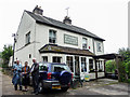
In a field on the bank of a small stream behind the Woodman pub. Site No. 53 on the Puddingstone Trail.
You may be viewing yesterday's version of this page. To see the most up to date information please register for a free account.
Do not use the above information on other web sites or publications without permission of the contributor.
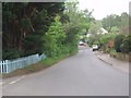
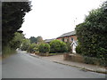
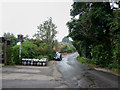
Nearby Images from Geograph Britain and Ireland:
©2012(licence)
©2013(licence)
©2014(licence)
©2013(licence)
©2013(licence)
The above images may not be of the site on this page, they are loaded from Geograph.
Please Submit an Image of this site or go out and take one for us!
Click here to see more info for this site
Nearby sites
Key: Red: member's photo, Blue: 3rd party photo, Yellow: other image, Green: no photo - please go there and take one, Grey: site destroyed
Download sites to:
KML (Google Earth)
GPX (GPS waypoints)
CSV (Garmin/Navman)
CSV (Excel)
To unlock full downloads you need to sign up as a Contributory Member. Otherwise downloads are limited to 50 sites.
Turn off the page maps and other distractions
Nearby sites listing. In the following links * = Image available
3.6km SSE 167° Griffin's Hole* Holy Well or Sacred Spring (TL2720403249)
3.8km NW 324° Mill Green Museum Museum (TL240097)
5.6km SSW 195° Potters Bar Museum Museum (TL2494101262)
7.4km W 266° Tyttenhanger Puddingstones Natural Stone / Erratic / Other Natural Feature (TL189060)
8.9km ESE 113° Flamstead Puddingstone Marker Stone (TL346035)
9.7km NNW 344° Welwyn Roman Baths* Ancient Village or Settlement (TL23451602)
10.0km NNW 343° Welwyn Puddingstone* Natural Stone / Erratic / Other Natural Feature (TL231162)
10.1km NW 312° Devil's Dyke (Hertfordshire)* Ancient Village or Settlement (TL186133)
10.3km N 359° Perry's Grove Boundary Ditch* Misc. Earthwork (TL25851700)
11.0km NE 53° Chadwell Spring* Holy Well or Sacred Spring (TL349136)
11.1km WNW 285° Beech Bottom Dyke* Ancient Village or Settlement (TL155093)
11.6km W 271° Holy Well (St. Albans)* Holy Well or Sacred Spring (TL14640670)
12.3km ENE 63° Emma's Well* Holy Well or Sacred Spring (TL372125)
12.4km W 275° St Albans Puddingstones* Natural Stone / Erratic / Other Natural Feature (TL139075)
12.5km SSE 154° Bush Hill Hillfort (TQ321956)
12.6km ESE 109° Monkham Puddingstone Marker Stone (TL384029)
12.9km ESE 108° Holyfield Puddingstone* Marker Stone (TL38670303)
12.9km W 275° Verulamium Puddingstone Natural Stone / Erratic / Other Natural Feature (TL134074)
14.0km ESE 103° Galley Hill Puddingstone Marker Stone (TL400038)
14.1km W 278° Devil's Ditch (Hertfordshire) Ancient Village or Settlement (TL123084)
14.7km W 266° Potterscrouch Puddingstones Natural Stone / Erratic / Other Natural Feature (TL116052)
16.3km ESE 101° Parvills Puddingstone* Marker Stone (TL424039)
16.5km S 171° St. Dunstan's Well Holy Well or Sacred Spring (TQ293905)
16.5km NE 39° Lunardi Stone* Natural Stone / Erratic / Other Natural Feature (TL364198)
16.6km SW 220° Stanmore common barrows Misc. Earthwork (TQ15869381)
View more nearby sites and additional images


 We would like to know more about this location. Please feel free to add a brief description and any relevant information in your own language.
 Wir möchten mehr über diese Stätte erfahren. Bitte zögern Sie nicht, eine kurze Beschreibung und relevante Informationen in Deutsch hinzuzufügen.
 Nous aimerions en savoir encore un peu sur les lieux. S'il vous plaît n'hesitez pas à ajouter une courte description et tous les renseignements pertinents dans votre propre langue.
 Quisieramos informarnos un poco más de las lugares. No dude en añadir una breve descripción y otros datos relevantes en su propio idioma.