


<< Our Photo Pages >> Tumuli de Condé-sur-Ifs - Chambered Cairn in France in Normandie:Calvados (14)
Submitted by thecaptain on Sunday, 08 October 2006 Page Views: 4262
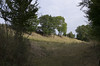
Neolithic and Bronze AgeSite Name: Tumuli de Condé-sur-Ifs Alternative Name: Tumuli de Bruyère-du-HamelCountry: France
NOTE: This site is 5.429 km away from the location you searched for.
Département: Normandie:Calvados (14) Type: Chambered Cairn
Nearest Town: Falaise Nearest Village: Condé-sur-Ifs
Latitude: 49.026013N Longitude: 0.127455W
Condition:
| 5 | Perfect |
| 4 | Almost Perfect |
| 3 | Reasonable but with some damage |
| 2 | Ruined but still recognisable as an ancient site |
| 1 | Pretty much destroyed, possibly visible as crop marks |
| 0 | No data. |
| -1 | Completely destroyed |
| 5 | Superb |
| 4 | Good |
| 3 | Ordinary |
| 2 | Not Good |
| 1 | Awful |
| 0 | No data. |
| 5 | Can be driven to, probably with disabled access |
| 4 | Short walk on a footpath |
| 3 | Requiring a bit more of a walk |
| 2 | A long walk |
| 1 | In the middle of nowhere, a nightmare to find |
| 0 | No data. |
| 5 | co-ordinates taken by GPS or official recorded co-ordinates |
| 4 | co-ordinates scaled from a detailed map |
| 3 | co-ordinates scaled from a bad map |
| 2 | co-ordinates of the nearest village |
| 1 | co-ordinates of the nearest town |
| 0 | no data |
Be the first person to rate this site - see the 'Contribute!' box in the right hand menu.
Internal Links:
External Links:
I have visited· I would like to visit
TheCaptain has visited here
")
IMPORTANT NOTE :- Exact position of site unsure.
You may be viewing yesterday's version of this page. To see the most up to date information please register for a free account.
Do not use the above information on other web sites or publications without permission of the contributor.
Nearby Images from Flickr

The above images may not be of the site on this page, but were taken nearby. They are loaded from Flickr so please click on them for image credits.
Click here to see more info for this site
Nearby sites
Click here to view sites on an interactive map of the areaKey: Red: member's photo, Blue: 3rd party photo, Yellow: other image, Green: no photo - please go there and take one, Grey: site destroyed
Download sites to:
KML (Google Earth)
GPX (GPS waypoints)
CSV (Garmin/Navman)
CSV (Excel)
To unlock full downloads you need to sign up as a Contributory Member. Otherwise downloads are limited to 50 sites.
Turn off the page maps and other distractions
Nearby sites listing. In the following links * = Image available
111m NW 311° La Butte du Hu* Chambered Cairn
1.9km N 357° La Pierre Cornue* Standing Stone (Menhir)
7.2km SSW 208° Menhir d'Olendon* Standing Stone (Menhir)
8.8km SW 223° Langrais menhirs* Standing Stones
9.2km SW 228° Mont Joly* Ancient Village or Settlement
9.4km SW 228° Bons Tassilly polissoirs* Polissoir
9.5km W 270° Bretteville-le-Rabet* Ancient Mine, Quarry or other Industry
11.6km SSW 211° Menhir de Soulangy* Standing Stone (Menhir)
14.4km W 270° Pierre Tourneresse (Gouvix)* Standing Stone (Menhir)
14.4km SW 234° Pierre du Pôt* Standing Stone (Menhir)
14.5km WSW 257° La Roche Piquée (St-Germain-le-Vasson)* Standing Stone (Menhir)
14.7km SW 226° Menhir de la Grurie* Standing Stone (Menhir)
16.7km SW 231° Menhir dit Pierre de la Hoberie* Standing Stone (Menhir)
17.3km NE 34° Chateau des Anglais Hillfort
17.5km WNW 281° Pierre Tournante (Fresnay-le-Puceux)* Standing Stone (Menhir)
18.3km WNW 295° La Hoguette* Chambered Tomb
18.8km WNW 294° La Hogue* Chambered Tomb
21.1km SSE 154° Dolmen dit Pierre-Levée (Fontaine)* Burial Chamber or Dolmen
22.0km E 93° Pierre Tournante (Livarot)* Standing Stone (Menhir)
22.1km SSE 166° Camp Celtique de Bière* Ancient Village or Settlement
22.2km NW 309° Fleury-sur-Orne necropolis* Barrow Cemetery
23.5km SSE 151° Trun menhir Standing Stone (Menhir)
24.6km S 186° Dolmen dit Pierre-aux-Bignes* Burial Chamber or Dolmen
24.6km S 186° Tumulus des Hogues* Round Barrow(s)
24.7km NW 306° Menhir dit la Pierre Couchée (Louvigny)* Standing Stone (Menhir)
View more nearby sites and additional images


 We would like to know more about this location. Please feel free to add a brief description and any relevant information in your own language.
 Wir möchten mehr über diese Stätte erfahren. Bitte zögern Sie nicht, eine kurze Beschreibung und relevante Informationen in Deutsch hinzuzufügen.
 Nous aimerions en savoir encore un peu sur les lieux. S'il vous plaît n'hesitez pas à ajouter une courte description et tous les renseignements pertinents dans votre propre langue.
 Quisieramos informarnos un poco más de las lugares. No dude en añadir una breve descripción y otros datos relevantes en su propio idioma.