


<< Text Pages >> Dolmen de la Mouleyre - Burial Chamber or Dolmen in France in Aquitaine:Gironde (33)
Submitted by TheCaptain on Friday, 06 May 2011 Page Views: 2040
Neolithic and Bronze AgeSite Name: Dolmen de la Mouleyre Alternative Name: Dolmen de Bois de LucCountry: France
NOTE: This site is 2.039 km away from the location you searched for.
Département: Aquitaine:Gironde (33) Type: Burial Chamber or Dolmen
Nearest Town: Bordeaux Nearest Village: Blasimon
Latitude: 44.745565N Longitude: 0.047913W
Condition:
| 5 | Perfect |
| 4 | Almost Perfect |
| 3 | Reasonable but with some damage |
| 2 | Ruined but still recognisable as an ancient site |
| 1 | Pretty much destroyed, possibly visible as crop marks |
| 0 | No data. |
| -1 | Completely destroyed |
| 5 | Superb |
| 4 | Good |
| 3 | Ordinary |
| 2 | Not Good |
| 1 | Awful |
| 0 | No data. |
| 5 | Can be driven to, probably with disabled access |
| 4 | Short walk on a footpath |
| 3 | Requiring a bit more of a walk |
| 2 | A long walk |
| 1 | In the middle of nowhere, a nightmare to find |
| 0 | No data. |
| 5 | co-ordinates taken by GPS or official recorded co-ordinates |
| 4 | co-ordinates scaled from a detailed map |
| 3 | co-ordinates scaled from a bad map |
| 2 | co-ordinates of the nearest village |
| 1 | co-ordinates of the nearest town |
| 0 | no data |
Be the first person to rate this site - see the 'Contribute!' box in the right hand menu.
Internal Links:
External Links:
burial chamber in Aquitaine:Gironde
Dolmen de la Mouleyre is a burial chamber in the community of Blasimon, Departement of Gironde, Region of Aquitaine
Location Source: T4T35.fr
You may be viewing yesterday's version of this page. To see the most up to date information please register for a free account.
Do not use the above information on other web sites or publications without permission of the contributor.
Nearby Images from Flickr

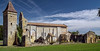
The above images may not be of the site on this page, but were taken nearby. They are loaded from Flickr so please click on them for image credits.
Click here to see more info for this site
Nearby sites
Click here to view sites on an interactive map of the areaKey: Red: member's photo, Blue: 3rd party photo, Yellow: other image, Green: no photo - please go there and take one, Grey: site destroyed
Download sites to:
KML (Google Earth)
GPX (GPS waypoints)
CSV (Garmin/Navman)
CSV (Excel)
To unlock full downloads you need to sign up as a Contributory Member. Otherwise downloads are limited to 50 sites.
Turn off the page maps and other distractions
Nearby sites listing. In the following links * = Image available
454m E 100° Les Grangeottes (Mauriac)* Standing Stone (Menhir)
3.0km NE 54° Menhir dit la Gran'Boyne de Balette* Standing Stone (Menhir)
4.1km W 266° Menhir Notre Dame de Bonne Nouvelle* Standing Stone (Menhir)
6.2km WSW 254° Dolmen les Trois Pierres Burial Chamber or Dolmen
7.2km W 271° Pontaret Menhir* Standing Stone (Menhir)
8.9km W 274° Gisement de Grand-Moulin Cave or Rock Shelter
9.0km WSW 252° Dolmens de Bignon* Burial Chamber or Dolmen
9.2km WNW 289° Curton Dolmen* Burial Chamber or Dolmen
9.2km W 265° Frontenac tumulus Chambered Tomb
9.4km WNW 285° Pierre du Maine du Prieuré * Standing Stone (Menhir)
9.7km W 274° Roquefort Allée couverte* Passage Grave
9.8km W 272° Roquefort Settlement Ancient Village or Settlement
10.0km WNW 287° Sabatey Dolmen 2* Burial Chamber or Dolmen
10.1km WNW 287° Sabatey Dolmen 1* Burial Chamber or Dolmen
11.4km WSW 255° Baigneaux tumulus Chambered Tomb
13.0km NE 50° Abri du Morin Cave or Rock Shelter
14.4km WSW 255° La Palanque de Peyre Standing Stone (Menhir)
15.6km WSW 249° Côte de Cayron tumulus Chambered Tomb
16.6km WNW 285° Allée Couverte de Ligarde Passage Grave
17.0km WNW 288° Allée Couverte de Lafut Passage Grave
17.1km N 5° Pitray Allée couverte* Passage Grave
18.7km WNW 287° Gisement de Camiac Cave or Rock Shelter
18.9km N 8° Dolmen de Puy Landry* Burial Chamber or Dolmen
19.0km N 8° Menhir de Clotte Standing Stone (Menhir)
19.3km WSW 254° Soulignac menhir Standing Stone (Menhir)
View more nearby sites and additional images


 We would like to know more about this location. Please feel free to add a brief description and any relevant information in your own language.
 Wir möchten mehr über diese Stätte erfahren. Bitte zögern Sie nicht, eine kurze Beschreibung und relevante Informationen in Deutsch hinzuzufügen.
 Nous aimerions en savoir encore un peu sur les lieux. S'il vous plaît n'hesitez pas à ajouter une courte description et tous les renseignements pertinents dans votre propre langue.
 Quisieramos informarnos un poco más de las lugares. No dude en añadir una breve descripción y otros datos relevantes en su propio idioma.