Featured: How and why the ancients enchanted Great Britain and Brittany

How and why the ancients enchanted Great Britain and Brittany

Random Image


Rebala

Great Stone Circles, Aubrey Burl

Great Stone Circles, Aubrey Burl

Who's Online

There are currently, 272 guests and 1 members online.

You are a guest. To join in, please register for free by clicking here

Sponsors

<< Our Photo Pages >> Le Rocher Mystérieux - Natural Stone / Erratic / Other Natural Feature in France in Midi:Hautes-Pyrénées (65)

Submitted by Nick- on Sunday, 17 December 2006  Page Views: 5897

Natural PlacesSite Name: Le Rocher Mystérieux
Country: France
NOTE: This site is 1.837 km away from the location you searched for.

Département: Midi:Hautes-Pyrénées (65) Type: Natural Stone / Erratic / Other Natural Feature
Nearest Town: Lourdes  Nearest Village: Ossen
Latitude: 43.084225N  Longitude: 0.064533W
Condition:
5Perfect
4Almost Perfect
3Reasonable but with some damage
2Ruined but still recognisable as an ancient site
1Pretty much destroyed, possibly visible as crop marks
0No data.
-1Completely destroyed
2 Ambience:
5Superb
4Good
3Ordinary
2Not Good
1Awful
0No data.
5 Access:
5Can be driven to, probably with disabled access
4Short walk on a footpath
3Requiring a bit more of a walk
2A long walk
1In the middle of nowhere, a nightmare to find
0No data.
1 Accuracy:
5co-ordinates taken by GPS or official recorded co-ordinates
4co-ordinates scaled from a detailed map
3co-ordinates scaled from a bad map
2co-ordinates of the nearest village
1co-ordinates of the nearest town
0no data
4

Internal Links:
External Links:

Le Rocher Mystérieux
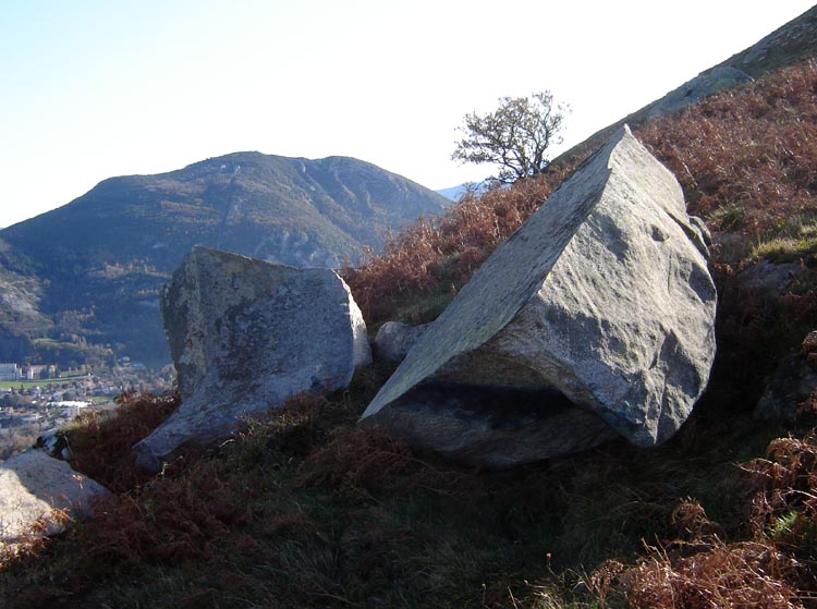
Le Rocher Mystérieux submitted by Nick- : 15th December 2006. 'Glacial Errratic' just South from "Le Rocher Mystérieux" with me as scale but slightly cut off at the bottom. Looking in the South east direction. (Vote or comment on this photo)
In the foothills of the Pyrénées, 1.5 kms southwest from from the centre of Lourdes. This natural feature (?) is on the mountain summit of "Le Béout" at a height (approx) of 719 metres. The whole mountain is littered with (glacial??) rocks, and the map also shows many mounds and a cairn, none of which, I could pin down, as there wasn't time........

The ascent up the mountain is extremely steep and precarious when approaching from the North West (the way I took). The path shown on the IGN 1:25000 map {IGN Série Bleue 1646E LOURDES(3)}, which approaches from the South (village of Ossen) may be easier....

Near to 'Le Rocher Mystérieux' a 'Gouffre' is marked on the map (which translates as 'pit' or maybe cave) I didn't have time to find it, but found a nice glacial erratic instead......... A large Cross has been planted on the 'Rocher', fairly recently as it's not marked on the map..... One gets good views up there, of Lourdes, and further afield.
You may be viewing yesterday's version of this page. To see the most up to date information please register for a free account.
Le Rocher Mystérieux
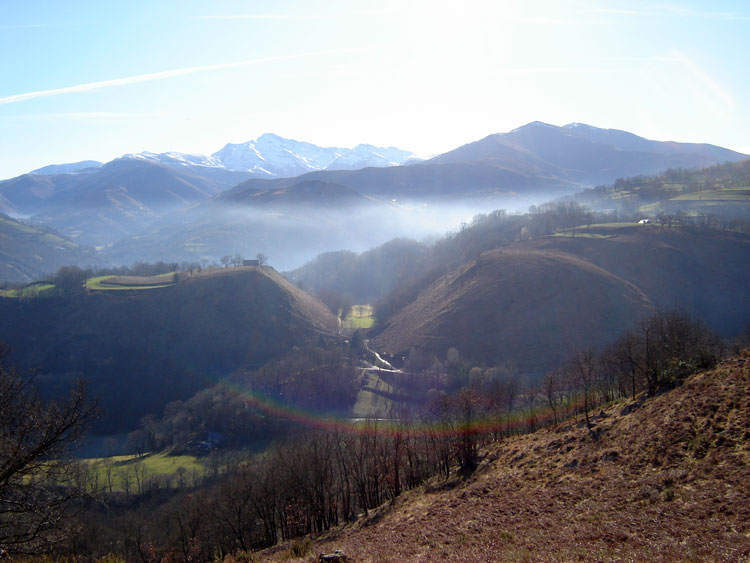
Le Rocher Mystérieux submitted by Nick- : Site in Midi:Hautes-Pyrénées (65) 5th February 2008 While walking up the path from the village of Ossen,leading to "Le Rocher Mystérieux",looking Southwards at the altitude of about 594 metres (near enough to where the height is shown on the map.) The hills in the photo are marked with banks and other earthworks, they don't show up too well on the photo though... Spain is behind t... (Vote or comment on this photo)

Le Rocher Mystérieux
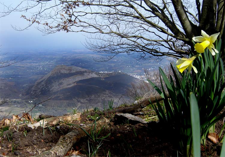
Le Rocher Mystérieux submitted by Nick- : 15th Dec.2006 On the Northern slope approaching 'Le Rocher Mystérieux'. Lourdes is at the bottom on the left. (1 comment - Vote or comment on this photo)

Le Rocher Mystérieux
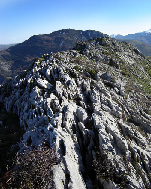
Le Rocher Mystérieux submitted by Nick- : 15-12-06 Rock formations leading up to the erratic. (Vote or comment on this photo)

Le Rocher Mystérieux
Le Rocher Mystérieux submitted by Nick- : 26th Feb 2008--- Les Rochers taken from the summit of 'Pic d'Alian'(3kms to the South) at the height of 1089m. {4 metres higher than Snowdon in North Wales} The highest point of 'Les Rochers' is 300m lower. Note all the burnt ground on the slopes. Check out the map and sat. photo here. (4 comments - Vote or comment on this photo)

Le Rocher Mystérieux
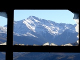
Le Rocher Mystérieux submitted by Nick- : 5th Feb 2008 Right next to Le Rocher is a disused cable car building "Téléphérique du Béout", which probably started operation in the 1930's, and closed in the early 1990's(?) The photo shows a view of the Pyrénées through one of the smashed window of the building...A poster showing the cable car is to be found here. (3 comments)

Le Rocher Mystérieux
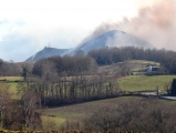
Le Rocher Mystérieux submitted by Nick- : 7th February 2008 I had an appointment in Tarbes in the morning, and decided to continue to 'Le Rocher Mystérieux' to check out the cave (finally equiped with a torch) as Lourdes is nearby... (in the interests of saving petrol and my limited wallet...) I arrived in the area to find several people setting light to the mountain! This is probably some sort of bracken control,or maybe it helps... (1 comment)

Le Rocher Mystérieux
Le Rocher Mystérieux submitted by Nick- : 5th February 2008 Near the summit, looking Westwards...

Le Rocher Mystérieux
Le Rocher Mystérieux submitted by Nick- : 5th February 2008 On the Southern path to the summit one finds le "Gouffre du Béout". A cave at an altitude of 670m which leads to a large vertical shaft. (Length and amount of tunnels unknown, as I had forgotten my torch!) It was here in 1974 that M. Lacrampe found several long bones of a reindeer (Late Pleistocene Period) in "clay of the filling, under a stalagmite(?) floor" which had p...

Le Rocher Mystérieux
Le Rocher Mystérieux submitted by Nick- : Site in Midi:Hautes-Pyrénées (65) 5th February 2008 Near the summit of "Le Rocher Mystérieux",one of several glacial erratics is on the right....

Le Rocher Mystérieux
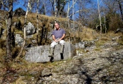
Le Rocher Mystérieux submitted by Nick- : Site in Midi:Hautes-Pyrénées (65) 5th February 2008 While walking up the path from the village of Ossen,leading to "Le Rocher Mystérieux" , there were a few 'worked' stones lying around and evidence of quarrying. About 700 metres South from the summit (approx.altitude 527m).... Here is the largest stone I saw. Approximately, 2 metres long How this ties up exactly with the possibl... (1 comment)

Le Rocher Mystérieux
Le Rocher Mystérieux submitted by Nick- : Site in Midi:Hautes-Pyrénées (65) 5th February 2008 While walking up the path from the village of Ossen,leading to "Le Rocher Mystérieux" , there were a few 'worked' stones lying around and evidence of quarrying. About 700 metres South from the summit (aprox.altitude 527m).... Here is one the stones. Approximately, 1.5 metres long How this ties up exactly with the possible cairns ... (1 comment)

Le Rocher Mystérieux
Le Rocher Mystérieux submitted by Nick- : Site in Midi:Hautes-Pyrénées (65) 5th February 2008 While walking up the path from the village of Ossen,leading to "Le Rocher Mystérieux" , there were a few 'worked' stones lying around and evidence of quarrying. About 700 metres South from the summit (aprox.altitude 527m).... Here are the possible remains of a quarry... How this ties up exactly with the possible cairns up on ... (1 comment)

Le Rocher Mystérieux
Le Rocher Mystérieux submitted by Nick- : 15-12-06 Another view of the glacial erratic. Looking in the South East direction..... (3 comments)

Le Rocher Mystérieux
Le Rocher Mystérieux submitted by Nick- : 15th December 2006. Natural (?) Rock near to "Le Rocher Mystérieux". In the background is Lourdes....

Le Rocher Mystérieux
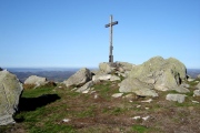
Le Rocher Mystérieux submitted by Nick- : 15th December 2006. "Le Rocher Mystérieux" Looking in the North West direction.... The faint white line in the distance, to the left of the cross and the rocks, is the city of Pau (in the Pyrénées Atlantique -64)

Le Rocher Mystérieux
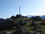
Le Rocher Mystérieux submitted by Nick- : 15th December 2006. "Le Rocher Mystérieux", looking South East, towards the higher snow covered Pyrénées.

Do not use the above information on other web sites or publications without permission of the contributor.
Click here to see more info for this site

Nearby sites

Click here to view sites on an interactive map of the area

Key: Red: member's photo, Blue: 3rd party photo, Yellow: other image, Green: no photo - please go there and take one, Grey: site destroyed

Download sites to:
KML (Google Earth)
GPX (GPS waypoints)
CSV (Garmin/Navman)
CSV (Excel)

To unlock full downloads you need to sign up as a Contributory Member. Otherwise downloads are limited to 50 sites.


Turn off the page maps and other distractions

Nearby sites listing. In the following links * = Image available
 705m SW 228° Pierres Dressées de Bescuns Standing Stone (Menhir)
 1.5km W 266° Caverne des Espelugues* Cave or Rock Shelter
 1.8km SSW 210° Trois menhirs de Ségus Standing Stones
 2.8km N 351° Peyre-Crabère* Standing Stone (Menhir)
 4.5km N 351° Poueyferré Tumulus* Chambered Tomb
 4.9km NNW 332° Peyrasse menhir* Standing Stone (Menhir)
 4.9km SSW 192° Pibeste Cromlech* Stone Circle
 5.1km N 9° Peyre Hicadé (Bartrès)* Standing Stone (Menhir)
 5.5km ENE 70° Lézignan-Bourréac menhir Standing Stone (Menhir)
 5.6km SSW 192° Menhir dit Calhaou de Nageou Standing Stone (Menhir)
 5.7km N 6° Sarrails tumulus Chambered Tomb
 5.8km NNW 348° Oppidum de Peyrehicade Hillfort
 6.2km NNW 330° Dolmen du Peyre-Dusets* Burial Chamber or Dolmen
 6.2km N 4° Pouey Casanières Chambered Tomb
 6.7km N 3° Pouey Peyre Chambered Tomb
 7.0km N 2° Pouey Pastadere 1 Chambered Tomb
 7.0km NE 53° Oppidum de Julos Hillfort
 7.1km N 2° La Halliade tumulus* Chambered Tomb
 7.2km N 2° Pouey Pastadere 2 Chambered Tomb
 8.0km N 359° Pouey-Mayou* Burial Chamber or Dolmen
 8.4km N 356° Fontaine de Trois Seigneurs tumulus* Chambered Tomb
 9.3km E 81° Château de Lourdes Hillfort
 9.6km SW 232° Col d'Andorre Cromlechs* Cairn
 10.2km N 355° Peyre Blanc tumuli Chambered Tomb
 10.6km SSW 212° Trois Menhirs de Bayle-Bernicaze Standing Stone (Menhir)
View more nearby sites and additional images

<< Ammachatram

Mamallapuram >>

Please add your thoughts on this site

Prehistoric Monuments of the Lake District

Prehistoric Monuments of the Lake District

Sponsors

Auto-Translation (Google)

Translate from English into:

"Le Rocher Mystérieux" | Login/Create an Account | 5 News and Comments
  
Go back to top of page    Comments are owned by the poster. We aren't responsible for their content.
Re: Le Rocher Mystérieux by Nick- on Friday, 14 March 2008
(User Info | Send a Message)
Blurry view of Lourdes, from Le Rocher Mystérieux.

[ Reply to This ]

Re: Le Rocher Mystérieux by Nick- on Sunday, 17 December 2006
(User Info | Send a Message)
Hells Bells! The site is 1.5kms aprox SE from Lourdes not 'South'.......
[ Reply to This ]
    Re: Le Rocher Mystérieux by TheCaptain on Sunday, 17 December 2006
    (User Info | Send a Message)
    I'll take that to mean South WEST !

    And isn't there a cable car or suchlike to the top of the mountain ?
    [ Reply to This ]
      Re: Le Rocher Mystérieux by Nick- on Sunday, 17 December 2006
      (User Info | Send a Message)
      Yes, I forgot to mention this, (realized after the posting). The cable car house on the summit, (some way from 'le rocher') is unpainted and looks in a bad state. Wondered indeed if the cable car was still running......
      [ Reply to This ]
    Re: Le Rocher Mystérieux by Nick- on Sunday, 17 December 2006
    (User Info | Send a Message)
    I obviously have some type of problem with the compass.... "Le Rocher Mystérieux" is just South West of Lourdes........(Maybe this time I'll have got it more or less right)
    [ Reply to This ]

Your Name: Anonymous [ Register Now ]
Subject:


Add your comment or contribution to this page. Spam or offensive posts are deleted immediately, don't even bother

<<< What is five plus one as a number? (Please type the answer to this question in the little box on the left)
You can also embed videos and other things. For Youtube please copy and paste the 'embed code'.
For Google Street View please include Street View in the text.
Create a web link like this: <a href="https://www.megalithic.co.uk">This is a link</a>  

Allowed HTML is:
<p> <b> <i> <a> <img> <em> <br> <strong> <blockquote> <tt> <li> <ol> <ul> <object> <param> <embed> <iframe>

We would like to know more about this location. Please feel free to add a brief description and any relevant information in your own language.
Wir möchten mehr über diese Stätte erfahren. Bitte zögern Sie nicht, eine kurze Beschreibung und relevante Informationen in Deutsch hinzuzufügen.
Nous aimerions en savoir encore un peu sur les lieux. S'il vous plaît n'hesitez pas à ajouter une courte description et tous les renseignements pertinents dans votre propre langue.
Quisieramos informarnos un poco más de las lugares. No dude en añadir una breve descripción y otros datos relevantes en su propio idioma.