 with our Megalithic Portal iPhone app")

<< Text Pages >> Shepreth - Cursus in England in Cambridgeshire
Submitted by EssexMan on Wednesday, 07 April 2010 Page Views: 3383
Neolithic and Bronze AgeSite Name: SheprethCountry: England
NOTE: This site is 4.426 km away from the location you searched for.
County: Cambridgeshire Type: Cursus
Nearest Town: Royston Nearest Village: Shepreth
Map Ref: TL387468 Landranger Map Number: 154
Latitude: 52.102153N Longitude: 0.023619E
Condition:
| 5 | Perfect |
| 4 | Almost Perfect |
| 3 | Reasonable but with some damage |
| 2 | Ruined but still recognisable as an ancient site |
| 1 | Pretty much destroyed, possibly visible as crop marks |
| 0 | No data. |
| -1 | Completely destroyed |
| 5 | Superb |
| 4 | Good |
| 3 | Ordinary |
| 2 | Not Good |
| 1 | Awful |
| 0 | No data. |
| 5 | Can be driven to, probably with disabled access |
| 4 | Short walk on a footpath |
| 3 | Requiring a bit more of a walk |
| 2 | A long walk |
| 1 | In the middle of nowhere, a nightmare to find |
| 0 | No data. |
| 5 | co-ordinates taken by GPS or official recorded co-ordinates |
| 4 | co-ordinates scaled from a detailed map |
| 3 | co-ordinates scaled from a bad map |
| 2 | co-ordinates of the nearest village |
| 1 | co-ordinates of the nearest town |
| 0 | no data |
Internal Links:
External Links:
Discredited Cursus in Cambridgeshire
Status: Discredited
Extent: 560mx16m
Almost certainly a road
Note: This location marks one terminal (end) of a cursus monument. The location of the other terminal can be found in the Nearby Site list below.
You may be viewing yesterday's version of this page. To see the most up to date information please register for a free account.
Do not use the above information on other web sites or publications without permission of the contributor.
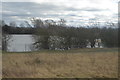
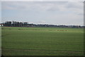
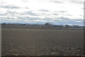
Nearby Images from Geograph Britain and Ireland:
©2016(licence)
©2014(licence)
©2016(licence)
©2016(licence)
©2023(licence)
The above images may not be of the site on this page, they are loaded from Geograph.
Please Submit an Image of this site or go out and take one for us!
Click here to see more info for this site
Nearby sites
Key: Red: member's photo, Blue: 3rd party photo, Yellow: other image, Green: no photo - please go there and take one, Grey: site destroyed
Download sites to:
KML (Google Earth)
GPX (GPS waypoints)
CSV (Garmin/Navman)
CSV (Excel)
To unlock full downloads you need to sign up as a Contributory Member. Otherwise downloads are limited to 50 sites.
Turn off the page maps and other distractions
Nearby sites listing. In the following links * = Image available
669m ENE 65° Shepreth Cursus (TL393471)
1.8km SW 220° Meldreth Hoard Ancient Mine, Quarry or other Industry (TL3761845415)
2.1km WSW 247° Mettle Hill Misc. Earthwork (TL3678245915)
2.8km S 189° Chalk Hill Barrow Round Barrow(s) (TL3833943972)
3.4km SSW 202° Melbourn Long Barrow* Long Barrow (TL3751343664)
4.4km S 176° Goffers Knoll Round Barrow(s) (TL3916342449)
5.4km S 185° Five Hill Barrow Cemetery (TL3836341431)
5.6km E 91° Thriplow Round Barrow(s) (TL4431646901)
5.9km SE 125° Thrplow Heath 2 Round Barrow(s) (TL4362943549)
6.2km ESE 105° Thriplow Ring Ditch Misc. Earthwork (TL44784537)
6.4km ESE 110° Thriplow Heath 1 Round Barrow(s) (TL4479044782)
6.5km E 85° Chronicle Hills Barrow Cemetery (TL452475)
6.6km SSW 211° Royston Ermine Street Barrow Long Barrow (TL3549241079)
6.6km WSW 242° Bassingbourn Village College ditches Misc. Earthwork (TL3293643488)
6.8km SSW 209° Royston and District Museum and Art Gallery* Museum (TL3552240812)
6.8km SSW 208° Royston Cave* Cave or Rock Shelter (TL3561640698)
6.8km SSW 209° Royston Stone* Natural Stone / Erratic / Other Natural Feature (TL3559440696)
6.8km SSW 209° Icenhilde Street Chambered Tomb (TL3550640735)
7.4km SSW 213° Royston Cricket Pitch Barrow Misc. Earthwork (TL3487540441)
7.7km SW 215° Earl's Hill earthwork* Misc. Earthwork (TL3446540367)
7.7km SW 215° Earl's Hill* Round Barrow(s) (TL3445240335)
7.8km S 190° Whiteley Hill Springfield style enclosure Ancient Village or Settlement (TL3760739122)
7.8km S 190° Whiteley Hill Barrow Cemetery Barrow Cemetery (TL3760739122)
7.8km SSW 212° The Two Hills* Barrow Cemetery (TL34724007)
7.9km SW 216° Rumbolds Mount Round Barrow(s) (TL34184027)
View more nearby sites and additional images


 We would like to know more about this location. Please feel free to add a brief description and any relevant information in your own language.
 Wir möchten mehr über diese Stätte erfahren. Bitte zögern Sie nicht, eine kurze Beschreibung und relevante Informationen in Deutsch hinzuzufügen.
 Nous aimerions en savoir encore un peu sur les lieux. S'il vous plaît n'hesitez pas à ajouter une courte description et tous les renseignements pertinents dans votre propre langue.
 Quisieramos informarnos un poco más de las lugares. No dude en añadir una breve descripción y otros datos relevantes en su propio idioma.