 with our Megalithic Portal iPhone app")


<< Text Pages >> Lamplugh - Stone Circle in England in Cumbria
Submitted by Anonymous on Tuesday, 17 September 2002 Page Views: 8821
Neolithic and Bronze AgeSite Name: LamplughCountry: England
NOTE: This site is 1.676 km away from the location you searched for.
County: Cumbria Type: Stone Circle
Map Ref: NY065177 Landranger Map Number: 89
Latitude: 54.545888N Longitude: 3.446898W
Condition:
| 5 | Perfect |
| 4 | Almost Perfect |
| 3 | Reasonable but with some damage |
| 2 | Ruined but still recognisable as an ancient site |
| 1 | Pretty much destroyed, possibly visible as crop marks |
| 0 | No data. |
| -1 | Completely destroyed |
| 5 | Superb |
| 4 | Good |
| 3 | Ordinary |
| 2 | Not Good |
| 1 | Awful |
| 0 | No data. |
| 5 | Can be driven to, probably with disabled access |
| 4 | Short walk on a footpath |
| 3 | Requiring a bit more of a walk |
| 2 | A long walk |
| 1 | In the middle of nowhere, a nightmare to find |
| 0 | No data. |
| 5 | co-ordinates taken by GPS or official recorded co-ordinates |
| 4 | co-ordinates scaled from a detailed map |
| 3 | co-ordinates scaled from a bad map |
| 2 | co-ordinates of the nearest village |
| 1 | co-ordinates of the nearest town |
| 0 | no data |
Internal Links:
External Links:
Stone Circle in Cumbria
Have you visited this site? Please contribute a description or any thoughts by adding a comment.
You may be viewing yesterday's version of this page. To see the most up to date information please register for a free account.
Do not use the above information on other web sites or publications without permission of the contributor.
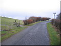
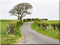
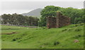
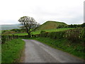
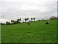
Nearby Images from Geograph Britain and Ireland:
©2005(licence)
©2021(licence)
©2017(licence)
©2014(licence)
©2014(licence)
The above images may not be of the site on this page, they are loaded from Geograph.
Please Submit an Image of this site or go out and take one for us!
Click here to see more info for this site
Nearby sites
Key: Red: member's photo, Blue: 3rd party photo, Yellow: other image, Green: no photo - please go there and take one, Grey: site destroyed
Download sites to:
KML (Google Earth)
GPX (GPS waypoints)
CSV (Garmin/Navman)
CSV (Excel)
To unlock full downloads you need to sign up as a Contributory Member. Otherwise downloads are limited to 50 sites.
Turn off the page maps and other distractions
Nearby sites listing. In the following links * = Image available
3.7km S 186° Blakeley Raise* Stone Circle (NY06011403)
4.3km S 183° Hodgsons Well burnt mound Artificial Mound (NY06191339)
5.3km NNW 330° Studfold Stone Circle* Stone Circle (NY03992234)
6.0km S 181° Swarth Fell funerary cairn* Round Cairn (NY06241167)
6.9km NE 55° Holme wood Round Barrow(s) (NY12312154)
7.0km S 173° Capelcrag Beck* Ring Cairn (NY07231072)
7.4km SSW 196° Yewcroft* Stone Circle (NY043106)
7.6km W 271° Le Wheles Stone Circle (NX989180)
7.6km S 184° Friar's Well Barrow Cemetery (NY058101)
7.7km N 3° St Oswald's Church (Dean)* Rock Art (NY0709725353)
7.9km S 175° Tongue How Cairn* Ring Cairn (NY070098)
8.0km S 172° Tongue How Settlement* Ancient Village or Settlement (NY074097)
8.3km SSE 167° Town Bank* Ancient Village or Settlement (NY08260954)
9.0km S 174° Thornholme farm* Ancient Village or Settlement (NY0727008760)
9.9km SW 224° Egremont Stone Circle (NX995107)
10.1km WSW 242° St Bega's Well (St Bees) Holy Well or Sacred Spring (NX9751413094)
10.1km SSE 158° Stockdale Moor* Cairn (NY101082)
10.2km SSE 160° Sampson's Bratfull* Long Barrow (NY098080)
10.4km S 176° Birrel Sike Ancient Village or Settlement (NY071073)
11.1km WSW 239° St Bee's Priory Crosses* Ancient Cross (NX9687212142)
11.5km SSE 147° Mecklin Park Cairn (NY126079)
11.9km SSW 202° Beckermet Ancient Crosses (St John's Church)* Ancient Cross (NY01890671)
12.1km NE 38° Stanger Spa* Holy Well or Sacred Spring (NY14122716)
12.6km SSW 202° Beckermet Ancient Crosses (St Bridget's)* Ancient Cross (NY015061)
13.3km N 7° Chantry Well (Brigham)* Holy Well or Sacred Spring (NY08463083)
View more nearby sites and additional images


 We would like to know more about this location. Please feel free to add a brief description and any relevant information in your own language.
 Wir möchten mehr über diese Stätte erfahren. Bitte zögern Sie nicht, eine kurze Beschreibung und relevante Informationen in Deutsch hinzuzufügen.
 Nous aimerions en savoir encore un peu sur les lieux. S'il vous plaît n'hesitez pas à ajouter une courte description et tous les renseignements pertinents dans votre propre langue.
 Quisieramos informarnos un poco más de las lugares. No dude en añadir una breve descripción y otros datos relevantes en su propio idioma.