


<< Our Photo Pages >> Hargate Hill - Standing Stone (Menhir) in England in Greater Manchester
Submitted by astronomer on Friday, 20 May 2005 Page Views: 12148
Neolithic and Bronze AgeSite Name: Hargate HillCountry: England
NOTE: This site is 0.618 km away from the location you searched for.
County: Greater Manchester Type: Standing Stone (Menhir)
Nearest Town: Glossop Nearest Village: Charlesworth
Map Ref: SK01239315
Latitude: 53.435130N Longitude: 1.982952W
Condition:
| 5 | Perfect |
| 4 | Almost Perfect |
| 3 | Reasonable but with some damage |
| 2 | Ruined but still recognisable as an ancient site |
| 1 | Pretty much destroyed, possibly visible as crop marks |
| 0 | No data. |
| -1 | Completely destroyed |
| 5 | Superb |
| 4 | Good |
| 3 | Ordinary |
| 2 | Not Good |
| 1 | Awful |
| 0 | No data. |
| 5 | Can be driven to, probably with disabled access |
| 4 | Short walk on a footpath |
| 3 | Requiring a bit more of a walk |
| 2 | A long walk |
| 1 | In the middle of nowhere, a nightmare to find |
| 0 | No data. |
| 5 | co-ordinates taken by GPS or official recorded co-ordinates |
| 4 | co-ordinates scaled from a detailed map |
| 3 | co-ordinates scaled from a bad map |
| 2 | co-ordinates of the nearest village |
| 1 | co-ordinates of the nearest town |
| 0 | no data |
Internal Links:
External Links:
")
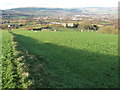
Hargate Hill standing stone (my term...it doesn't seem to have a local name) is at the junction with High Lane and a road up from Hargate Hill, immediately to its north. It stands in a corner of a field mid-way between the High Peak villages of Charlesworth and Simmondley, about 600m W of Cloud farm. It and another stone 100m eastwards was marked on the 1894 OS map. The standing stone is about 1.8m high, 0.6m broad and 0.25m thick.
It stands some 2.5km NNE of Robin Hood's Picking Rods, at Chisworth, and about 2km SSE of the Roman Fort at Melandra. The area is rich in Romano-British archaeology but it is not possible to put this stone into any particular context. According to Glossop historian, Neville Sharpe (via e-mail 20 May 2005), it is one of several standing stones in the area that are rather too big to have been gateposts, that dont have any obvious purpose, but which obviously took some time and effort to erect.
You may be viewing yesterday's version of this page. To see the most up to date information please register for a free account.
")
")
Do not use the above information on other web sites or publications without permission of the contributor.
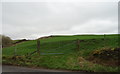
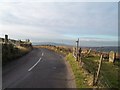
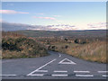
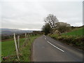
Nearby Images from Geograph Britain and Ireland:
©2019(licence)
©2013(licence)
©2012(licence)
©2019(licence)
©2008(licence)
The above images may not be of the site on this page, they are loaded from Geograph.
Please Submit an Image of this site or go out and take one for us!
Click here to see more info for this site
Nearby sites
Key: Red: member's photo, Blue: 3rd party photo, Yellow: other image, Green: no photo - please go there and take one, Grey: site destroyed
Download sites to:
KML (Google Earth)
GPX (GPS waypoints)
CSV (Garmin/Navman)
CSV (Excel)
To unlock full downloads you need to sign up as a Contributory Member. Otherwise downloads are limited to 50 sites.
Turn off the page maps and other distractions
Nearby sites listing. In the following links * = Image available
1.5km SSE 147° Coombes Edge* Ring Cairn (SK0204591892)
2.3km SSW 196° Robin Hood's Picking Rods* Ancient Cross (SK0060990941)
2.3km SSW 193° Chisworth Cupmarked stone* Rock Art (SK007909)
2.7km NNE 33° Mouselow Castle Hillfort (SK027954)
2.8km S 187° Ringstones (new circle at Near Slack Farm)* Modern Stone Circle etc (SK0087290394)
2.9km E 83° Carr House Lane standing stone Standing Stone (Menhir) (SK041935)
2.9km SW 231° Ludworth Intake* Round Barrow(s) (SJ98989131)
3.3km SW 227° Brown Low* Round Barrow(s) (SJ988909)
3.6km S 190° Ringstones (Derbyshire)* Stone Circle (SK006896)
4.1km W 270° Werneth Low Enclosure Ancient Village or Settlement (SJ97099315)
4.3km W 267° Werneth Low Cairn Cairn (SJ969929)
4.6km NNW 332° Hobson Moor Cairn II Cairn (SJ991972)
4.7km NNW 330° Buckton Edge Cairn (SJ989972)
4.8km W 274° Hangingbank, Werneth Low* Ancient Village or Settlement (SJ96479352)
5.1km W 274° Lower Higham Farm Cairn (SJ961935)
5.2km SW 215° Mellor Hillfort* Hillfort (SJ982889)
5.3km W 266° Werneth Low (Hyde) Ancient Village or Settlement (SJ959928)
5.3km NNW 335° Hobson Moor Cairn I Cairn (SJ990980)
5.4km NNW 334° Stalybridge Cairn* Cairn (SJ989980)
6.0km ESE 120° Kinder Scout I Round Barrow(s) (SK06439014)
6.4km ESE 121° Kinder Scout II Round Barrow(s) (SK06728981)
6.4km SSW 203° Mellor Moor* Cairn (SJ9867187246)
6.5km ESE 123° Cairn on Kinder Scout Cairn (SK067896)
7.0km SSE 157° Watery Hey Well* Holy Well or Sacred Spring (SK0399986733)
7.0km NNW 345° Harridge Pike Cairn (SJ994999)
View more nearby sites and additional images


 We would like to know more about this location. Please feel free to add a brief description and any relevant information in your own language.
 Wir möchten mehr über diese Stätte erfahren. Bitte zögern Sie nicht, eine kurze Beschreibung und relevante Informationen in Deutsch hinzuzufügen.
 Nous aimerions en savoir encore un peu sur les lieux. S'il vous plaît n'hesitez pas à ajouter une courte description et tous les renseignements pertinents dans votre propre langue.
 Quisieramos informarnos un poco más de las lugares. No dude en añadir una breve descripción y otros datos relevantes en su propio idioma.