


<< Text Pages >> Nantwich Museum - Museum in England in Cheshire
Submitted by Anne T on Wednesday, 03 July 2024 Page Views: 2490
MuseumsSite Name: Nantwich MuseumCountry: England
NOTE: This site is 2.8 km away from the location you searched for.
County: Cheshire Type: Museum
Nearest Town: Nantwich
Map Ref: SJ6519352172
Latitude: 53.065647N Longitude: 2.520879W
Condition:
| 5 | Perfect |
| 4 | Almost Perfect |
| 3 | Reasonable but with some damage |
| 2 | Ruined but still recognisable as an ancient site |
| 1 | Pretty much destroyed, possibly visible as crop marks |
| 0 | No data. |
| -1 | Completely destroyed |
| 5 | Superb |
| 4 | Good |
| 3 | Ordinary |
| 2 | Not Good |
| 1 | Awful |
| 0 | No data. |
| 5 | Can be driven to, probably with disabled access |
| 4 | Short walk on a footpath |
| 3 | Requiring a bit more of a walk |
| 2 | A long walk |
| 1 | In the middle of nowhere, a nightmare to find |
| 0 | No data. |
| 5 | co-ordinates taken by GPS or official recorded co-ordinates |
| 4 | co-ordinates scaled from a detailed map |
| 3 | co-ordinates scaled from a bad map |
| 2 | co-ordinates of the nearest village |
| 1 | co-ordinates of the nearest town |
| 0 | no data |
Be the first person to rate this site - see the 'Contribute!' box in the right hand menu.
Internal Links:
External Links:
Museum in Cheshire
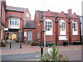
Nantwich Museum, opened in 1980 in what was the old Victorian library, can be found on Pillory Street, Nantwich, Cheshire, CW5 5BQ. It's location is exactly as described - opposite the old pillory. Published opening hours are: Tuesday to Saturday, 10am until 4pm.
See the Nantwich Museum website for more information.
The museum hosts a series of talks throughout 2023/24, focusing on the history of the town and surrounding areas; see Nantwich Museum Talks; these can also be delivered digitally. The museum also offers walking tours and a series of exhibitions (check the website as these change throughout the year).
There is a permanent exhibition about Nantwich Salt production - for more details see Nantwich Salt. Also refer to our site page for Old Biot Holy Well.
Thanks to Reg Crawford for the information.
You may be viewing yesterday's version of this page. To see the most up to date information please register for a free account.
Do not use the above information on other web sites or publications without permission of the contributor.
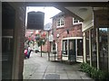
Nearby Images from Geograph Britain and Ireland:

©2016(licence)
©2009(licence)
©2009(licence)

©2015(licence)
©2016(licence)
The above images may not be of the site on this page, they are loaded from Geograph.
Please Submit an Image of this site or go out and take one for us!
Click here to see more info for this site
Nearby sites
Key: Red: member's photo, Blue: 3rd party photo, Yellow: other image, Green: no photo - please go there and take one, Grey: site destroyed
Download sites to:
KML (Google Earth)
GPX (GPS waypoints)
CSV (Garmin/Navman)
CSV (Excel)
To unlock full downloads you need to sign up as a Contributory Member. Otherwise downloads are limited to 50 sites.
Turn off the page maps and other distractions
Nearby sites listing. In the following links * = Image available
347m NW 318° Old Biot* Holy Well or Sacred Spring (SJ64965243)
2.2km WNW 294° Church of St Mary the Virgin (Acton)* Ancient Cross (SJ63175308)
8.6km S 174° The Bear Stone* Natural Stone / Erratic / Other Natural Feature (SJ66004365)
8.6km S 174° St James the Great, Audlem* Round Barrow(s) (SJ66004365)
10.9km NW 315° Robin Hood's Tump* Round Barrow(s) (SJ575599)
12.2km WNW 297° Peckforton Mere* Ancient Village or Settlement (SJ543577)
13.4km WNW 301° Beeston Castle* Hillfort (SJ538592)
13.7km NE 51° Sandbach Crosses* Ancient Cross (SJ7587760825)
14.5km SSE 159° Bradling Stone* Standing Stone (Menhir) (SJ70333864)
14.9km NW 317° Salterswell* Holy Well or Sacred Spring (SJ552632)
15.4km W 272° Maiden Castle (Cheshire)* Hillfort (SJ49805286)
15.4km SSE 159° Devil's Ring and Finger* Holed Stone (SJ7072737783)
15.8km SSE 165° Betton Standing Stone (Menhir) (SJ69193691)
15.9km SSE 161° The Ineaz Stone Standing Stone (Menhir) (SJ70223706)
16.0km ENE 77° Church Lawton South* Stone Circle (SJ808557)
16.1km SSE 160° The Blew Stone Standing Stone (Menhir) (SJ705370)
16.1km ENE 76° Church Lawton Barrows* Barrow Cemetery (SJ809559)
16.4km NNW 341° Long Stone Cross* Ancient Cross (SJ599677)
17.1km NW 325° High Billinge* Round Barrow(s) (SJ5548066242)
17.2km NNW 330° Seven Lows* Round Barrow(s) (SJ567671)
17.2km N 360° Moultonbank Farm Round Barrow(s) (SJ653694)
17.3km NNW 329° Seven Lows Round Barrow(s) (SJ56336703)
17.3km ENE 78° All Saints (Church Lawton)* Artificial Mound (SJ82165573)
17.4km NNW 334° Oakmere* Ancient Village or Settlement (SJ576678)
18.0km NW 324° Whistlebitch Well* Holy Well or Sacred Spring (SJ548669)
View more nearby sites and additional images


 We would like to know more about this location. Please feel free to add a brief description and any relevant information in your own language.
 Wir möchten mehr über diese Stätte erfahren. Bitte zögern Sie nicht, eine kurze Beschreibung und relevante Informationen in Deutsch hinzuzufügen.
 Nous aimerions en savoir encore un peu sur les lieux. S'il vous plaît n'hesitez pas à ajouter une courte description et tous les renseignements pertinents dans votre propre langue.
 Quisieramos informarnos un poco más de las lugares. No dude en añadir una breve descripción y otros datos relevantes en su propio idioma.