


<< Our Photo Pages >> Maiden's Head - Holy Well or Sacred Spring in England in Norfolk
Submitted by jamesrattue on Thursday, 15 October 2015 Page Views: 5513
Springs and Holy WellsSite Name: Maiden's HeadCountry: England
NOTE: This site is 4.2 km away from the location you searched for.
County: Norfolk Type: Holy Well or Sacred Spring
Nearest Town: Aylsham
Map Ref: TG178246
Latitude: 52.775032N Longitude: 1.227564E
Condition:
| 5 | Perfect |
| 4 | Almost Perfect |
| 3 | Reasonable but with some damage |
| 2 | Ruined but still recognisable as an ancient site |
| 1 | Pretty much destroyed, possibly visible as crop marks |
| 0 | No data. |
| -1 | Completely destroyed |
| 5 | Superb |
| 4 | Good |
| 3 | Ordinary |
| 2 | Not Good |
| 1 | Awful |
| 0 | No data. |
| 5 | Can be driven to, probably with disabled access |
| 4 | Short walk on a footpath |
| 3 | Requiring a bit more of a walk |
| 2 | A long walk |
| 1 | In the middle of nowhere, a nightmare to find |
| 0 | No data. |
| 5 | co-ordinates taken by GPS or official recorded co-ordinates |
| 4 | co-ordinates scaled from a detailed map |
| 3 | co-ordinates scaled from a bad map |
| 2 | co-ordinates of the nearest village |
| 1 | co-ordinates of the nearest town |
| 0 | no data |
Internal Links:
External Links:
")
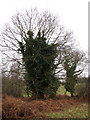
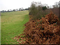
In fact nothing appears to be known apart from that lyrical name; and whatever spring there is lies almost inaccessible among the boggy woods around the rivulet. I’m not even sure whether the muddy puddle I discovered is actually it, hence giving detailed directions seems superfluous; I wouldn’t advise trying to find it.
You may be viewing yesterday's version of this page. To see the most up to date information please register for a free account.
Do not use the above information on other web sites or publications without permission of the contributor.
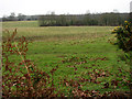
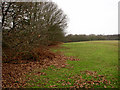
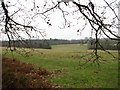
Nearby Images from Geograph Britain and Ireland:
©2007(licence)
©2007(licence)
©2007(licence)
©2007(licence)
©2007(licence)
The above images may not be of the site on this page, they are loaded from Geograph.
Please Submit an Image of this site or go out and take one for us!
Click here to see more info for this site
Nearby sites
Key: Red: member's photo, Blue: 3rd party photo, Yellow: other image, Green: no photo - please go there and take one, Grey: site destroyed
Download sites to:
KML (Google Earth)
GPX (GPS waypoints)
CSV (Garmin/Navman)
CSV (Excel)
To unlock full downloads you need to sign up as a Contributory Member. Otherwise downloads are limited to 50 sites.
Turn off the page maps and other distractions
Nearby sites listing. In the following links * = Image available
6.4km SE 138° Fiddler's Hill (Stratton) Long Barrow (TG2225520048)
6.8km S 176° Horsford Woods Barrow Cemetary* Barrow Cemetery (TG18571780)
8.1km SW 221° Alderford Common Barrow Round Barrow(s) (TG12751828)
9.2km SW 227° The Warren Barrow Round Barrow(s) (TG11371798)
9.3km W 263° Pettywell* Holy Well or Sacred Spring (TG086230)
11.7km NNE 25° Roughton Cursus Cursus (TG222355)
14.2km N 4° Aylmerton Cross* Ancient Cross (TG18073879)
14.2km S 187° Roundwell* Holy Well or Sacred Spring (TG168104)
14.5km N 4° Aylmerton Shrieking Pits* Misc. Earthwork (TG1823939072)
15.2km ENE 57° Knapton* Modern Stone Circle etc (TG3020433448)
16.0km SSW 191° St Walstan's Well* Holy Well or Sacred Spring (TG15350878)
16.9km E 91° Devil's Ditch Ancient Trackway (TG347252)
16.9km SSE 164° Norwich Castle Museum and Art Gallery* Museum (TG231085)
17.0km NNW 348° Howe’s Hill Oval Barrow* Round Barrow(s) (TG1340941007)
17.3km N 360° Calves Well* Holy Well or Sacred Spring (TG170419)
17.5km N 351° Church Conduit* Holy Well or Sacred Spring (TG144418)
18.9km S 172° Eaton Heath* Barrow Cemetery (TG2128006050)
19.1km W 264° North Elmham Chapel* Ancient Temple (TF9888121640)
19.6km SSE 164° Arminghall Henge* Henge (TG240060)
20.3km NNW 334° Salthouse Heath* Barrow Cemetery (TG07974241)
21.2km ENE 74° Happisburgh Ancient Village or Settlement (TG379315)
21.4km NNW 330° The Hangs* Round Barrow(s) (TG06304270)
21.8km S 169° Venta Icenorum* Ancient Village or Settlement (TG230034)
22.2km WSW 242° St Withburga's Well* Holy Well or Sacred Spring (TF9865213305)
24.2km SSW 200° St Thomas's Well (Wymondham)* Holy Well or Sacred Spring (TG10550146)
View more nearby sites and additional images


 We would like to know more about this location. Please feel free to add a brief description and any relevant information in your own language.
 Wir möchten mehr über diese Stätte erfahren. Bitte zögern Sie nicht, eine kurze Beschreibung und relevante Informationen in Deutsch hinzuzufügen.
 Nous aimerions en savoir encore un peu sur les lieux. S'il vous plaît n'hesitez pas à ajouter une courte description et tous les renseignements pertinents dans votre propre langue.
 Quisieramos informarnos un poco más de las lugares. No dude en añadir una breve descripción y otros datos relevantes en su propio idioma.